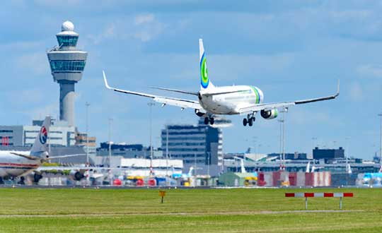
Aircraft throughout Europe are guided by EUROCONTROL, which will have access to ADS-B data through Aireon. Here, a plane lands at Schiphol Airport in The Netherlands. (Photo: Sjo/iStock Unreleased/Getty Images Plus)
Aireon and EUROCONTROL have signed a 10-year agreement to integrate space-based ADS-B data into their air traffic management processes across it’s 41 Member States and two Comprehensive Agreement (CA) States.
The space-based automatic dependent surveillance-broadcast (ADS-B) data will enhance aircraft management capabilities, contributing to improve predictability, capacity, environmental impact supporting sustainable growth throughout the European region.
It will also support other applications, such as crisis management, contingency management, environmental monitoring, performance monitoring and expanded datasets for post-analysis, traffic statistics and safety-related assessments.
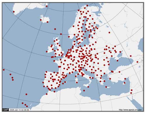
Spanning 43 countries from Turkey to Ireland, Finland to Portugal, EUROCONTROL’s aircraft management states encompass over 11.5 million square kilometers of terrestrial airspace, as well as part of the airspace over the North Atlantic, Mediterranean and Baltic.
Aireon data will be integrated into the EUROCONTROL’s enhanced tactical flow management system (ETFMS), which provides data to European aviation stakeholders, regardless of operational borders, in real time.
Space-based ADS-B data will enrich ETFMS’s complex traffic demand and slot allocation calculations, which currently rely on ground-based surveillance data and flight plan processing systems. As a result, Aireon’s data will support Europe’s primary flow management system to be more accurate in its trajectory predictions and unlock an otherwise unavailable operational capacity.
“With Aireon’s high-integrity, high-quality data, the EUROCONTROL network manager will have the ability to work with information from beyond the European airspace,” said Eamonn Brennan, director general, EUROCONTROL. “Full integration of Aireon space-based ADS-B data will allow us to be more accurate in our trajectory predictions and ensure higher levels of safety, predictability and efficiency in our flow management operations. This partnership is the latest development in our effort to ensure European airspace is one of the most dynamic and efficient in the world.”
EUROCONTROL. Having been nominated as the Network Manager by the European Commission until the end of 2029, EUROCONTROL is driving a coordinated and technologically advanced approach to the challenges faced by the European air traffic network.
Helping address the improvements that are needed in operations, cybersecurity, service provision, crisis management, airspace design, utilization and more, EUROCONTROL provides support and expertise to air navigation service providers (ANSPs), airlines, airports and military partners in the region to help make European aviation, safe, synchronized, efficient and environmentally friendly.
Aerion. In 2019, the European Aviation Safety Agency (EASA) certified Aireon as the first provider of aircraft surveillance-as-a-service. Additionally, Aireon has the only global, single-source dataset available to the industry.
For EUROCONTROL, this means that once the service is integrated into its systems, it will have unprecedented visibility into the full picture of aircraft arriving, departing and crossing over Europe over an area of six flight hours and 3,000 nautical miles around EUROCONTROL Member States.
“EUROCONTROL is a leader in air traffic flow management. They are the first customer to use Aireon data well beyond their own area of responsibility. This will enable them to maximize the effectiveness of their processes and procedures by including long-range arrivals and neighboring States into their capacity and demand measures,” said Don Thoma, CEO, Aireon. “EUROCONTROL recognizes the global value in connecting ANSPs through a common, high-fidelity, global data source that provides situational awareness of actual aircraft position information. We look forward to the benefits all EUROCONTROL customers will see in the near, medium and long-term.”
Aireon’s data will also be integrated in EUROCONTROL’s new system called iNM, which will implement incremental updates to all of EUROCONTROL’s operational systems and digital infrastructure in the course of this decade.
Gilla detta:
Gilla Laddar in …