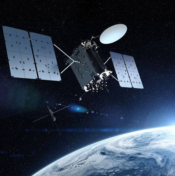
Publicerad den Lämna en kommentar

BAE Systems to develop advanced GPS chips for warfighters

Logo: BAE SystemsBAE Systems has received a $247 million contract from the U.S. Space Force’s Space and Missile Systems Center to design and manufacture an advanced military GPS receiver and next-generation semiconductor.

The technology will provide positioning, navigation, and timing (PNT) capabilities to warfighters so they can execute missions in challenging electromagnetic environments.

MGUE Increment 2

The contract is related to November’s U.S. Department of Defense contract for M-Code military GPS technology.

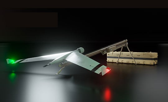
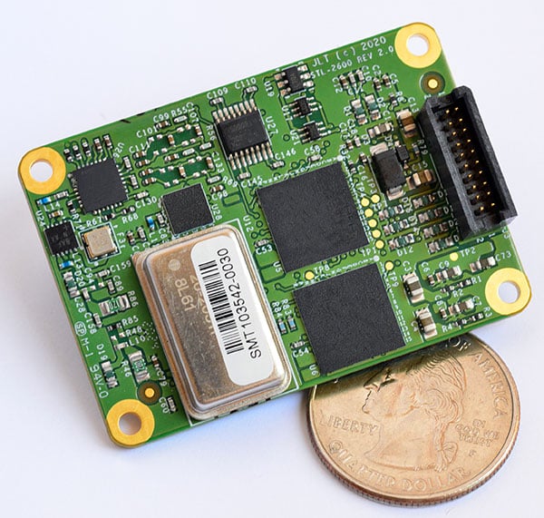
The Military GPS User Equipment (MGUE) Increment 2 Miniature Serial Interface program will provide improved capabilities for size-constrained and power-constrained military GPS applications, including precision-guided munitions and battery-powered handheld devices.

The program will focus on the certification of an advanced application-specific integrated circuit (ASIC) and the development of an ultra-small, low-power GPS module.

Both products will work with the next-generation military M-code signal technology, which provides reliable GPS data with anti-jamming and anti-spoofing capabilities to protect against electronic warfare threats.

“This program enables us to further develop our core M-code technology to deliver high-performance, next-generation GPS capabilities,” said Greg Wild, director of Navigation and Sensor Systems at BAE Systems. “Our M-code receiver and next-gen ASIC will enable secure and reliable military GPS capabilities in a broader range of platforms.”

BAE Systems’ Precision Strike business has 45 years of military GPS experience and more than 1.5 million GPS devices on over 280 platforms around the world. The company is currently producing M-code GPS receivers in multiple form factors, including a low power, small form factor M-code solution.

Additional prototypes are in development for ground, weapons and airborne mission applications, and the company’s M-code GPS products are available to U.S. allies via foreign military sales.

Work on the program will be conducted at the company’s facility in Cedar Rapids, Iowa.

Publicerad den Lämna en kommentar

GMV takes part in European GEODE military project

Photo:Spain-based GMV is taking responsibility for integration of the GNSS/PRS receiver system for the European Union’s (EU’s) GEODE project.

GEODE (GalilEO for EU DEfence) is the biggest Galileo application development project ever launched and a crucial and decisive step towards the development of the Galileo Galileo PRS (PRS) military user segment. GEODE is and one of the most ambitious defense cooperation projects launched under the umbrella of the European Commission’s European Defence Industrial Development Programme (EDIDP).

Co-financed by Belgium, Germany, Italy, France and Spain, GEODE is supported by the EU with a grant of about 44 million Euros.

GMV, part of the Spanish industrial team, will develop the GNSS/PRS receiver’s signal-processing, navigation and timing functions. GMV also participated in the Feb. 8 GEODE kick-off meeting.

GEODE aims to boost the EU industry’s competitiveness in the highly strategic domain of military positioning, navigation, timing and synchronization (PNT) and to endow EU military forces with Galileo PRS capacity. The project will be implemented by a consortium of 30 undertakings from 14 EU countries.

The Spanish industrial team made up by GMV, Indra and Tecnobit, takes on first-level responsibility for the complete development of the solution for naval military platforms (GNSS/PRS receiver with security module and CRPA antenna). GMV is responsible for the integration of the GNSS/PRS receiver system and, in particular, for the development of all the receiver’s signal-processing, navigation and timing functions.

GEODE will provide the EU Industry with an even playing field in the Defense PNT market, where military GPS’s essentialness at the moment ensures U.S. industry’s supremacy. It will also reinforce EU military capability and autonomy and maximize the benefits of the Galileo program by promoting take-up of its crucial PRS service.

Following an initial specification and standardization phase, the project will then prototype, test and qualify all the elements of a complete PRS solution:

  • PRS security modules
  • PRS receivers
  • GPS/Galileo PRS compatible controlled radiation pattern antennas (CRPAs)
  • A common and standardized test environment.

A PRS solution for spacecraft will be also designed and prototyped. Complementarily, a PRS infrastructure will be developed to ensure the availability of the security assets necessary for operational testing.

Military operational field testing will be organized on military naval and land platforms, RPAS, and a timing and synchronization system.

GEODE will boost the EU industry competitiveness in the highly strategic domain of military positioning, timing and synchronization, it will foster the equipment of EU Member States’ military forces with the Galileo PRS capability, essential to reinforce their interoperability and autonomy. It also will facilitate access to complex security certified technologies and make them affordable through means of standardization and by creating the necessary critical mass.

Publicerad den Lämna en kommentar

Russian UAV maker launches new VTOL drone

Zala Aero Group unveiled the ZX1, a new hybrid unmanned aerial vehicle (UAV) at the 2021 International Defense Industry Exhibition (IDEX) and Conference, which opened on Feb.21 in Abu Dhabi.

The new drone has vertical-takeoff-and-landing (VTOL). According to Zala, it combines the best qualities of fixed-wing and multirotor types of UAVs; its configuration can change depending on the conditions of the performed task.

Ease of operation allows the UAV system to reduce the operator’s role, decrease the amount of equipment used when performing a flight mission, and fully automate flight processes of the UAV.

The ZX1’s onboard computer uses artificial intelligence, which makes it possible to process data in full high-definition, and transmit HD video and photos via encrypted communication channels to the GCS, ensuring the effectiveness of monitoring even before the aircraft lands.

The VTOL design makes it compatible with existing ZALA payloads, and also allows the installation of additional surveying equipment. It can be used to perform air monitoring for the fuel and energy sector and search-and-rescue operations from sites in urban environments.

Zala Aero Group, founded in 2004, is a Russian developer and manufacturer of unmanned aerial systems, payloads and mobile systems. It is now part of Concern Kalashnikov. It’s main products are reconnaissance unmanned systems and digital solutions. Currently, more than 2,000 of Zala UAS operate within Russia. Areas of application are the protection of state borders, reconnaissance and rescue operations, monitoring of high-risk facilities, and emergencies.

Publicerad den Lämna en kommentar

Trimble SX12 total station adds features for tunneling

Photo: Trimble

Photo: Trimble

Trimble has introduced its SX12 Scanning Total Station, the next iteration of its 3D scanning total station that provides fast and efficient data capture for surveying, engineering and geospatial professionals.

New features include a high-power laser pointer and high-resolution camera system, expand capabilities in surveying, and complex 3D modeling. The SX12 enables enable new workflows in tunneling and underground mining, Trimble said.

The Trimble SX12 merges high-speed 3D laser scanning, Trimble VISION imaging technology and high-accuracy total station measurements into familiar field and office workflows for surveyors.

A new green, focusable Class 1M laser pointer — safe for viewing with the naked eye — offers high-power visibility and makes it easy to see at a distance. An improved camera system provides enhanced pointing and site documentation capabilities.

“The new SX12 adds more features and applications to an already widely adopted, field-proven scanning total station,” said Gregory Lepere, marketing director of Optical and Imaging for Trimble Geospatial. “The addition of a premium laser pointer completes the picture for surveyors wanting an instrument that can operate as an everyday high-end total station with the added value of scanning and imagery.”

Tunnels and underground mining

The Trimble SX12 allows users to quickly and easily operate with common survey workflows, including new versions of Trimble’s field and office software.

With Trimble Access™ 2021 Field Software, users can harness the full potential of the Trimble SX12, whether performing accurate measurements or comparing 3D scanning as-built data in the field. The combination is designed for infrastructure projects such as utilities, roads, rail, water, transportation and telecom.

The laser pointer enables new applications for laser-guided drilling and excavation guidance, rock bolt and blast hole set out, and as-built verification for underground tunnel and mine construction.

By integrating rich data from the Trimble SX12 into intuitive office workflows, Trimble Business Center version 5.40 enables users to quickly create complete customer deliverables. With its enhanced point-cloud management, eCogAI automated information extraction, and interoperability to leading CAD and GIS packages, the solution empowers users to exceed even the toughest client demands.

The combination also enables the capture of tunnel point clouds for as-built comparison, automated tunnel extraction routines and detailed 3D mesh inspection resulting in intuitive reporting deliverables for construction verification.

“Tunneling projects are highly dependent on accurate positioning to precisely control equipment and track progress in difficult underground construction environments,” said Boris Skopljak, marketing director of Monitoring and Tunneling for Trimble Geospatial. “The combination of the SX12 and new software workflows, simplifies the capture of site conditions, enabling tunneling and mining surveyors to make accurate and informed decisions without the complexity and additional cost of multiple systems.”

Publicerad den Lämna en kommentar

Telit offers first L1+L5 module under collaboration with Sony

Photo: Telit

Photo: Telit

Telit has launched the SE868SY-D multi-frequency, high-precision GNSS receiver module for applications that require high accuracy, fast updates, multi-constellation support and multipath resistance.

At 11 x 11 mm, the SE868SY-D accommodates ultra-compact devices and IoT trackers.

Available now, the high-precision SE868SY-D module is Telit’s first multi-frequency, multi-constellation GNSS receiver module, featuring an ultra-sensitive -167 dBm (tracking) RF front end. By using both the L1 and L5 bands, the SE868SY-D supplies a significantly higher location accuracy than single-frequency devices — even in high-multipath environments such as urban canyons, Telit said.

This sub-1-meter precision is a major reason ABI Research expects more than 1 billion multi-frequency GNSS devices to ship annually by 2023.

The SE868SY-D is the first product from a new strategic collaboration between Sony and Telit, and features Sony’s next-generation CXD5610 GNSS receiver large-scale integrated circuit (LSI).

The Telit SE868SY-D is designed for battery-powered applications such as IoT trackers and wearables. With less than 45 mW in L1+L5 tracking mode, the module has low power consumption, despite using both L1 and L5 bands.

For high-dynamic applications, the SE868SY-D a high update rate of up to 25 Hz. Its high-accuracy, one-pulse-per-second (1 PPS) signal also makes the module suitable for timing applications.

“With the new SE868SY-D, Telit is uniquely prepared to meet the burgeoning global demand for multi-frequency, multi-constellation GNSS receivers for IoT trackers, wearables and more,” said Eric Lagorce, Telit business development director. “The SE868SY-D also perfectly complements Telit’s two decades of GNSS expertise, and its broad portfolio and highlights the potential of our strategic collaboration with Sony.”

The Telit SE868SY-D provides pin-to-pin compatibility for applications based on Telit’s legacy GPS module JF2 and GNSS module SE868V3.

Publicerad den Lämna en kommentar

L3Harris contracted for GPS III Follow-On payloads

GPS IIIF’s M-Code can be broadcast from a high-gain directional antenna in a concentrated, high-powered spot beam, in addition to a wide-angle, full-Earth antenna. (Artist rendering: Lockheed Martin)

Lockheed Martin, the prime contractor for GPS III/IIIF, selected L3Harris in 2018 to design and build the first two fully-digital MDUs, the heart of the satellite’s navigation payload. (Artist rendering: Lockheed Martin)

L3Harris Technologies has received contracts totaling $137 million for four navigation payload Mission Data Units (MDU) for future GPS III Follow-On (GPS IIIF) satellites.

Lockheed Martin, the prime contractor for GPS III/IIIF, selected L3Harris in 2018 to design and build the first two fully-digital MDUs, the heart of the satellite’s navigation payload. The MDU generates more powerful GPS signals and assures clock operations for GPS users, L3Harris said.

“The digital MDU is flexible enough to adapt to advances in GPS technology and future changes in mission needs,” said Ed Zoiss, president, Space and Airborne Systems, L3Harris. “The new MDU will also support a smooth transition for the U.S. Space Force’s GPS OCX ground control segment.”

The U.S. Space Force expects the first GPS IIIF satellite, which builds on GPS III adding new capabilities and technology, to be available for launch in 2026. According to L3Harris, the GPS IIIF MDU will provide improved capabilities over L3Harris’ 70-percent-digital MDU on the first ten GPS III satellites. The first four GPS III satellites have successfully launched and are now operational in the GPS constellation.

L3Harris Technologies is a global aerospace and defense technology innovator, delivering end-to-end solutions that meet customers’ mission-critical needs. The company provides advanced defense and commercial technologies across air, land, sea, space and cyber domains.

Publicerad den Lämna en kommentar

Sokkia releases two robotic total stations for survey, layout

Photo: Sokkia

Photo: Sokkia

Sokkia has launched two robotic total stations designed to improve job site productivity: the iX-1200 and iX-600.

According to Sokkia, the total stations, designed as a part of a full workflow solution, are professional-level positioning tools for survey and layout in the building construction and infrastructure trades. They’re engineering for integration with field controllers, software and GNSS receivers.

In addition, advanced users can take measurements in almost any environment while switching to the most appropriate technology — total station measurement integrated with GNSS measurement — through an optional upgrade to Hybrid Positioning technology, Sokkia said. The stations also can be seamlessly integrated into BIM workflows.

“The high-performance technologies incorporated into the design provide increased prism-tracking strength,” said Ray Kerwin, director of global product planning. “Through a combination of optical sensing and ultrasonic motors, UltraTrac technology helps users stay locked onto the prism — and productive with less down time resulting from the need to reacquire prism lock — even in dynamic job site conditions. The system also features the RC-PR5A remote controller option used on the prism pole so the user can quickly and simply reestablish the connection between prism and total station.”

The total stations, available in multiple accuracy models, can be used with the SHC6000 field controller and GeoPro or MAGNET Field software for optimal performance, Sokkia added.

Publicerad den Lämna en kommentar

LORAN-5G: Paper envisions new use for venerable tech

Image: KENGKAT/iStock/Getty Images Plus/Getty Images

Image: KENGKAT/iStock/Getty Images Plus/Getty Images

A new paper by two Qualcomm engineers imagines restructuring Loran technology to more easily incorporate timing signals into telecommunication systems.

The paper, titled simply “LORAN-5G,” was authored by Guttorm Opshaug and Dave Tuck. It envisions moving away from legacy pulsed signals to a more continuous wave form which would allow significantly lower power transmissions.

According to Opshaug, “Another big advantage that may not be as apparent, is the built-in orthogonality in the signal structure of OFDM. This means that a receiver would be able to detect very weak signals from distant towers at the same time as receiving signals from a very strong close tower. Such robustness towards near-far effects is critical for terrestrial navigation use.”

Another change would be a marked increase in the capacity of the Loran data channel to more than 2.6kbps. “This could open opportunities for additional service options and/or reduce latency of existing ones,” according to Tuck.

UrsaNav CEO, Charles Schue, expressed great interest in Qualcomm’s paper. UrsaNav is a long-time provider of Loran equipment and consulting. “The intersection of PNT and communications discussed in the Qualcomm paper is exactly what is needed to ensure that PNT systems evolve and stay relevant,” he said. “In fact, we build our software defined transmitter and receiver solutions to specifically include the ability to produce and use these types of signals.” A Cooperative Research and Development Agreement between UrsaNav and the Department of Homeland Security demonstrated these type of potential upgrades in 2012.

This paper is the first publicly released effort examining the use of Loran technology to support 5G telecommunications. The general concept was discussed in a 2016 paper by the Alliance for Telecommunications Industry Solutions’ (ATIS) Synchronization Committee. Based on the paper, ATIS in 2017 encouraged members of Congress to pass legislation that would become the National Timing Resilience and Security Act of 2018 (NTRSA).


There are tradeoffs. Opshaug and Tuck’s proposal would replace the legacy Loran standard signal with a new one.


“I was in the midst of developing proposals for the 3GPP standards organization when I first heard about the NTRSA,” said Opshaug. “5G seemed like exactly the kind of critical infrastructure that could benefit from a backup timing solution.”

“We wanted to bring some of the ideas used to develop 5G position and timing to Loran,” said Tuck. “Using Loran as the timing synch could enable 5G to improve overall infrastructure resilience.”

Yet, as with most things, there are tradeoffs. Opshaug and Tuck’s proposal would replace the legacy Loran standard signal with a new one. This would require redesign of receivers and some transmitters. The proposal could support denser deployments to further improve resiliency.

“The new signals seem incompatible with existing receivers and Loran networks,” according to Professor Jiwon Seo of South Korea’s Yonsei University. South Korea is upgrading its Loran-C network to the eLoran standard. The new South Korean system will be compatible with neighboring Russian and Chinese Loran systems, so users will be able to benefit from signals anywhere in East Asia. Until 2010 signals from the U.S. Loran system cooperated with these networks as part of the Far East Radionavigation Service (FERNS).

Navigation expert Logan Scott is intrigued by the proposal but observes that more work needs to be done. “This is an interesting waveform,” he said, though he had questions about the propagation channel, antennas, and possible distortion.

The authors acknowledge that much more needs to be done, including better determining timing and positioning accuracy.

Yet they and others see potential in combining the very different phenomenologies of low frequency, 100KHz Loran and 5G telecommunications which typically operate in the gigahertz range.

Opshaug and Tuck’s paper LORAN-5G can be accessed here.

Publicerad den Lämna en kommentar

Jackson Labs offers miniature STL LEO receiver

The STL-2600 STL-capable receiver provides a GNSS-independent low SWaP-C UTC-time and location capability with sub 45-ns RMS typical timing and better than five-meter typical location accuracy

Jackson Labs Technologies Inc. (JLT), a designer and manufacturer of GNSS, timing and frequency equipment, has announced the availability of the STL-2600 Satellite Timing and Location (STL) receiver designed in partnership with Satelles Inc., the STL service provider.

The STL-2600 commercial receiver provides a completely GNSS-independent, low-cost capability to generate UTC nanosecond timing and meters-accurate positioning anywhere in the world. It operates in a way similar to GPS, but without GPS or GNSS. The STL signal has 30-db (1,000 times) higher power compared to GPS signals, allowing the receiver to operate deep indoors independent of any GPS/GNSS signal.

“Useful for non-GNSS-based E911 location and UTC(NIST) timing applications, the STL-2600 receiver is deployable today to fulfill critical infrastructure PNT objectives such as those outlined in Executive Order 13905 on the responsible use of PNT in the U.S. and the emerging mandates for a GNSS-independent backup solution in Europe,” said Said Jackson, president of JLT.

The STL-2600 receiver is also useful in marine applications where GNSS signals are regularly denied or manipulated and for stationary high-accuracy timing applications such as 5G.

The STL-2600 receiver can be directly connected to JLT’s GPS Transcoder products for glue-less retrofit capability of existing customer legacy GPS-only receiver systems to Galileo, GLONASS, BeiDou, QZSS and SBAS as well as adding the STL and optional atomic holdover capability to these legacy systems.

The receiver module combines a custom-designed STL L1 LEO receiver and a latest-generation concurrent-GNSS receiver with a disciplined high-stability reference oscillator sub-system on one circuit board.


Features and specifications of the STL-2600

Photo: JLT

Photo: JLT

Form factor: 1.4″ x 2.0″ x 0.5″ (36mm x 51 mm x 13mm)

Switching modes: User-selectable automatic and manual switching between GNSS and STL signal reception during jamming or manipulation events

Integration: Incorporates into user systems just like a legacy GNSS receiver would using NMEA and SCPI serial messages, with the use of standard NMEA messages for STL positioning and timing features making system integration trivially easy

Oscillator options and performance: Internal high-stability TXCO standard; capable of directly and gluelessly disciplining numerous optional DOCXO, CSAC and rubidium oscillators for holdover capability, with ultra-stable ADEV performance from 0.1s to infinity with better than 10E-12 stability when using a DOCXO or Rubidium as the holdover oscillator

Low-power consumption: Ranges between 0.7 W to 1.45 W (depending on configuration) allowing for long-term battery operation for use cases without AC power

Antenna support: One GNSS/STL combined standard; optional support of a second antenna for diversity

Interfaces: TTL serial port standard; optional USB serial port allow easy evaluation and design-in

Upgrades: One-button firmware updates performed in situ through any of the serial ports


The receiver includes JLT’s proven frequency and timing disciplining and holdover IP deeply embedded into the entire signal chain for ultra-low phase noise performance and high-stability 1PPS and 10 MHz operation, even when using only the built-in TCXO oscillator.

The unit operates fully autonomously from just a USB cable and is compatible with a customized version of the GPSCon software — offered at no cost to JLT customers — for monitoring and control.

The STL signal has been deployed worldwide since 2016 and can be evaluated and implemented SWaP-C-effectively today via this receiver module.

The STL-2600 is available now. Contact Jackson Labs Technologies for configuration and pricing information.

Publicerad den Lämna en kommentar

Hitec Commercial Solutions releases SG50BL actuator

Photo: Hitec Commercial Solutions

Photo: Hitec Commercial Solutions

Hitec Commercial Solutions has introduced the SG50BL actuator with CAN and UAVCAN connectivity.

The SG50BL, designed with robust steel gears and a high-performance brushless motor, is capable of operating at a voltage range of 18 to 32 volts, the company said.

The actuator features a programmable digital circuit with a MOSFET amplifier; a BLDC motor; a magnetic encoder position sensor; five hardened steel gears low gear backlash (less than .5°); four ball bearing supported output shaft; nine needle bearing supported idlers; rugged anodized aluminum alloy case; and an IP68 waterproof rating.

The SG50BL also is capable of 360° proportional rotation and boasts T4131012051-000 TE connectivity. It includes CAN 2.0 A/B or UAVCAN control options, customization and modification options, and custom connector options.

Founded in 1973, Hitec designs and produces high quality actuators and radio control components for a variety of applications and demands.