Publicerad den Lämna en kommentar

Garmin announces GPS marine satellite compass

Photo: Garmin

Photo: Garmin

GPS-based navigation tool with multi-band GNSS provides reliable, accurate heading and position information

Garmin International Inc. has launched the MSC 10 marine satellite compass with multi-band GNSS and a fully integrated attitude and heading reference system (AHRS) for a smooth and accurate GPS-derived heading and position on the water.

“Garmin was the first to deliver a marine positioning receiver and antenna utilizing multi-band GNSS support, and we’re pleased to continue to bring this innovative technology to our customers with the MSC 10 satellite compass,” said Dan Bartel, Garmin vice president of worldwide sales. “An advanced navigation tool, the GPS-based MSC 10 won’t be impacted by magnetic interference, so even in challenging situations, you’ll know exactly where you’re headed.”

Utilizing both L1 and L5 GPS frequencies, along with multi-constellation support (GPS, Galileo, GLONASS and BeiDou), the MSC 10 provides precise positioning and heading accuracy within 2 degrees. Its 10-Hz position update rate delivers better, more detailed tracking information. By using satellite signals, it eliminates magnetic interference, which can degrade heading accuracy.

The MSC 10 is easy to install and can be used as the primary position and heading sensor across multiple systems, including autopilots. Along with heading, the MSC 10 will also deliver reliable, precise pitch, roll and heave information — even in rough seas — to a compatible Garmin chartplotter via the NMEA 2000 network. In the rare case that satellite signal is lost, it will seamlessly transition from GPS-based to a backup magnetometer-based heading.

NMEA 2000 certified, the MSC 10 is compatible with a wide range of Garmin chartplotters, including the GPSMAP 8400/8600 series, the new GPSMAP 7×3/9×3/12×3 series, and the keyed GPSMAP 10×2/12×2 series.

The MSC 10 is expected to be available this month.

Publicerad den Lämna en kommentar

May 27 ION webinar focuses on hurricane hunters

ION logoHurricane season starts June 1. Every year on that date, two Lockheed WP-3D Orion aircraft and a crew from NOAA’s Aircraft Operations Center deploy as “Hurricane Hunters,” flying directly into violent hurricanes to perform aerial weather reconnaissance.

Data gathered helps forecasters make accurate predictions on hurricane strength, direction and threats to land and life. But what is it like to fly these missions? What navigation tools and instruments are used? How do weather conditions impact these flights?

On May 27, the Institute of Navigation will host a webinar presented by Lt. Cmdr. Brian Richards, WP-3D Orion navigator and training section chief for NOAA’s Aircraft Operations Center. Deborah Lawrence, Federal Aviation Administration, will moderate. Space is limited; register early to secure a spot.


“Hurricane Hunters: Navigating a Plane through a Hurricane”
Thursday, May 27, at 11:00 a.m. EDT

Publicerad den Lämna en kommentar

“Take the bullseye off GPS before it’s too late!” — PNT Leaders at GWU Webinar

A webinar this week about the GPS Backup Technology Demonstration by the U.S. Department of Transportation (DOT) provided valuable insights about the project and intended way forward for PNT efforts in the department.

It also evolved into a policy discussion with former government leaders saying establishing alternative positioning, navigation, and timing (PNT) systems would make GPS safer by “taking the bullseye off,” and that “the time is now, before it is too late.”

The webinar, titled “What Technologies Can Secure GPS?”, was hosted by the Space Policy Institute at George Washington University (GWU). A bipartisan constellation of civil PNT stars gathered to participate in the event.

Featured in the webinar were:

  • introductory remarks by Robert Hampshire, chief scientist for the U.S. Department of Transportation (DOT). He has also been nominated to be DOT’s assistant secretary for research and technology.
  • a presentation by Karen Van Dyke, director, Positioning, Navigation and Timing for DOT, and Andrew Hansen of DOT’s Volpe Transportation Systems Center.
  • discussion of the issues by Diana Furchtgott-Roth, adjunct professor at GWU and a DOT deputy assistant secretary during the Trump administration, and Greg Winfree, director of the Texas Transportation Institute at Texas A&M University and DOT assistant secretary during the Obama administration, both of whom led civil PNT issues for the federal government during their time in office.
  • Scott Pace, director of GWU’s Space Policy Institute, serving as moderator; he was executive secretary of the Space Council during the Trump administration.

Hampshire opened the event with an address that touched on Biden administration themes of “building back better,” modernizing infrastructure, reducing transportation deaths, making transportation more efficient, and preserving America’s technological leadership. All of these were linked to the need to improve PNT resiliency and reliability.

Robert Hampshire, U.S. DOT chief scientist, speaking at GWU webinar on May 5. (Image RNT Foundation)

Robert Hampshire, U.S. DOT chief scientist, speaking at GWU webinar on May 5. (Image RNT Foundation)

Backup tech demo did not close any doors

Van Dyke and Hansen then gave a presentation on the results of the department’s technology demonstration project.
Van Dyke pointed out that, while “GPS backup” may be a popular term, we need complementary capabilities that come into play not just when GPS is unavailable but work alongside it and provide additional capability and resilience all the time.

She also mentioned that the department is well aware there are more candidate technologies than those selected for the demonstration. Companies offering other ways of providing PNT will not be excluded from future consideration and efforts just because they were not part of the demonstration project.

Also, while the government collected the data during the demonstrations, she acknowledged that the effort was designed to “showcase the technologies in their best light.” Further study, stress testing, and evaluation will be needed for any system or technology that might be of interest to the government.

Key elements in the demos

Hansen discussed the particulars of how the technology demonstrations were conducted and some of the results. While the department evaluated 14 measures of effectiveness during the project, Hansen said that two were key — accuracy and coverage per unit of infrastructure.

All the technologies demonstrating timing showed accuracy that would be useful across a wide range of applications, he said. Positioning accuracy, though, varied from a “ones of meters to around 300 meters” depending on the technology.

Hansen said that coverage per unit of infrastructure varied exceptionally between the technologies. These included satellite systems that provide global coverage with a fixed infrastructure, and radio frequency systems with widely different coverage areas per transmitter.

He also observed that the technology demonstration project was not the end of the department’s technical inquiries. In fact, some of its results—such as eLoran performance in an underground scenario—were unexpected and are being further examined.

Transportation has some of the most stringent PNT requirements for accuracy, integrity, availability, and reliability, he said. And not all safety-critical transportation requirements may be met by market-based business models. Commercial systems lack the open standards and specifications that have made GPS so useful and widely adopted. Hansen said that the department will be working on these issues going forward, as well as performance monitoring for alternative systems.

A recurring theme throughout the webinar from all participants was that there is no single solution, no silver bullet, to achieve sufficient national PNT resilience. A systems-of-systems approach was needed. In Hansen’s words “a plurality of complementary systems” is required to ensure PNT reliability and safety, as well as efficient transportation.

Take the bullseye off GPS! — An urgent national security issue

While agreeing with the systems-of-systems approach, Greg Winfree pointed out that a first step still needs to be taken. He said that the nation has known about the need for alternate PNT since a 2001 report by DOT’s Volpe Center. Twenty years later, still no long overdue first step has been taken.

Just establishing the first alternative and complementary system, Winfree said, will make GPS and the United States much safer. “We need to take the bullseye off of GPS,” he said. GPS is so critically important to this country that it is a very attractive target for those who would do us harm. Having even one just alternative in place would make it much less of a target.

Diana Furchtgott-Roth pointed out that China, Russia, Iran and others have terrestrial systems that complement space-based PNT. About establishing alternatives, she said “The time is now, before it’s too late.”

Provisions in the United States National Space Policy provide that “[a]ny purposeful interference with or an attack upon the space systems of the United States or its allies that directly affects national rights will be met with a deliberate response at a time, place, manner, and domain of our choosing.”

Scott Pace also commented that an having an alternative to GPS will contribute to national security and improve global stability. It will “lower the pressure on us to escalate and respond” should GPS satellites be damaged, or services disrupted, he said.

Next steps

One of the questions posed at the end of the session was about actions and expected accomplishments in alternate PNT at DOT in the next 18 months. When could the first alternative system be expected?

The DOT technology demonstration report recommended that the department work next to develop standards and requirements for alternative systems. Current government employees were appropriately reluctant to say much more.

Calling upon her recent experience in government, however, Diana Furchtgott-Roth that said she believed that the department needed time to stress test technologies, develop standards and finalize requirements. Since many capable technologies were mature, some already in operation, she thought the first capability could be up and running within a year after that.

The only missing element according to Furchtgott-Roth is funding, and the focus needs to be on motivating Congress to provide it. The stage is set, she said, with all parties agreeing on the importance of resilient PNT.

She observed that it is very difficult to get the two parties in Congress to agree, and to pass legislation. Yet this has happened three times in support of establishing GPS alternatives. And PNT is such a critical capability that the entire executive branch even came together to protect it last year opposing the FCC’s decision in the Ligado Networks application.

She also related that, when she was in office, she requested $15M for the current fiscal year to do needed stress testing and standards development, but the funding did not appear in the budget.

One reason could have been questions she was asked about whether it is the government’s job to pay for an alternative to GPS, she said.

As a conservative economist her answer was and is a resounding “Yes.” The national need is beyond the business model of one company or private entity. That is something also suggested in DOT’s report on the tech demo.

Also, “enormous value and vast efficiencies” come from one entity funding such a utility, she said. “Just as the government funds national defense, it should also provide a complement to GPS.”

George Washington University’s Space Policy Institute reports a recording of the webinar will be posted on YouTube within the next week.


Dana A. Goward is President of the Resilient Navigation and Timing Foundation.

Publicerad den Lämna en kommentar

Orolia presents GPS World webinar on resilient PNT for a 5G world

Webinar discusses new requirements to implement 5G technology in critical infrastructures

Logo: OroliaThe world is moving quickly toward 5G communication networks and devices to reach better performance with exponentially higher data speeds and greater reliability. However, these systems require the right combination of hardware, signal and software compatibility to work, and operating standards vary depending on the environment and the required transmission speed.

With these variables in play, global telecom, defense, and critical infrastructure organizations are in the process of thoroughly testing the functionality of this new technology on their particular systems in the appropriate operating environment before deploying 5G.

The fifth-generation technology standard for telecommunications is here, and it is already being tested and deployed in locations worldwide. This informative webinar will provide updates on the testing and implementation of 5G infrastructures, highlighting use cases in automotive and other mission-critical applications.

Panelists will discuss key factors for the successful implementation of 5G, the testing requirements needed to ensure consistent operations, and resilient positioning, navigation and timing (PNT) technologies that can help ensure accurate, continuous operations for critical applications during interference or signal loss.


What: Orolia Presents: GPS World Webinar, “Resilient PNT for a 5G World”
When: May 20 at 1 p.m. EDT
Where: Online, Register here

Confirmed panelists:

  • Lisa Perdue, Product Line Director, Simulation, Orolia
  • Christine Caviglioli, VP Automotive & Mobility Services, Thales
  • Cecil Taylor, Senior Product Manager, Anritsu Company

Register here. To learn more about this and other GPS World webinars, visit this page.


Publicerad den Lämna en kommentar

GMV supplies a Galileo second-generation RF constellation simulator

Logo: GMVThe European Space Agency has selected GMV to supply the radio-frequency constellation simulator (RFCS) for the Galileo second generation (G2G) program.

According to GMV, this is the multinational’s largest contract in Portugal.

From Portugal, GMV will lead a consortium to supply an RFCS covering both the first and second Galileo generations. The Galileo first generation (G1G), running since December 2016, consists of space infrastructure (26 satellites to date) and ground infrastructure.

Under the G2G RFCS contract, GMV teams in Portugal and Spain — partnering with Orolia and Tecobit — will develop an RFCS covering both Galileo generations as well as Galileo Open Service and Public Regulated Service (PRS). The RFCS will simulate the progressive deployment of the G2G with its new signals and will be key to supporting development of G2G infrastructure and testing of experimental user receivers.

The G2G aims to phase in new services, improve existing services, and boost system robustness. It also will enhance security while cutting operating and maintenance costs.

The RFCS will cover user characteristics such as dynamic behavior, signal impairments such as multipath and interference but also solution hybridization (for example, inertial sensors) and signal distortions. It will be designed to guarantee flexibility, configurability, modularity and scalability, as well as segregation of need-to-know information. For this purpose, the RFCS will be built with consumer-off-the-shelf products and follow a software-defined radio approach.

The project is closely linked with other PRS activities within GMV, identified as strategic for the maintenance of GMV’s European leadership position in the Galileo program.

Publicerad den Lämna en kommentar

Surveyors, not the tools, define the profession

Many have debated how the surveying profession has morphed into something less than what our predecessors would have called surveying.

In earlier times, the surveyor was an honored figure in the community and held in high regard, like the local doctor and clergy. Surveyors had the final word on boundaries and the limits of a family’s land holdings, so they were treated like royalty.

Measuring devices were simple yet complicated enough for only the trained person to understand how boundary lines were determined. Surveyors during those times depended much on natural monumentation and terrestrial features; these items made for solid and definable boundaries. Measurements along these features were to be completed only by surveyors and their means of determining distances.

Much has changed since those centuries past, including the reputation of the surveying profession. No longer are we mentioned in the same breath as doctors, clergy and lawyers. Even engineers are seen as “more professional” than surveyors. Many have debated how the surveying profession has been degraded from the noble status it once enjoyed and morphed into something less than what our predecessors would call surveying.

There are many layers to each of the previously described professions, but they all have several things in common: each one relies on data collection, analysis, and professional opinion. Each of these steps requires a specific skill set that includes education and experience. Nowhere in this process does it allow for advancing technology to completely replace any of these steps.

The evolution of technology and associated tools may help improve the profession, but it will not replace the knowledge necessary to be considered a true professional. Data collection within most professions is the biggest beneficiary of technology; surveying is a testament to these advancements. The breakdown, however, is the availability of the technology to the public and turning non-practitioners into low budget pseudo-surveyors.
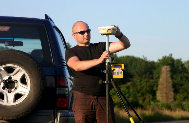
Photo: lukaszfus/iStock/Getty Images Plus/Getty Images

Photo: lukaszfus/iStock/Getty Images Plus/Getty Images

What makes us professionals

Here is the abridged version of the definition of “professional” according to the Merriam-Webster Dictionary Online:

professional (adjective)
: of, relating to, or characteristic of a profession
: engaged in one of the learned professions
: characterized by or conforming to the technical or ethical standards of a profession
professional (noun)
: one who is professional
: one who engages in a pursuit or activity professionally

Similar professions have several examples of how the collection of data is a separate process and experience level from its analysis. Consider the following:

MRI technicians train for their jobs through education, interning and experience. They know how to place patients within the equipment, shield them, apply the rays, and produce the scans as required by their job description. In simple terms, they are data collectors of patients’ medical conditions. Technicians do not analyze the scans nor offer any opinion on the prognoses of the patients. They are, however, relied upon to obtain the proper scans correctly and efficiently for review by doctors.

Staff accountants or clerks are typically charged with data entry, maintaining ledgers and journals, and verifying data/entry accuracies. Often, clerks organize invoices, statements, and other receivables for input into clients’ accounts. Much of the work for this position is electronic and relies on the employees to be savvy with spreadsheets and able to import various data formats and spot suspect data. Once this work is completed, it become the responsibility of certified public accountants (CPAs) to review and certify the information. The key role here, however, is the accurate compilation of the accounting data.

Paralegals play a key role in doing the heavy lifting of data collection for lawyers. Paralegals perform client and case research, interview witnesses, handle discovery of case information, and draft many of the documents needed by lawyers. They are tasked with assembling exhibits, delivering and filing necessary court documents, and helping with trial preparation. While they cannot express legal opinions on any case matter, it is the paralegals’ work that lawyers use to develop case strategies. Once again, the data collection is the key to the success of the lawyers’ work.

Professional surveyors are no different from doctors, accountants, and lawyers in these examples. They rely on data collection obtained by experienced staff trained to operate sophisticated instruments and data collectors.

Field technicians often serve as surveyors’ eyes, so specific training is necessary to ensure that they can accurately locate the required information. Technicians, however, cannot offer legal opinions on the location of land and parcel boundaries.

This function is solely on the shoulders of land surveyors, who are licensed specifically in that jurisdiction to apply legal principles and case law to boundary issues.

Photo: aerogondo/iStock/Getty Images Plus.Getty Images

Photo: aerogondo/iStock/Getty Images Plus.Getty Images

There is one in every crowd — the North Carolina lawsuit

For those who are not paying attention, we are solidly in the 21st century and fully engulfed in the proliferation of geospatial data. Surveyors remain at the forefront of these technological advances with a plethora of tools and techniques being introduced on a regular basis.

These tools and associated software are much advanced compared to their earlier surveying instrument counterparts, but through extensive programming and easy-to-use interfaces, this equipment may seem simple to use to the layperson. The elder surveying generation likes to refer to newer technicians as button pushers, because the users perform no true calculations.

Yes, there are necessary checks and balances even with the new equipment, but the knowledge to operate these instruments is user-friendly and intuitive. So what happens when the technology is used by someone who is not a surveyor?

Among the hazards of making these newer tools and software widely available is how they are used by the non-professional public. As many surveyors have already read about in the news and social media, a UAV operator in North Carolina has filed suit against the NC Board of Examiners for Engineers and Surveyors.

The board previously ordered the operator to discontinue his UAV flights that engaged in mapping, surveying and photogrammetry services. The operator had been providing images to realtors and homeowners that depicted graphical lines representing property lines, but also included a disclaimer that the product was not intended for surveying purposes. The board ruled he was surveying without a license. The operator is now suing the board and accusing them of violating his First Amendment rights of free speech.

This case is a high-tech example of what surveyors have faced in the past with overzealous owners of metal detectors. Many instances of low-budget outfits and even fence installers have been brought before state licensing boards because they misrepresented surveying services.

It should also be noted that survey field crews who use their equipment during off hours to help family or friends with property location without their licensed supervisor’s knowledge face the same consequences. While the “corner finders” are somewhat harmless and get a slap on the wrist from licensing boards, it is the high-tech offenders who are creating much of the harm to the public.

These situations with unlicensed surveying practices have greatly increased simply because of the available technology and low cost of entry. While GNSS receivers, robotic total stations, and associated data collectors are still quite expensive, new remote-sensing applications are being produced using consumer-grade equipment and advancing software. As technology continues to increase based upon miniaturization and capability, the costs also continue to decrease based upon volume of sales.

Can I get that UAV in purple like my phone?

Illustration: jemastock/iStock/Getty Images Plus/Getty Images

Illustration: jemastock/iStock/Getty Images Plus/Getty Images

Leading the charge into non-licensed use of new technology is the UAV and the new standard use of GPS technology within its guidance system of reasonably priced units. Hobby planes and helicopters have been around for years but required lots of skill and space to fly and were quite expensive. The invention of the multi-rotor UAV with integrated GPS has created an easy-to-fly vehicle with lots of capability.

Couple this new vehicle with a high-resolution camera for photos and video; now it allows amateurs to be aerial cinematographers. Image storage space is not an issue due to increased SD card capacity and speed.

A well-built UAV with all these capabilities is now very affordable and available everywhere. This revolution has led to larger format platforms with more rotors and heavier payloads for more sophisticated cameras and sensors. Once you have the photos and video, now you must do something with them.

The advancement of software technology for processing photos, video, and remote sensing modules has become the hottest ticket in site modeling. The combination of the UAV’s capability and the software’s output enables trained pilots and software technicians to provide orthometric-based imagery. This imagery was previously completed by airplanes and cameras costing hundreds of thousands of dollars and processed by technicians on high-end computers using years of skill and experience.

This entire operation can now be completed by one person with less than a $5,000 initial investment. This is a far cry from the funding needed in years past to outfit a survey vehicle with the necessary equipment and personnel to do this same project.

Enter the FAA and new rules for flying unmanned aircraft. After much consideration, the FAA instituted guidelines for flying UAVs along with requiring a pilot’s certification to fly for commercial purposes. They also specified limits to UAV sizes and payloads, and limited flights to 400 feet above the ground.

Many companies have purchased UAVs to provide aerial photos of their own facilities and projects, but fail to realize that publishing their images or videos qualifies them as a commercial user. Unfortunately, these regulations are much like driving a car without a license or insurance — it is only against the law if one is caught.

The iPhone 12 Pro’s lidar scanner

Another technology that will be catching on soon is lidar imagery from smartphones. The Apple iPhone 12 Pro and Pro Max contain sensors capable of capturing lidar data that is easily imported into computer drafting software. Several phone apps are also available for integrating this data into survey drawings. Geospatial data is literally at your fingertips.

50 states, 50 rulebooks

Rules and policies are put in place to regulate various professions and surveying is no different. The goal of these rules is simply to protect the public. Unlawful practice by non-licensed and/or non-qualified persons is a detriment to public safety.

The question is often raised about professional surveying licensure and the ability to practice in multiple states. Each state differs in statutory rules regarding boundary surveys. The colonial states (and Texas) follow a metes-and-bounds standard while the remaining states generally adopt a PLSS rule. Local surveying methods, terrain challenges and early settlers often affected the statutes enacted by each state, therefore variations in licensing must be applied to applicants.

However, the guiding principles for land surveyors remain the same in all states to protect the public. Boundary establishment and retracement is the sole responsibility of licensed land surveyors.

The tools of the trade are a completely different matter. Controlling the surveying services would be easier if the equipment and supplies necessary to do the work were only available to licensees, but the free market will never let that happen. If a company has $30,000 and wants a robotic total station but has no surveying license, the dealer will not stop the sale. When we drop the price tag to an $800 UAV purchase for performing aerial photography, no one bats an eye. As the cost of equipment continues to fall, the number of unlicensed users will climb.
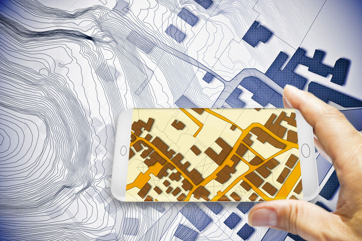
Photo: Francesco Scatena/iStock/Getty Images Plus/Getty Images

Photo: Francesco Scatena/iStock/Getty Images Plus/Getty Images

‘Men have become the tools of their tools’ (Henry David Thoreau)

The point of this topic is that surveying is not about the tools necessary to complete the task. Surveyors carried out their work for thousands of years before electronic instruments and can continue to do so if they choose. The advancement of the equipment and the technology has made it easier for surveyors to do their work, but the true meaning of the task lies within the profession.

Boundary analysis and determination is the responsibility of land surveyors. Data collection for that analysis can be completed by technicians using a variety of measuring tools. The team works together to complete the surveying process.

Anyone can buy the tools; that, however, does not make them qualified to use them properly. It is not reasonable for one to buy a scalpel and offer brain surgery with a disclaimer. Ask any surveyor; there are some boundary retracements that are the equivalent of brain surgery. And we do not get to put a disclaimer on it.

Publicerad den Lämna en kommentar

QGIS Grant Programme 2021 Results

We are extremely pleased to announce the 8 winning proposals for our 2021 QGIS.ORG grant programme. Funding for the programme was sourced by you, our project donors and sponsorsNote: For more context surrounding our grant programme, please see: QGIS Grants #6: Call for Grant Proposals 2021.

The QGIS.ORG Grant Programme aims to support work from our community that would typically not be funded by client/contractor agreements. This means that we did not accept proposals for the development of new features. Instead proposals focus on infrastructure improvements and polishing of existing features.

Voting to select the successful projects was carried out by our QGIS Voting Members. Each voting member was allowed to select up to 6 proposals. The full list of votes are available here (on the first sheet). The following sheets contain the calculations used to determine the winner (for full transparency). The table below summarizes the voting tallies for the proposals:

qgis-grants-2021

A couple of extra notes about the voting process:

  • Voting was carried out based on the technical merits of the proposals and the competency of the applicants to execute on these proposals.
  • No restrictions were in place in terms of how many proposals could be submitted per person / organization, or how many proposals could be awarded to each proposing person / organization.
  • Voting was ‘blind’ (voters could not see the existing votes that had been placed).

We received 39 votes from 23 community representatives and 16 user group representatives.

On behalf of the QGIS.ORG project, I would like to thank everyone who submitted proposals for this call!

Nyhet från QGIS, orginal inlägg

Publicerad den Lämna en kommentar

BAE Systems to open Iowa facility for mission-critical GPS work

Illustration: BAE Systems

Illustration: BAE Systems

BAE Systems is investing more than $100 million to build a state-of-the-art facility in Cedar Rapids, Iowa, expected to be completed in 2022. The facility will support the company’s newly acquired Navigation & Sensor Systems business, which makes mission-critical military GPS products.

The new building will bring the company’s local design and production employees from multiple locations into a single center of excellence with modern manufacturing, engineering and office space.

“Our world-class military GPS business is built on the rich talent pool in Greater Cedar Rapids,” said John Watkins, vice president and general manager of Precision Strike & Sensing Solutions at BAE Systems. “This investment will provide our high-tech engineering and manufacturing experts with a world-class workspace and the tools to enhance operational excellence.”
The facility will improve operational efficiency, optimize production, and enhance the company’s ability to deliver high-quality military GPS products to the warfighter.

The 278,000-square-foot research and development center will be located on a 32-acre site. The building will include a large factory; several hundred offices, workstations, and flexible work spaces; and classified and unclassified labs. The building was designed for growth, with the ability to add 50,000 square feet of additional space.

Publicerad den Lämna en kommentar

British Army Light Dragoons demo anti-jam technology

NATO forces are deployed in some of the world’s most aggressive electronic-warfare (EW) environments. Intentional interference comes both from “personal protection” devices and large, high-powered EW assets.

To navigate despite EW, armed forces need reliable and resilient GNSS/GPS positioning with anti-jam technology. The Light Dragoons — a light cavalry regiment of the British Army — are in a perfect position to test anti-jam technology for assured positioning, navigation and timing (A-PNT).

The Light Dragoons were deployed as the United Kingdom’s Light Cavalry contribution to “Battlegroup Poland,” part of NATO’s enhanced Forward Presence. On the front line, the Light Cavalry engage in reconnaissance, mark targets for indirect fires, and prepare routes for the rest of the force. In this role, being prepared for EW is essential.

To test A-PNT technologies, the Light Cavalry took part in Project Thundercat, a light cavalry capability investigation run by the Armoured Trials and Development Unit (ATDU). A Hexagon | NovAtel GPS anti-jam technology (GAJT) antenna, the GAJT-410ML, was fitted to a Jackal high-mobility transporter and integrated with its onboard positioning system.

GAJT successfully defeats jamming on GPS L1 and L2 and Galileo E1 frequencies. When interference is detected, GAJT recognizes the unwanted interference and reduces reception in that direction. The result is a more resilient GNSS solution, protected measurements and A-PNT.

The Light Dragoons found that GAJT successfully protected their positioning system despite experiencing interference. The GAJT-410ML antenna was easy to install in a simple plug-in-and-go process.

In upcoming experiments, the British Army will use NovAtel technology to gain electronic situational-awareness data to characterize the radio frequency environment.

GAJT systems are offered by NovAtel with customized offerings for land, marine and air applications.

The Light Dragoons test NovAtel GAJT anti-jamming antennas in Project Thundercat. (Photo: Photo: British Army}

The Light Dragoons test NovAtel GAJT anti-jamming antennas in Project Thundercat. (Photo: Photo: British Army}

Publicerad den Lämna en kommentar

Hexagon selected by Munich for shared mobility solution

Partnership with Fujitsu will help city track bicycles, e-scooters and ridesharing companies 

The mobility department of Munich, Germany, has selected Hexagon Geospatial to implement a smart monitoring system to better manage and understand the impacts of shared mobility services in the city. 

Hexagon will partner with Fujitsu to provide Munich a software-as-a-service (SaaS) solution for tracking, visualizing and analyzing internet of things (IoT) data from a variety of mobility providers. The solution will monitor shared vehicles, such as e-scooters, bikes and cars, and will be the first of its kind in Germany.

The solution will also feature a dynamic digital twin of the city, allowing users to fuse the real and digital worlds and receive constant updates. Along with Hexagon’s M.App Enterprise software, Fujitsu will provide the necessary infrastructure for the project, which is designed to evolve constantly according to officials’ needs.

Hexagon was selected from among 14 competitors based on the technical completeness and capabilities of its offering and established expertise in the transportation domain. With this smart monitoring system in place, the city can continually monitor and guide future mobility concepts based on data.

“Shared mobility is a big issue around the world, and the city of Munich is on the leading edge of leveraging technology to manage these services,” said Maximillian Weber, senior vice president, EMEA, Hexagon’s Safety & Infrastructure and Geospatial divisions. “We are excited to deliver a system that will help officials better identify and understand transportation patterns with the goal of improving future city mobility.” 

Tracking eScooters in Munich with Hexagon's M.App Enterprise. (Image: Hexagon Geospatial)

Tracking eScooters in Munich with Hexagon’s M.App Enterprise. (Image: Hexagon Geospatial)