Publicerad den Lämna en kommentar

ION award winners honored for GNSS and PNT contributions

ION logoThe Institute of Navigation (ION) presented its annual awards during the ION International Technical Meeting (ITM) and Precise Time and Time Interval Systems and Applications (PTTI) meeting in San Diego, California, Jan. 21-24.

The ION Annual Awards Program is sponsored by The Institute of Navigation to recognize individuals making significant contributions or demonstrating outstanding performance relating to the art and science of navigation.

Ramsey Faragher received the Per Enge Early Achievement Award for outstanding innovations in mobile positioning and navigation, and in particular for pioneering the revolutionary SuperCorrelation technology. The Per Enge Early Achievement Award is presented in recognition of outstanding contributions made early in one’s career.

Pascal Rochat received the Distinguished PTTI Service Award for advancing the state-of-the-art in high stability atomic clocks and for producing the only space-based H-maser in the world, operating on all Galileo satellites. The Distinguished PTTI Service Award is presented to recognize outstanding contributions related to the management of PTTI systems.

Jordan D. Larson, Demoz Gebre-Egziabher and Jason H. Rife received the Samuel M. Burka Award for their paper “Gaussian-Pareto Overbounding of DGNSS Pseudoranges from CORS” published in the Spring 2019 issue of NAVIGATION, Journal of The Institute of Navigation, Vol. 66, No. 1, pp. 139-150. The Samuel M. Burka Award recognizes outstanding achievement in the preparation of a paper advancing the art and science of positioning, navigation and timing.

Joseph J. Rushanan received the Captain P. V. H. Weems Award for sustained contributions to the design of GPS, including M-code, the L1C signal, and the promotion of assurance concepts for all GPS users. The Captain P. V. H. Weems Award is presented to individuals for continuing contributions to the art and science of navigation.

André Hauschild received the Tycho Brahe Award for outstanding and sustained contributions in the field of GNSS-based navigation, timing and attitude determination of space vehicles. The Tycho Brahe Award is given in recognition of outstanding contributions to the science of space navigation, guidance and control.

James J. Miller received the Norman P. Hays Award for exemplary leadership in establishing and sponsoring the National Space-based Positioning, Navigation and Timing (PNT) Advisory Board to serve the worldwide user community. The Norman P. Hays Award is given in recognition of outstanding encouragement, inspiration and support contributing to the advancement of navigation.

Zaher (Zak) M. Kassas received the Thomas L. Thurlow Award for foundational work in the theory and practice of exploiting signals of opportunity for accurate and reliable positioning, navigation and timing. The Thomas L. Thurlow Award recognizes outstanding contributions to the science of navigation.

Suneel I. Sheikh received the Distinguished Service Award in recognition of his visionary leadership in promoting positioning, navigation and timing education through the establishment, promotion and administration of the ION Satellite Division’s Autonomous Snowplow Competition. The Distinguished Service Award recognizes extraordinary service to The Institute of Navigation.

Publicerad den Lämna en kommentar

BAE Systems to get Collins GPS and Raytheon ATR businesses

Logo: BAE SystemsBAE Systems Inc. has reached definitive agreements for the proposed acquisitions of Collins Aerospace’s military GPS business and Raytheon’s Airborne Tactical Radios (ATR) business.

The two high-performing businesses are being sold in connection with obtaining the required antitrust clearances for the previously announced pending merger between Raytheon and United Technologies Corporation (UTC).

The proposed acquisitions are structured as asset transactions with associated tax benefits, and they remain subject to customary closing adjustments. The asset purchase agreement for the Collins military GPS business calls for cash of $1.925 billion, with an expected tax benefit of approximately $365 million. For Raytheon’s ATR business, the purchase agreement calls for cash of $275 million, with an expected tax benefit of approximately $50 million.

“As militaries around the world increasingly operate in contested environments, the industry-leading, battle-tested products of these two businesses will complement and extend our existing portfolio of solutions we offer our customers,” said Jerry DeMuro, CEO of BAE Systems, Inc. “This unique opportunity to acquire critical radio and GPS capabilities strengthens our position as a leading provider of defense electronics and communications systems, and further supports our alignment with the modernization priorities of the U.S. military and its partners.”

These proposed acquisitions are subject to the successful closure of the Raytheon-UTC transaction, as well as the satisfaction of other customary closing conditions, including receipt of the required U.S. regulatory approvals. Upon closure, both business lines would be integrated into the company’s Electronic Systems sector.

“These are strong businesses with talented employees who share our focus on quality and technology innovation,” said Tom Arseneault, president and COO of BAE Systems Inc. “We are confident of a smooth transition that will accelerate our future together and look forward to welcoming these new employees to the BAE Systems team once the transactions are approved.”

Collins’ Military GPS Business

Based in Cedar Rapids, Iowa, Collins’ military GPS business is a longstanding provider of mission critical military GPS receiver solutions and has been a pioneer in military GPS receiver markets for over 40 years. Today, it designs and produces advanced, hardened and secure GPS products to include M-Code, anti-jamming, and anti-spoofing technologies. The business has an installed base of over 1.5 million devices on approximately 280 platform types around the world, including ground, airborne, and weapon systems.

Given the requirement for ubiquitous, secure geo-positioning in contested battlefields, this technology offering will continue to be critical to the U.S. military and partners worldwide. For example, the business is currently developing the next generation of M-Code GPS technologies for the U.S. military, which will advance our collective position to address the priority growth area of precision guided munitions.

Raytheon’s Airborne Tactical Radios Business

Raytheon’s ATR business is a leading provider of airborne tactical radio solutions. Based in Fort Wayne, Indiana, and Largo, Florida, the ATR business designs, manufactures, and supplies a wide array of mission-critical communication systems to the U.S. Department of Defense, allied governments, and large defense aircraft manufacturers. The business has leveraged its innovative technologies to develop secure communications solutions that are installed on a broad range of military airborne platforms.

Coupled with the Electronic Systems sector of BAE Systems, Inc., Raytheon’s ATR business will enhance our positions in airborne communications with broad spectrum, multi-band, multi-channel radios including battle proven, robust, anti-jam, and encryption capabilities. The ATR business brings both complementary waveform expertise and a long trusted partnership with the U.S. Army.

These businesses will be excellent strategic fits with the strong BAE Systems Electronic Systems sector, and our combined capabilities will benefit our customers and all of our stakeholders.

Publicerad den Lämna en kommentar

Audi, Qualcomm and Virginia DOT to deploy C-V2X

Audi of America, the Virginia Department of Transportation (VDOT) and Qualcomm Technologies Inc. are planning for initial deployments of cellular vehicle-to-everything (C-V2X) communication on northern Virginia roadways.

C-V2X employs advanced wireless communications to enhance vehicle safety by using the same portion of the 5.9-GHz band that the Federal Communications Commission (FCC) has proposed to allocate for C-V2X.

In line with the Federal Department of Transportation’s announcement to establish a First Responder Safety Pilot Program, the organizations’ combined efforts are designed to focus on improving safety for construction workers and motorists.

The initial deployment is expected to take place on select roadways in Virginia beginning in the third quarter of this year.

C-V2X will be used to deliver work zone warnings on highways as well as signal timing information on approaches to signalized intersections on arterial roadways. In both cases, C-V2X communications can help deliver critical safety messages between vehicles and infrastructure with minimal latency, while less time-sensitive alerts are designed to be provided via C-V2X using the cellular network.

Photo: Audi

Photo: Audi

The initial deployments are aimed at expanding safety use cases in the connected vehicle safety spectrum established by the FCC, with the aim to curtail road hazards and fatalities. In a given year, traffic fatalities in the U.S. exceed 36,000 people.

The initial deployment is designed for connected-car systems designed to

  • boost safety around school buses,
  • warn motorists about dangerous road conditions,
  • alleviate congestion at traffic chokepoints and curbsides,
  • help improve the performance of automated vehicles that are nearing commercialization
  • potentially let cars communicate with mobile devices to send warnings that may one day help prevent the more than 6,000 pedestrian fatalities per year.

The northern Virginia initial deployment involves two primary use cases:

  • Work zone warnings, which the organizations feel is an important use case on highways, featuring a Qualcomm 9150 C-V2X chipset solution via an in-vehicle display in Audi Q8 SUVs designed to deliver a graduated warning, with the last link being a low-latency, reliable warning to drivers of the workers’ physical presence.
  • On arterial roadways, the signal phase and timing (SpaT) from a traffic signal, will be transmitted with a Qualcomm 9150 C-V2X chipset solution to Audi Q8 SUVs. These vehicles have the Audi Traffic Light Information (TLI) service that can provide drivers a countdown to the green light. C-V2X from the traffic signal can also provide direct information to the Audi Q8, which will be used by the TLI system to fine-tune the countdown information of the signal phase and timing.

“VDOT has long supported research into the benefits of connected and automated vehicles, particularly those aspects that have the potential to significantly enhance safety,” said Virginia’s Director of Transportation Research and Innovation Cathy McGhee. “The inclusion of shorter-range, direct communication in the 5.9 GHz band using C-V2X is exciting, as it can allow us to evaluate this emerging communication option for essential and practical safety and mobility services, including saving the lives of maintenance and construction personnel in work zones.”

Photo: Audi

Photo: Audi

“We recognize the immediate value of the spectrum that the FCC proposed to allocate to C-V2X, and we endeavor to show our V2X equipped cars on real roads engaging in how transportation safety and mobility could be jump-started,” said Anupam Malhotra, Director, Connected Vehicle Services, Audi of America. “We are excited about our participation in this pilot deployment as it highlights the broad societal advantages that technology is now poised to deliver through the full 5.9 GHz V2X spectrum near term with far, far more to come as connected and automated vehicle fleets emerge over the next decade.”

Audi’s Traffic Light Information V2X services operate in 25 cities and nearly 10,000 intersections nationwide, including more than 1,700 intersections in the Washington D.C. metropolitan region.

“Qualcomm Technologies is excited to work with the VDOT, through its partner Virginia Tech and Audi to support the C-V2X use cases on the very same spectrum that the FCC has proposed to allocate for C-V2X. Qualcomm Technologies has long been a pioneer in the connected car with over 20 years of experience delivering in-vehicle telematic systems,” said Jim Misener, senior director, product management, Qualcomm Technologies, Inc. “With the advances in cellular communications now enabling us to also offer direct connectivity for safety services, traffic efficiency and emerging automated use cases, we are pleased to work closely with VDOT, Audi of America and Virginia Tech to showcase the commercial maturity and technological sophistication of C-V2X and to start the proliferation of the technology on U.S. roadways.”

The Virginia Tech Transportation Institute (VTTI) will develop the software and systems to support the primary use cases defined for the initial deployment. Following software development, the institute will then conduct a demonstration of C-V2X technology operating in these use cases.

C-V2X Features and Benefits

  • The C-V2X solution used in this initial deployment is based on third-generation partnership project (3GPP) Release 14 and Release 15 specifications. Direct communication of this solution uses 20 MHz from the 5.905 – 5.925 GHz ITS band, the same spectrum that the FCC has proposed allocating for C-V2X.
  • A more advanced mode of C-V2X has an evolution path to 5G using 3GPP Release 16 specifications.
    Field test results issued by the 5G Automotive Association (5GAA) have proven C-V2X to be an efficient and effective radio access technology, showing that it significantly increases in range and reliability compared to other radio technologies.
  • C-V2X commercial products are now widely available in the form of multiple chip platforms, wireless modules, vehicular Onboard Units and infrastructure Roadside Units.
  • C-V2X encompasses both direct short-range communications that operate in the 5.9GHz ITS band and longer-range network communications delivered by mobile network operators; chipsets now offer both direct and network connectivity in the same solution concurrently, aiding in the adoption of the technology.

For more information about the Traffic Light Information technologies on Audi models in select markets, visit www.media.audiusa.com.

Publicerad den Lämna en kommentar

Galileo now replying to SOS messages worldwide

News from the European Space Agency

As well as providing global navigation services, Europe’s Galileo satellite constellation is contributing to saving more than 2,000 lives annually by relaying SOS messages to first responders. And from now on the satellites will reply to these messages, assuring people in danger that help is on the way.

This ESA-design return link system, unique to Galileo, was declared operational this week, during the 12th European Space Conference in Belgium. The delivery time for the return link acknowledgement messages from initial emergency beacon activation is expected to be a couple of minutes in the majority of cases, up to 30 minutes maximum, depending primarily on the time it takes to detect and locate the alert.

Cospas-Sarsat rescue beacon activated. Its signals are picked up by satellites in orbit, including Galileo. (Photo: GSA)

Cospas-Sarsat rescue beacon activated. Its signals are picked up by satellites in orbit, including Galileo. (Photo: GSA)

“Anyone in trouble will now receive solid confirmation, through an indication on their activated beacon, informing them that search and rescue services have been informed of their alert and location,” explains ESA’s Galileo principal search and rescue engineer Igor Stojkovic. “For anyone in a tough situation, such knowledge could make a big difference.”

All but the first two out of 26 Galileo satellites carry a Cospas-Sarsat search and rescue package. At only 8 kg in mass, these life-saving payloads consume just 3 percent of onboard power, with their receive-transmit repeater housed next to the main navigation antenna.

As part of the Operation Shark Bait test of Galileo Search and Rescue, Belgian Coast Guard boat Orka R6 dashed out to sea, guided by a positioning precision of less than 2 km, joined by an NH90 Caiman helicopter. In the test scenario, the patient had been burned and required medical evacuation to hospital. Once Tara was taken aboard the ship, she was winched aboard the helicopter. (Video: ESA–I. Stojkovic)

As part of the Operation Shark Bait test of Galileo Search and Rescue, Belgian Coast Guard boat Orka R6 dashed out to sea, guided by a positioning precision of less than 2 km, joined by an NH90 Caiman helicopter. In the test scenario, the patient had been burned and required medical evacuation to hospital. Once Tara was taken aboard the ship, she was winched aboard the helicopter. (Video: ESA–I. Stojkovic)

Founded by Canada, France, Russia and the US in 1979, Cospas-Sarsat began with payloads on low-orbiting satellites, whose rapid orbital motion allows Doppler ranging of distress signals, to pinpoint their location. The drawback is these fly so close to Earth that their field of view is comparatively small.

Geostationary satellites went on to host Cospas-Sarsat payloads. These see much more of the planet, but because they are motionless relative to Earth’s surface, Doppler ranging is not possible.

FIGURE 1. Overall concept of search and rescue system. (Image: Cospas-Sarsat)

Overall concept of search and rescue system. (Image: Cospas-Sarsat)

Medium-orbiting satellites such as Galileo – orbiting at 23 222 km altitude – offer the best of both worlds, providing a wide ground view by multiple satellites combined with time-of-arrival and Doppler ranging techniques to localise SOS signals. This improves the maximum signal detection time from four hours to less than five minutes, down to one or two kilometres (within a formal specification of 5 km within 10 minutes).

Galileo’s Search and Rescue service is Europe’s contribution to Cospas-Sarsat, operated by the European Global Navigation Satellite System Agency, GSA, and designed and developed at ESA. As the overall Galileo system architect and design authority, ESA has been responsible for the interface between the core Galileo infrastructure to the Return Link Service Provider facility, procured by the European Commission and operated by French space agency CNES.

The Cospas-Sarsat satellite repeaters are supplemented by a trio of ground stations at the corners of Europe, known as Medium-Earth Orbit Local User Terminals (MEOLUTs), based in Norway’s Spitsbergen Islands, Cyprus and Spain’s Canary Islands and coordinated from a control centre in Toulouse, France. This trio is soon to become a quartet, with a fourth station on France’s La Reunion Island in the Indian Ocean under development.

The satellites relay distress messages to these MEOLUTs, which then relay them to local search and rescue authorities.

a public demonstration of Galileo's return link service was performed at the Cospas-Sarsat Joint Committee Meeting in Doha in Qatar in summer 2019. ()Photo: ESA)

A public demonstration of Galileo’s return link service was performed at the Cospas-Sarsat Joint Committee Meeting in Doha in Qatar in summer 2019. ()Photo: ESA)

The service’s return link message capability was developed as an inherent part of the Galileo system. The messages are relayed to the individual beacons that sent the original distress call by being embedded within Galileo signals broadcast from satellites in their view.

“The switching on of the return link service was enabled by a thorough test campaign carried out by ESA, with the support of the GSA and CNES,” adds Igor. “We needed to be sure the service remains reliable even with multiple distress calls being replied to at once.”

A key milestone was a public demonstration of the return link service, performed at the Cospas-Sarsat Joint Committee Meeting in Doha in Qatar last summer.

“The return link is a joint service of Cospas-Sarsat and Galileo and therefore agreement by Cospas-Sarsat was crucial,” adds Igor.

“This acceptance was achieved through long discussions led by the European Commission at the Cospas-Sarsat Council last November, supported by plentiful documentation of simulations and test results provided by ESA and CNES.”

Publicerad den Lämna en kommentar

Microchip’s new atomic clock improves performance yet stays small

Microchip releases MAC-SA5X, enhancing its miniature atomic clock (MAC) technology to deliver wider temperature range and rapid warm-up time

As reliance on precise frequency and timing increases due to GNSS enabling 5G communication networks, data centers and other mission critical infrastructure, smaller size and high-performance atomic clock technology has become essential to supporting both military and commercial applications.

To meet demand for a small-footprint atomic clock, Microchip Technology Inc. has announced a higher performance atomic clock for its size and power. The new device also delivers a wider thermal range, critical performance improvements and other enhancements over previously available technology, the company said.

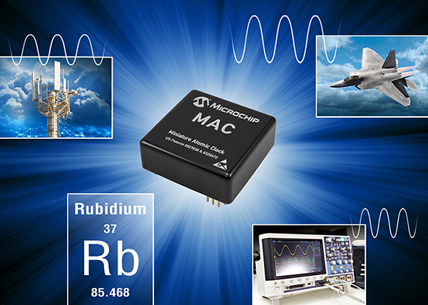
Next-Gen Timing. Microchip’s next-generation MAC-SA5X miniaturized rubidium atomic clock produces a stable time and frequency reference that maintains a high degree of synchronization to a reference clock, such as a GNSS-derived signal.

Its combination of low monthly drift rate, short-term stability and stability during temperature changes allows the device to maintain precise frequency and timing requirements during extended periods of holdover during GNSS outages or for applications where large rack-mount clocks are not possible.

Image: Microchip

Image: Microchip

Operating over a wider temperature range of -40 to +75 Celsius, the MAC-SA5X was designed to quickly achieve atomic stability performance by taking less time to lock compared to some of the existing clock technology, Microchip said. In an aircraft application, for example, these attributes enable faster power up of critical communication and navigation systems in extreme climates.

The MAC-SA5X allows system developers to avoid the need for extra circuitry by integrating a one pulse per second (1PPS) input pin for fast frequency calibration, saving time and development cost. In addition, the MAC-SA5X is designed with the same footprint as previous generation miniature atomic clock technology, reducing the development time to transition to the newer, higher performance device.

“As an industry leader, Microchip continues to invest in next-generation atomic clock technology for Department of Defense programs, mission-critical infrastructure and networks that require a high degree of accuracy in timekeeping and synchronization,” said Randy Brudzinski, vice president and general manager of Microchip’s frequency and time business unit. “The MAC-SA5X adds several performance and feature enhancements while retaining the same footprint as the previous generation MAC-SA.3X products, enabling customers to easily transition to the new technology.”

Designed and manufactured in the U.S., the MAC-SA5X operates to the following additional specifications:

  • <5.0E-11 frequency stability over operating temperature;
  • <5.0E-11 per month aging rate; 6.3-watt power consumption;
  • 47 cc in volume.

The MAC-SA5X provides backward compatibility with its predecessor MAC-SA.3Xm family and comes in an ovenized crystal oscillator (OCXO)-sized package of 50.8 mm x 50.8 mm.

Microchip has delivered more than 275,000 rubidium clocks, 120,000 chip-scale atomic clocks (CSACs), 12,500 Cesium clocks and 200 active hydrogen masers to customers worldwide.

Development Tools. The MAC-SA5x family of atomic clocks is supported by evaluation kit 090-44500-000.

Availability. The MAC-SA5X atomic clock is available now for pre-sampling, and will be available for deliveries in February. Microchip supports the MAC-SA5X with technical support services as well as an extended warranty.

Publicerad den Lämna en kommentar

4th GPS civilian signal goes live

A new GPS civilian signal is now available for use. The new signal is stronger, more accurate, more resilient to interference events, and interoperable with European Galileo system.

Researchers from the Finnish Geospatial Research Institute (FGI) recorded the new civilian signal transmitted by the first GPS III operational satellite.

On Jan. 13 at 21:29 Finnish time, the first GPS III satellite (SVN74) was marked healthy after extensive operational testing in orbit. The satellite broadcasts PRN04 identification codes. It also transmits a new GPS civilian signal, known as L1C, different than the legacy L1 C/A signal used nowadays.

10 times stronger

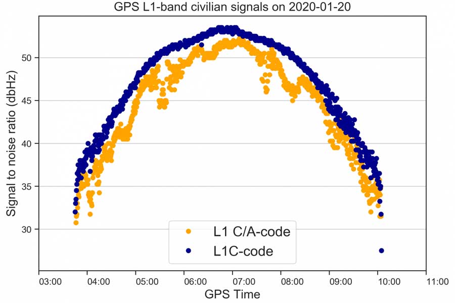
The two signals are transmitted at the same frequency, but L1C codes are 10 times longer than L1 C/A. This makes the signal more robust to interference when multiple satellites are tracked on the same frequency band.

“Marking a satellite health means receivers can use this satellite in their positioning, navigation and timing applications,” said Octavian Andrei, senior research scientist at the Finnish Geospatial Research Institute (FGI). “L1C is the 4th GPS signal for the civilian use.”

The other three civilian signals of GPS are L2C, L5 and L1 C/A.

The new signal (L1C, marked with blue) is 3-5 dBHz stronger and more robust than the legacy L1 C/A signal (marked with orange). (Image: Octavian Andrei)

The new signal (L1C, marked with blue) is 3-5 dBHz stronger and more robust than the legacy L1 C/A signal (marked with orange). (Image: Octavian Andrei)

Interoperable with the European GNSS signal

L1C signal is transmitted on L1-band at 1575.42 MHz. It is meant to replace the legacy C/A signal in the future. L1C allows for the first time GPS compatibility and full interoperability with signals from other satellite systems, such as E1 signal from the European Galileo.

The interoperability with Galileo is further enhanced by transmission of the inter-system timing biases; that is, the GPS-Galileo Time Offset. All these improvements will bring further benefits and developments to the GNSS market and civilian users in general.

Ionosphere no problem with dual-frequency

Andrei said the new signals means “Exciting times ahead for the civilian users and applications that demand precise satellite positioning and navigation. Most of the effects due to the ionosphere layers of the atmosphere are removed by combining signals from two frequency bands sufficiently apart from each other. This is the case with L1 and L2 or L1 and L5. All these civilian signals are stronger and more robust than ever before,” he explained.

The satellite signals are affected by errors while travelling through the atmosphere. The main errors are due to the ionosphere, which is a dispersive medium and frequency dependent. The latter proves to be actually a significant benefit for the precise applications.

More than 99 % of the ionosphere effect is removed by forming special linear combination of signals observed on two different frequencies. This is the main reason why high-precision is achieved with dual-frequency receivers.

FinnRef network ready for new satellites and signals

“Two GPS III satellites have been launched until now and two more are expected to be launched during 2020. With signals from four satellites, we will also be able to estimate L1C-only positions,” Andrei said.

The first GPS III satellite SVN74, nicknamed Vespucci, was launched on Dec. 23, 2018. The second satellite SVN75, nicknamed Magellan, was launched on Aug.22, 2019. The third and the fourth satellite are planned to be launched in March and July during 2020. The first L1C testing signals were recorded at the FinnRef station in Metsähovi on April 5, 2019.

FinnRef national network includes state-of-the-art multi-constellation tracking stations distributed around Finland. These stations are capable of tracking multiple satellite signals on multiple L-band frequencies from almost 120 GNSS satellites, including the European Union’s Galileo, US GPS, Russian GLONASS, and Chinese BeiDou constellation.

Using new signals often requires updates to station equipment, usually meaning firmware updates on the receiver software. After the new firmware enabling L1C tracking is properly tested, the receivers will be updated and then whole FinnRef will start tracking GPS L1C.

Publicerad den Lämna en kommentar

U-blox L-band receiver enables cm-level positioning for mass market

Photo: u-blox

Photo: u-blox

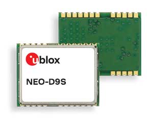
U-blox said its new NEO-D9S GNSS correction data receiver module provides an affordable approach to bringing centimeter-level accuracy to GNSS receivers.

The NEO-D9S receives from correction service providers broadcast on the L-band (1525-1559 MHz). A host processor can then decrypt this correction data and provide it to a high-precision GNSS receiver, combining corrections directly with readings from the satellite constellations to enable much more accurate position readings than those offered by GNSS signals alone.

Use of the NEO-D9S will also increase the availability of high-precision GNSS positioning data in areas with limited connectivity and reduce the amount of cellular data consumed by positioning receivers.

Customers are expected to include carmakers, both Tier 1 and OEMs, industrial system integrators that offer position-correction services, and any other applications that rely on very accurate positioning at low cost.

The NEO-D9S module is a correction-only receiver, based on the latest u-blox ninth-generation (D9) platform. This means that it will integrate easily with the u-blox F9 RTK GNSS receivers from u-blox, or can be used as part of a modular product roadmap. The module also integrates a TCXO and SAW filter to ensure good RF sensitivity and resilience to interference from adjacent channels.

The module includes the algorithms necessary to decode satellite data broadcasts. It is configured to work initially with whichever correction service has been set as default, but can be configured for any L-band data broadcast. It stores its configuration settings in non-volatile memory.

Publicerad den Lämna en kommentar

New u-blox module aimed at indoor positioning

u-blox’s Bluetooth low-energy module features direction finding, bringing the benefits of high-precision positioning to indoor applications

U-blox, provider of positioning and wireless communication technologies, has announced the u-blox NINA-B4 Bluetooth low-energy module series. Based on Nordic Semiconductor’s recently announced nRF52833 chip, NINA-B4 enables a number of Bluetooth features including Bluetooth long range, Bluetooth mesh and Bluetooth direction finding.

The module is tailored to the needs of applications in the connected industry, smart homes, buildings and cities, asset tracking and eHealth.

The NINA-B4 offers a new direction-finding feature, a key component of the Bluetooth v5.1 specification that brings the benefits of high-precision positioning to indoor applications. It is the first u-blox module designed to act as both a transmitter and a receiver in angle of arrival (AoA) and angle of departure (AoD) direction finding and indoor positioning applications.

In AoA-based implementations, stationary beacons equipped with multi-antenna arrays determine the angle of arrival of signals emitted by a tracking device to pinpoint the tracker’s location with sub-meter-level accuracy. When AoD is used, the tracking device triangulates its position by calculating the angle of departure of signals from the stationary Bluetooth beacons’ multi-antenna arrays.

Mesh, long range, and extended temperature range

The u-blox NINA-B4 enables wireless mesh networks, which offer robust communication between large numbers of connected devices, extending the reach of messages by relaying them from node to node until they reach their destination. By simplifying the control of groups of devices, mesh networks are well suited for applications such as smart lighting systems in cities and buildings, which further benefit from the module’s enhanced operating temperature range (up to 105 °C).

Featuring Bluetooth long range, the NINA-B4 series can be deployed in harsh environments, for instance, to enable wirelessly connected and configurable equipment. Long range not only increases the distance that Bluetooth signals can travel in undisturbed environments, but also makes communications more robust and reliable in unfavorable ones, a common need in production plants or on factory floors.

The NINA-B4 series comes with u-blox u‑connect software, simplifying integration of Bluetooth into new and existing products by providing an easy-to-use interface to configure the connectivity required.

NINA-B4 has a powerful Arm Cortex-M4F MCU with an open CPU architecture, allowing customers to run their own applications on the module. Supporting Zigbee and Thread, the first members of the NINA-B4 family come with an internal PCB antenna, or alternatively with a U.FL connector for an external antenna of choice.

Samples of the NINA-B4 will be available in December.

Publicerad den Lämna en kommentar

Qualcomm launches 3 dual-frequency + NavIC smartphone modules

New modules enable entertainment, advanced connectivity features and next-generation artificial intelligence

Qualcomm Technologies has launched three new mobile platforms — the Qualcomm Snapdragon 720G, 662 and 460 — to enable enhanced user experiences across connectivity, gaming and entertainment.

The new mobile platforms support dual-frequency (L1 and L5) GNSS to improve location positioning accuracy and robustness. The system-on-chip solutions also support the Indian NavIC (Navigation with Indian Constellation).

Seven constellations. For the first time supported on mobile, the Qualcomm Location Suite now supports up to seven satellite constellations concurrently, including the use of all of NavIC’s operating satellites for more accurate location performance, faster time-to-first-fix (TTFF) position acquisition, and improved robustness of location-based services.

“ISRO is satisfied with the efforts of Qualcomm Technologies Inc. towards incorporating NavIC and we urge OEMs to leverage it for future handset launches in India,” said K. Sivan, chairman, ISRO. “The availability of NavIC across multiple mobile platforms will help enhance the geolocation capabilities of smartphones in the region and bring the benefits of this indigenous solution to Indian consumers for their day-to-day use.”

The new modules also enable fast 4G connectivity speeds, deliver key Wi-Fi 6 features and integrated Bluetooth 5.1 with advanced audio via the Qualcomm FastConnect 6-series subsystems.

Artificial Intelligence. Designed to deliver new and improved AI user experiences across photography, voice assistants and virtually always-on scenarios for increased contextual awareness, the new platforms also feature the Qualcomm AI Engine and Qualcomm Sensing Hub.

“While we see a fast adoption of 5G across geographies globally, we do recognize the phenomenal boost that 4G has given towards enabling broadband connectivity for Indian consumers. 4G will continue to remain a focus area for Qualcomm Technologies for regions like India, where it will stay a key technology for connectivity,” said Rajen Vagadia, vice president and president, Qualcomm India Pvt. Ltd. “Our goal is to enable our partners to continue creating solutions that offer seamless connectivity access and exceptional mobile experiences, that consumers can count on.”

“Today’s smartphone users want fast, seamless connectivity, advanced features and long-lasting battery life,” said Kedar Kondap, vice president, product management, Qualcomm Technologies, Inc. “This expansion of our 4G lineup enables our partners to offer sophisticated solutions that meet global demand and enable a remarkable gaming experience across multiple tiers and price segments.”
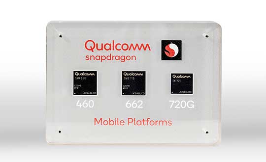
Photo: Qualcomm

Photo: Qualcomm

Snapdragon 720G

Snapdragon 720G reimagines extraordinary gaming and entertainment experiences with select Qualcomm Snapdragon Elite Gaming features, striking capture capabilities, and intelligent performance. Leveraging select Snapdragon Elite Gaming features from premium-tier mobile platforms, Snapdragon 720G delivers smooth HDR game play, dynamic color range and contrast, realistic and immersive in-game environments, and high-quality, synchronized sound with Qualcomm aptX Adaptive.

In addition to gaming, users will have a “home theater in their pocket” with HDR viewing and super-smooth video streaming with the Qualcomm Spectra 350L ISP, Qualcomm said. They can also capture 4K video or snap massive 192-megapixel photos.

Snapdragon 720G also features the latest fifth-generation Qualcomm AI Engine with the improved Qualcomm Hexagon Tensor Accelerator that will enable a host of new AI experiences for gaming, photography, voice assistants and virtually always-on contextual awareness.

The integrated Snapdragon X15 LTE modem supports 3-carrier aggregation, 4×4 MIMO on two carriers and 256-QAM modulation for fast download speeds up to 800 Mbps — allowing for quick app downloads and smooth video streaming and sharing.

In addition, Snapdragon 720G, with the FastConnect 6200 subsystem, virtually doubles Wi-Fi speed and range for online gaming and web browsing, compared to single antenna devices, while also delivering key Wi-Fi 6 features such as 8×8 sounding with multi-user MIMO for up to 2x improvement over competitive Wi-Fi 6 devices, Target Wake Time for up to 67% better power efficiency and the complete WPA3 security suite, as well as integrated Bluetooth 5.1 with advanced audio capabilities.

Finally, users will experience power savings and improved performance due to the Snapdragon 720G’s 8-nm process technology and upgraded CPU architecture.

Snapdragon 662

Snapdragon 662 brings astonishing camera and AI capabilities to the 6-series for the first time. It will feature the new Qualcomm Spectra 340T, which supports triple camera configurations and smooth switching between them — a first in the 6-series. A more robust ISP will enable support for photo capture in the HEIF file format for stunning image quality at half the file size.

The addition of the third-generation Qualcomm AI Engine with Hexagon Vector Extensions and the Qualcomm Spectra 340T will enable AI-based user experiences such as avatars, night photography, and face and voice authentication.

Snapdragon 662 also features the new Snapdragon X11 LTE modem with peak download speeds up to 390 Mbps thanks to 2-carrier aggregation, 2×2 MIMO and 256-QAM modulation, along with 150 Mbps peak uploads to support a snappy web browsing and social media experience.

Snapdragon 460

Snapdragon 460 boasts a gigantic leap in performance across the board in the 4-series, as well as significant boosts in connectivity, AI and camera improvements[1] for the next-generation of mass market smartphones. For the first time in the 4-series, Snapdragon 460 features performance CPU cores and an updated GPU architecture that translates into up to 70% and 60% increase in performance, respectively.

Overall system performance, meanwhile, delivers a 2x increase compared the previous generation. The Hexagon processor with Qualcomm Hexagon Vector eXtensions (HVX) is also introduced into the 4-series for the first time, thereby equipping it with a 3rd generation Qualcomm AI Engine and the Qualcomm Sensing Hub for new AI experiences for photography and voice assistance.

The Qualcomm Spectra 340 ISP is also among the many new additions to the 4-series, enabling the platform to capture stunning photographs and support for triple cameras. An integrated Snapdragon X11 LTE modem allows for download speeds up to 390 Mbps and uploads up to 150 Mbps.

To date, more than 85 commercial devices based on Snapdragon 7-series mobile platforms, more than 1600 commercial devices based on Snapdragon 6-series mobile platforms, and more than 2,500 commercial devices based on Snapdragon 4-series mobile platforms have been announced by global OEMs. Together, the 7-, 6- and 4-series amount to over 4,000 designs — an impressive feat for these segments.

Devices based on Snapdragon 720G are expected to be commercially available in Q1 2020 and devices based on Snapdragon 662 and 460 are expected to be commercially available by the end of 2020. For more information, please visit the product details pages for the Snapdragon 720G Mobile Platform, Snapdragon 662 Mobile Platform, and Snapdragon 460 Mobile Platform.

Publicerad den Lämna en kommentar

Airbus reminds pilots what to do when GNSS interference hits

Airbus is providing safety information to all pilots, not just those of the new BelugaXL. (Photo: Airbus)

Airbus is providing safety information to all pilots, not just those of the new BelugaXL. (Photo: Airbus)

Commercial airline pilots should be ready if their GNSS interference or jamming takes place. This safety message, along with steps to take, was provided by Airbus in the January issue of its publication Safety First.

In the publication, Airbus is reminding pilots of the consequences and required action in the cockpit, according to Aviation Week. Loss of the GNSS signal can affect navigation and surveillance functions. While built-in redundancies will maintain position computation, up to a dozen systems and functions can be affected.

Cover: Airbus

Cover: Airbus

“A loss of GNSS inputs does not lead to a map shift or an erroneous position computation by the FMS (Flight Management System). In the case of a loss of GPS signal, the FMS switches from the mixed GPS/IRS position to an IRS-DME/DME position or IRS-VOR/DME or pure IRS, in order of priority,” the experts explain in the publication.

Other affected systems can include the predictive functions of the terrain awareness and warning system, the runway overrun protection system, and ADS-B Out, in which case pilots should notify air traffic control.

Once the flight is over, pilots should report the GNSS interference event to air navigation service providers.