Publicerad den Lämna en kommentar

Big acquisition: Quorvo to acquire location company Decawave

logos-Decawave

Decawave announced today that Qorvo, a provider of RF solutions, is acquiring the company, as well as Custom MMIC. Financial details have not been disclosed.

“This acquisition is by far the biggest in the indoor location industry,” according to Bruce Krulwich, founder of Grizzly Analytics. “While the price is not disclosed, I and others have estimated it at $400-500 million.”

“Apple is using their own UWB chips in upcoming iPhones, but their own chips are too big and use too much power to be used in smartwatches or other small devices,” Krulwich said. “Decawave’s chips will enable Qurvo to sell compatible UWB chips to a much wider range of markets.Apple’s use of UWB in iPhones is the tipping point for UWB. With Apple’s stamp of approval, UWB will be incorporated into a wide range of location-aware electronics, including robots, drones, wearables, smartwatches and more.”

“The biggest implications for this acquisition are not only in the RTLS market, but also in the areas of internet of things, wearables and location-aware electronics,” Krulwich said. “UWB is being used in next-generation products like drones by Intel, robots by iRobot, and autonomous vehicle movement by Segway.”

Bob Bruggeworth, president and chief executive officer of Qorvo, said in a third-quarter financial release that the company was “looking forward to welcoming two industry-leading teams, Decawave and Custom MMIC, to the Qorvo family, expanding our technology portfolio and product offerings.”

Decawave is an Irish fabless semiconductor company specializing in precise location and connectivity applications. The acquisition will advance market penetration of IR-UWB and enable broad global adoption of the technology.

Decawave was founded in Dublin in 2007 by current CEO Ciaran Connell and CTO Michael McLaughlin. The co-founders had a vision that the new IR-UWB technology, based on a nascent IEEE standard, could deliver ultra-accurate location in a way that would revolutionize people’s lives like GPS did in the 1990s.

Twelve years later, IR-UWB is on the verge of becoming the next essential component technology, like GPS, Wi-Fi and Bluetooth before it. Already shipping in millions of smartphones and cars, and across more than 40 other verticals, IR-UWB is enabling accurate indoor location services, secure communications, context aware user interfaces and advanced analytics.

“We are thrilled to announce the acquisition of Decawave by Qorvo,” said co-founder and CEO Ciaran Connell. “We have created an incredibly unique technology, but we understand that to embrace the opportunity in front of us, we will need greater resources to execute at scale, accelerate our innovation and product launches and to continue to support our growing customer base with the same level of service.

“Joining forces with Qorvo’s leading expertise in RF technology, their experience in serving very high-volume markets like Mobile but also the thousands of customers in Industrial and Enterprise, is, for Decawave, a perfect combination to scale and further accelerate the adoption of IR-UWB.”

Eric Creviston, President of Qorvo Mobile Products, said, “We’re very pleased to welcome the Decawave team, which we believe will enhance Qorvo’s product and technology leadership while expanding new opportunities in mobile, automotive and IoT. We look forward to building on the groundbreaking work that Decawave has done and helping to drive new applications and businesses using their unique UWB capability.”

Decawave co-founder Michael McLaughlin added, “From proving a new technology, to building new markets and to today joining a Tier 1 semiconductor company, the past 12 years have been a challenging and fantastic journey.

“None of this would have been possible without the dedication and passion of Decawave employees as well as the constant support from our lead investor Atlantic Bridge, Act Venture Capital, Summit Bridge, Enterprise Ireland and our business angels. To all others who accompanied us on this journey we also say a sincere and profound thank you and we look forward to the next chapter for IR-UWB.”

In the coming months and years Decawave and Qorvo will:

  • Continue to contribute to the IEEE, Car Connectivity Consortium, FiRa and UWB alliance to define next-generation PHYs and protocols, ensuring interoperability across applications and fueling IR-UWB adoption,
  • Accelerate the roadmap of ICs and modules, leveraging their respective R&D strengths and product portfolio to bring even more IR-UWB solutions to the market,
  • Pursue existing partnerships and investments in enablement to offer flexible and easy to integrate IR-UWB solutions to our customers.
Publicerad den Lämna en kommentar

Sapcorda releases high-precision GNSS service in USA and Europe

Sapcorda-logoSapcorda Services GmbH has released its SAPA (Safe And Precise Augmentation) Premium GNSS positioning service.

The SAPA service enables mass-market GNSS devices to operate with increased accuracy and reliability across Europe and the continental United States. The service’s technology unlocks advanced performance with instantaneous sub-decimeter position accuracy for devices used in all market applications.

SAPA is delivered using the open industry-recognized SPARTN format, which allows efficiently delivery of the correction data via internet and satellite broadcast. “When using our service, users across Europe and the United States can experience homogeneous, gap-free, advanced positioning performance with any GNSS hardware designed for high precision positioning,” CTO Rodrigo Leandro said.

The SAPA service is tailored for mass-market applications including innovative mobility solutions, IoT applications, and traditional markets such as maritime.

SAPA was designed from ground up to support safety-critical applications such as autonomous driving.

SPARTN (Safe Position Augmentation for Real-Time Navigation) is a high-accuracy, open- and free-to-use GNSS format tailored for broadcast distribution in mass-market applications.

Sapcorda Services GmbH is a GNSS service provider focusing on the emerging high-precision GNSS mass markets. The company has designed its technology and service offering to serve high volume automotive, industrial and consumer markets.

Publicerad den Lämna en kommentar

GPS problems bedevil Denver light rail

Denver’s RTD light-rail system has bragged that “RTD is one of the few transit agencies, nationally, to meet Congress’ original Dec. 31, 2015 deadline” for instituting Positive Train Control (PTC).

Yet reception of the GPS signals upon which their PTC system depend continues to be a significant problem.
PTC is designed to prevent train-to-train collisions, derailments caused by excessive train speed, train movements through misaligned track switches, and unauthorized train entry into work zones.

This means that the location, speed and time information derived from GPS are critical elements.

Photo: RTD

Photo: Regional Transportation District of Denver (RTD).

Lack of reliable GPS reception has meant significant reductions in the efficiency and performance of the light-rail system overall, and much more work for its operators. Coping mechanisms have included manual overrides of PTC safety features and human flaggers at “automated” crossings.

This has undoubtedly greatly increased operating costs, not to mention the price of attorneys to deal with regulatory issues and litigation.

The upshot of all of this is that Denver RTD continues to struggle to make its operational PTC system work.

This has been a concern for the Federal Railroad Administration (FRA), the agency within the Department of Transportation responsible for overseeing and regulating such systems.

In a December 2018 submission to the FRA, Denver’s RTD outlined the steps it was taking to address this problem. In the document and public statements, RTD has blamed high-rise buildings in the vicinity of lines and terminals for its GPS problems.

“Specifically at Denver Union Station, there has been significant high-rise building development in the surrounding area which has impacted reception of GPS signal (sic) in the platform area. There are a few PTC initialization issues each day due to poor reception of GPS signal (sic). This increases PTC sut outs for the first section of the train trip and in some cases cause a longer waiting time at York crossing once the train initializes at 38th/Blake station.”

One of the solutions to be evaluated in January 2019 was installation of GPS signal repeaters at the stations to improve reception at the platform.

This was likely not successful. In October 2019 RTD responded to a complaint on Twitter with ”We are in the middle of installing hardware on our light-rail trains so they will be able to use GPS also.”

When asked this week about the status of their GPS problems, RTD replied simply “We are still working on it.”

GPS expert and Colorado resident Logan Scott opines that high-rise interference might not be as problematic if we can learn how to safely use all of the GNSS signals available. “Depending on the time of day, there are from 5 to 12 healthy GPS satellites visible in the open sky over that city. If we include all healthy GNSS satellites, the numbers rise to between 22 and 35 navigation satellites visible. As the nation looks for backups and augmentations to GPS for critical applications, the possibility and benefits of using GNSS systems beyond GPS is often overlooked.”

Scott will be teaching a course titled “Towards the Safe Use of GNSS in Critical Applications” at June’s ION Joint Navigation Conference in Cincinnati.

Publicerad den Lämna en kommentar

Editorial Advisory Board PNT Q&A: Matching receivers and antennas

What are the key technical criteria in matching GNSS receivers and antennas from the same or different manufacturers? For what uses does it matter most?

Photo: Orolia/Spectracom

John Fischer

“For fixed-pattern antennas, it’s fairly simple: RF + DC to power the antenna. Most vendors are compatible. The challenge is more for controlled radiation pattern antennas (CRPA). Power requirements vary greatly, and performance can be improved with a two-way data exchange between the CRPA and receiver, but there is no industry standard yet for this interface. An example: tilt angles from the receiver’s IMU can greatly aid beam pointing.”
John Fischer
Orolia


Ellen Hall

Ellen Hall

“Antenna selection is exceptionally critical for our military and high-precision users. The platform and environment are the primary drivers of these antenna requirements. In general, SWaP (size, weight and power) is at the forefront of all criteria. As operational plans are developed, requirements for a single or multi-element array,  element gain, and noise figure must be considered.”
Ellen Hall
Spirent Federal Systems


Members of the EAB

Tony Agresta
Nearmap

Miguel Amor
Hexagon Positioning Intelligence

Thibault Bonnevie
SBG Systems

Alison Brown
NAVSYS Corporation

Ismael Colomina
GeoNumerics

Clem Driscoll
C.J. Driscoll & Associates

John Fischer
Orolia

Ellen Hall
Spirent Federal Systems

Jules McNeff
Overlook Systems Technologies, Inc.

Terry Moore
University of Nottingham

Bradford W. Parkinson
Stanford Center for Position, Navigation and Time

Jean-Marie Sleewaegen
Septentrio

Michael Swiek
GPS Alliance

Julian Thomas
Racelogic Ltd.

Greg Turetzky
Consultant

Publicerad den Lämna en kommentar

Drone mystery lights up Colorado skies

A proposed FAA rule — open for public comment until March 2 — would require drones over 0.55 pounds to electronically transmit their location and ID.

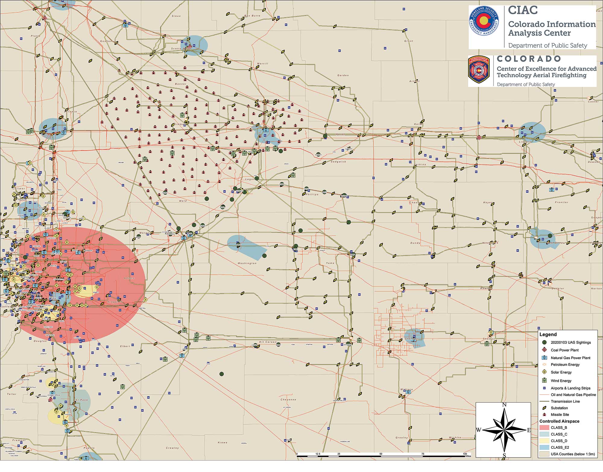
Northeastern Colorado was visited with a mystery in late December and January. Residents began seeing drones from 7 to 10 p.m. each night, moving in groups as large as 30, and flying in a grid pattern. The drones stayed about 200 feet to 300 feet in the air and flew steadily in squares of about 25 miles, at speeds estimated at 25–40 mph.

Reports were so numerous that a multi-agency task force was formed to investigate, including 10–15 law enforcement agencies as well as the FBI and Federal Aviation Administration (FAA). The drones were reported to measure six feet across and sound like a small jet engine. “These are not drones that people in our county can just buy,” said Washington County Sheriff Jon Stivers.

Numerous government agencies and companies denied the drones were theirs, including the U.S. Air Force, NOAA, NORAD, the FAA, and large drone developers Google, Amazon and Uber.

The Colorado Division of Fire Prevention and Control (DFPC) flew the state’s Multi-Mission Aircraft in an area where drones had been reported during two January missions.

This DFPC map, obtained by FOX31 TV, shows possible locations of drone sightings along with power plants, pipelines and missile sites. (Map: Colorado Division of Fire Prevention and Control)

This DFPC map, obtained by FOX31 TV, shows possible locations of drone sightings along with power plants, pipelines and missile sites. (Map: Colorado Division of Fire Prevention and Control)

Some suspect the drones were part of a secretive Air Force counter-drone program to protect nuclear missile silos. Another theory was a hunt for a missing nuclear warhead from one of the many intercontinental ballistic missile sites that dot the prairies of Wyoming, Colorado and Nebraska.

A group of Wichita, Kansas, drone enthusiasts also came forward, saying they had flown groups of drones in the area — but not to the same scale.

In an interview at January’s World Economic Forum in Davos, Switzerland, Transportation Secretary Elaine Chao told Yahoo Finance, “We don’t know who they belong to, we don’t know who’s operating them, to this day we do not.” Her department oversees the FAA, which issues Part 107 waivers to drone operators, allowing them to fly at night or out of line of sight of the operator. The waivers (thousands have been issued) lack enough specifics to narrow down who might be responsible for mystery drones.

A proposed FAA rule — open for public comment until March 2 — would require drones over 0.55 pounds to electronically transmit their location and ID, giving agencies access to information on drones in flight.

The new remote ID requirement would help with the creation of the Unmanned Aircraft System Traffic Management System, a project between the FAA, NASA and other agencies to “ultimately identify services, roles and responsibilities, information architecture, data exchange protocols, software functions, infrastructure, and performance requirements for enabling the management of low-altitude uncontrolled drone operations,” according to the FAA.

As of press time, no one has come forward to claim ownership of the drones. The public is encouraged to submit reports. As The X-Files’ Fox Mulder might say, “Watch the skies.”

Publicerad den Lämna en kommentar

Receiver innovators log trends and product launches

Cover photo: Topcon

Cover photo: Topcon

Lay of the GNSS Land

Top receiver manufacturers discuss what’s on the horizon for GNSS receivers. The companies reveal recent and upcoming innovations, how to combat spoofing and jamming, fusing GNSS with other sensors, and the impact of increasing accuracy both for professional surveyors and consumers.

With regard to jamming and spoofing, the preferred approach is a combination of monitoring, detection and filtering. However, shielding, the use of IMUs and other third-party sensors, and advances in processing algorithms also help mitigate interference. In a few years, hopefully, encrypted or “watermarked” signals will substantially reduce this problem.

IMUs and other sensors are now routinely integrated with GNSS receivers, with their outputs fused. This trend is largely propelled on the demand side by the needs of the emerging market for autonomous vehicles and on the supply side by smaller, cheaper and more accurate IMUs and lidar scanners. Meanwhile, developments in algorithms have improved the modeling of errors to correct for the inherent tendency of IMUs to drift. Additionally, digital cameras, lidar and other industry-specific sensors are increasingly common, especially for collision avoidance in human-machine interactions.

In surveying, the use of all constellations and frequencies, as they become available, is an industry trend. Costs will continue to drop as the growth in the adoption of GNSS solutions enables manufacturers to take greater advantage of economies of scale. Precise point positioning (PPP), which benefits greatly from the growth in GNSS constellations, is now giving real-time kinematic (RTK) positioning a run for its money. Available applications enable Android mobile devices to achieve centimeter accuracy, while innovations continue in core positioning algorithms.

In the world of mobile consumer devices, dual-frequency, multi-constellation GNSS chipsets are increasingly prevalent. As increased accuracy fuels expectations for even higher accuracy, precision positioning may become the norm in the consumer space, and new applications for these devices may emerge. Already, crowdsourcing the monitoring of both GNSS signals and interference helps improve accuracy for everyone, in a positive feedback loop.

Other notable trends include the introduction and expansion of 5G data networks, the increased use of satellite-based correction services, and continued efforts to develop precise positioning for indoor areas.


Topcon

Jamming and Spoofing. “We continue to develop and deploy patented technology to detect spoofing,” said Alok Srivastava, director, product management. “We already have cutting edge GNSS antenna technology to provide stellar support for interference rejection and filtering.” All Topcon end products have this advanced antenna and filtering technology.

Sensor Fusion. “Topcon has been using inertial systems for decades for a variety of positioning applications — such as machine control, mobile mapping, and agriculture,” said Srivastava. “In recent years, advancements in IMU technology have progressed to where the size and cost of these sensors are at levels to be utilized at a larger scale. For example, the recently released Topcon HiPer VR takes advantage of inertial technology to improve productivity in real time with our Topcon Integrated Leveling Technology (TILT), which compensates for mis-leveled field measurements out of plumb by as much as 15 degrees.”

Surveying. Topcon continues to invest in its core positioning algorithms to innovate such features as quartz lock loop, advanced multi-engine platform, and VHD heading technology into its positioning engines, Srivastava said. “We also produce solutions such as our Millimeter GPS and Hybrid Positioning innovations, which are designed around improving accuracy, higher reliability, and greater flexibility by converging positioning technologies.”

Consumer Devices. “GNSS in consumer devices and other commercial systems is used to aid other positioning sensors,” Srivastava said. “So, it may not be in the best of interest to offer that level of accuracy from GNSS alone.”

Other Challenges. Precise indoor positioning is a requirement of the vertical construction industry. “Topcon’s combined optical instrument takes a unique approach to solve that problem by integrating a compact laser scanner with a fully featured robotic total station,” Srivastava said.
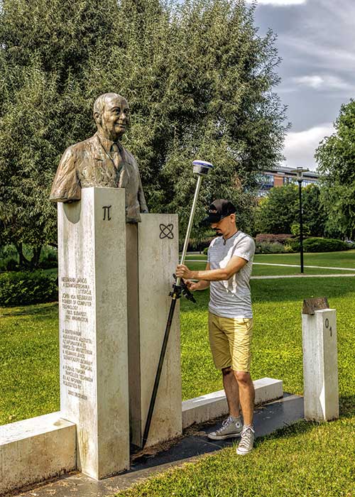

Photo: CHC Navigation

Photo: CHC Navigation

CHC Navigation

Jamming and Spoofing. CHCNav is currently taking a twofold approach to GNSS interference, said François Martin, vice general manager, International Division. “As a GNSS system integrator, we focus our design around strong electromagnetic shielding and sealed isolation chambers.” Additionally, he pointed out, the advanced filtering of GNSS signals and an antenna patch produce optimal interference mitigation.

Sensor Fusion. Integrating interference-free, high-dynamic IMUs instead of MEMS has brought the full benefits of tilt compensation to users, Martin said. The latest development in algorithms dramatically obviated the need for the annoying process of initializing GNSS IMU receivers and boosted the availability of GNSS RTK in demanding environments.

Surveying. The fast adoption of GNSS solutions by large user segments has reduced costs by enabling a sizable manufacturing economy of scale, Martin pointed out. “Tighter combination of embedded technologies such as GNSS and connectivity modules are sustaining that cost reduction process.”

Consumer Devices. “The emergence of dual frequency multi-constellation GNSS chipsets supports the development of untapped user segments, but the position accuracy repeatability remains an issue,” Martin said. “The integration of GNSS chipset and high-performance helical antennas, as precision add-on modules, onto rugged Android cell phone and tablets is creating a prosumer-grade centimeter to decimeter accuracy answering to a wide range of mobile workforce applications.”

Other Challenges. A growing number of positioning and navigation applications require the fusion of technologies to increase productivity, Martin said. “The integration of advanced tightly integrated positioning algorithms, scanners, IMUs, HDR cameras, IoT and cloud-based connected solutions are a clear trend.” However, their adoption by a large user base remains limited by their current price point.


Photo: Septentrio

Photo: Septentrio

Septentrio

Jamming and Spoofing. “Recent developments in receiver-antenna combinations maximize the benefits of anti-jamming techniques,” said Gustavo Lopez, market access manager. Third party sensors, such as IMUs, also help mitigate interference, he pointed out. “Septentrio’s advanced receiver technology such as AIM+, a standard feature on all the company’s products, bring not only real time monitoring but also jamming/spoofing mitigation. Galileo and GPS have clear roadmaps bringing signal authentication in order to avoid spoofing.”

Sensor Fusion. Smaller IMUs with higher grade performance now on the market are enabling new use cases in autonomous applications, said Lopez. Other important elements are a new generation of compact high-performance sensors and the growing importance of multi-sensor technology “to provide even higher levels of positioning integrity.” He cited Septentrio’s AsteRx-i family of products as an example of GNSS/INS integrated solutions.

Surveying. As an example of Septentrio’s survey-specific products, which “continuously benefit from advanced developments being rolled out in our platform,” Lopez cited the Altus NR3.

Consumer Devices. The increasing positioning accuracy of cell phones, Lopez pointed out, “has spurred innovations such as PPP and the use of mobile phone measurements,” as well as “other purposes, such as interference detection and crowdsourcing.”

Other Challenges. “Sensor fusion is a key element in positioning and orientation,” Lopez said. “Easy integration is a key element in this trend. Also, integrity in error reporting and positioning will be required as well as reliable raw measurements which can be integrated with other sensors. This drives the requirement for receivers capable of running customer proprietary software. Another important element will also be the possibility of running positioning algorithms on a third-party processor.”


Photo: Hemisphere GNSS

Photo: Hemisphere GNSS

Hemisphere GNSS

Jamming and Spoofing. “Hemisphere’s new Lyra II ASIC platform used in our Phantom and Vega series positioning and heading boards,” said Miles Ware, director of marketing, “introduces new technology and filtering methods to identify and mitigate known and unknown interference sources that typically have an adverse effect on GNSS performance.”

Sensor Fusion. “Advancements in IMU integration and sensor fusion,” Ware said, “will continue to be a key focus for Hemisphere to support the growth and adoption of the expanding autonomous vehicle and application marketplace. The positioning and heading technology offered in our Vega 28 will be a core component for autonomous marine, machine control, and agriculture solutions for new and emerging markets.”

Surveying. “Access to modern and future signals like BeiDou Phase III, ALTBOC and BS-ACEBOC significantly enhance GNSS accuracy, especially in challenging environments where satellite visibility is compromised by the topography and or the structures present,” Ware pointed out. “Survey solutions that can not only track but also use all the available GNSS measurements in their RTK solution will have a substantial advantage in the market.”

Consumer Devices. “As mobile phones and consumer devices continue to adopt hardware designs that can access the latest GNSS signals,” Ware said, “the opportunities for solutions where high precision measurement engines can be hosted within mobile devices opens up a new realm of solutions that can leverage the high accuracy positioning performance found in Hemisphere technology and products. We see this as a very exciting and emerging area.”

Other Challenges. Ware pointed to “leveraging GNSS technology to further support environmentally friendly transportation solutions and sustainable agriculture,” for which GNSS continues to be an integral component.


Photo: Unicore

Photo: Unicore

Unicore Communications

Sensor Fusion. “We are implementing GNSS with different level IMUs, including low-cost and high-end, targeting automotive, intelligent driving, and robot application scenarios,” said Gao Jingbo, marketing director. “The algorithm can also integrate with the already-existing sensors on the platform, such as IMUs, cameras and odometers. The solution can be done on the GNSS side, with high information synchronization accuracy, or processed on the platform.”

Surveying. Products with Unicore boards inside can provide centimeter- to millimeter-level positioning accuracy, said Jingbo. “Unicore’s high precision boards and modules can track all frequencies of all satellite systems. The UGypsophila RTK technology can make the most of the observation data of all frequencies in all systems even without the observations of the base station in the RTK solution, thus greatly improving the usability, reliability and accuracy of RTK.” The company is now also working to reduce the dimensions and cost of its products, Jingbo pointed out. “With Unicore’s single GNSS SoC on board, the UB4B0M and UM4B0 modules are making affordable high-end high precision surveying possible.”

Consumer Devices. Algorithms and hardware are ready now to implement PPP+RTK in cell phones, Jingbo said, and this increase in positioning accuracy will enable many more applications. “We have rich experience in high precision GNSS, but the antenna might be a challenge. Our new generation 22 nm GNSS SoC features low power consumption and support of sensor fusion. Additionally, true point technology by Rx-Networks (also a BDStar company) can provide sub-meter data service, which also enables users to access centimeter-level accuracy location data through their mobile phones and wearable technologies, without increasing the demand for processing power.”
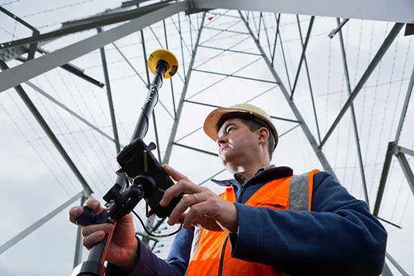

Photo: Trimble

Photo: Trimble

Trimble

Jamming and Spoofing. “Trimble’s latest GNSS receivers leverage our seventh-generation Maxwell technology, which implements hardware- and software-based techniques to detect and mitigate spoofing,” said Stuart Riley, vice president, GNSS Technology. “In addition, Trimble continues to improve the robustness of our GNSS receivers with advances in processing algorithms and hardware enhancements such as the integration of inertial technology.”

Sensor Fusion. “For many years, IMUs have been widely used in Trimble agriculture and Applanix products,” Riley said. “Over the past few years, we’ve created a new line of lower-cost inertially integrated board-level GNSS receivers. We have also integrated inertial components into survey and construction products, including tilt compensation in the Trimble R10, R12 and SPS986 receivers. Trimble also combines its GNSS solutions with optical, laser, lidar and other sensors.”

Surveying. Trimble’s GNSS products, Riley pointed out, range from GIS handhelds to high-performance mobile mapping systems.

Consumer Devices. “The Trimble Catalyst system uses Android-based smartphones or tablets to run an application that includes a software-defined GNSS receiver,” Riley said. “The recently introduced SiteVision system builds on this ecosystem and integrates Google’s ARCore platform with precision GNSS to provide an augmented reality solution for a variety of professional applications.”

Other Challenges. To address signal masking and multipath, Trimble has “continued to improve performance in difficult environments with products such as the Trimble R12 receiver, which provides sophisticated multipath mitigation and an advanced precision processing engine.” Riley said, “Trimble’s RTX Correction Services, delivered via satellite, enable users to achieve RTK speed and accuracy nearly anywhere on the planet without the need for local reference stations.”
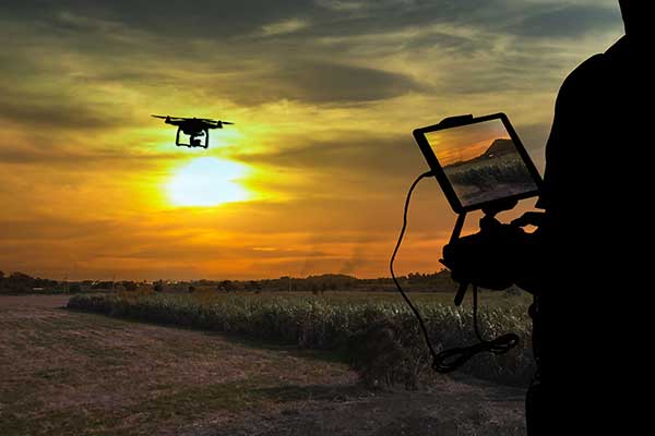

Photo: NovAtel

Photo: NovAtel

NovAtel

Jamming and Spoofing. “The RF environment is at best crowded and at worst hostile,” said Sandy Kennedy, vice president of innovation, Hexagon’s Positioning Intelligence division. “The NovAtel OEM7 generation of receivers was launched in 2016, with interference detection and mitigation as key features on every variant. Protecting authenticity, availability, and precision for multifrequency measurements is the challenge going forward — in all segments of the system: constellation management and SIS, antenna, receiver design and processing in FW/SW.”

Sensor Fusion. In the last three years, Kennedy pointed out, IMU manufacturers have made significant improvements in the performance offered in smaller, cheaper IMUs. “At the same time, new methods to improve error modelling (to control positioning errors) have been added to the NovAtel SPAN product line, especially in SPAN Land profile. Extended GNSS outages are easily handled now.”

Surveying. “PPP has become a strong competitor to RTK, as convergence times have decreased, and this will continue in service offerings like Terrastar-X from NovAtel,” Kennedy said.

Consumer Devices. The devices, Kennedy said, offer “the tantalizing promise of quality measurements from a common utility device with huge computing horsepower and data connectivity built in! It’s fun to watch, and we shall see if accuracy is truly addictive enough to fuel development for general use of precision positioning.”

Other Challenges. “In the past 20 years, users have moved from awe and wonder that centimeter-level positioning is possible — to utter contempt when it is not,” Kennedy said. “This will continue, with an added requirement of integrity and functional safety. Continuously available positioning within a usable protection level is a requirement for autonomous vehicles.”

Look for part 2 in our February issue.

Publicerad den Lämna en kommentar

Automated shipping moves containers with Locata

At ION GNSS+ in September, I met with Nunzio Gambale and Paul Benshoeff of Locata. They were excited to share their news about the timing tests conducted at White Sands Missile Range by the U.S. Air Force’s 746th Test Squadron.

In the January issue, we share the results of the tests. The two also showed me and Matteo Luccio, our contributing editor, a YouTube video highlighting another Locata project: guiding 100-ton robots around the Ports of Auckland, New Zealand.

The robots are straddle carriers, giant mechanisms that are usually driven by a human. The carriers move and sort the shipping containers as they arrive from ships and leave via truck or train.

In the new setup, Locata has made possible the elimination of the human element with nanosecond-precision tracking.

Tom Scott, a former Sky One television host and now host of a series of YouTube shows, highlighted the robotic system in April 2019 on his “Amazing Places” channel.

Screenshot: Tom Scott video

Screenshot: Tom Scott video

Compared to manned straddle carriers, the automated straddle carriers (A-STRADs) are able to stack the containers closer, higher and work more steadily, increasing the capacity of the limited land space at the port. The A-STRADs can stack containers with the accuracy of a few centimeters.

The automated system also allows stack shuffling, so that wear and tear on the asphalt is spread more evenly and requires fewer repairs.

The Locata local positioning system uses synchronized transmitters installed around the port, with two antennas on each straddle carrier using the lightspeed delay from each transmitter to find exact position. “They don’t just look at the timing signal itself, they track the phase of each transmitter’s carrier signal,” Scott explained.

Publicerad den Lämna en kommentar

GLONASS company to build 27 more satellites

Artist's rendering of a Glonass-K satellite. (Image: ISS-Reshetnev)

Artist’s rendering of a Glonass-K satellite. (Image: ISS-Reshetnev)

ISS-Reshetnev Company — the primary GLONASS contractor — has a backlog of orders for navigation satellites up to 2025, according to General Director Nikolay Testoyedov.

Testoyedov discussed GLONASS production on Dec. 30, 2019, at a meeting hosted by ISS-Reshetnev Company for Russia’s Science and Technical Council.

“Within the Federal Target Program, GLONASS ISS-Reshetnev Company is tasked with the production of 27 navigation satellites,” Testoyedov said. “Taking all things together, we plan to double the number of satellites launched in 2020 compared to 2019.”

The orders require production at full capacity at the company’s facilities. At any given time, about 50 satellites are in varying stages of production, including 12 ground spares. Some of them are slated for launch in 2020.

In 2019 eight satellites designed and built by the company were launched into various orbits. As of today,  104 ISS-Reshetnev-made satellites are in space, or two-thirds of Russia’s entire orbital fleet of satellites. ISS-Reshetnev also successfully completed several projects for the manufacture of satellite onboard systems and instruments, including the international ExoMars-2020 program slated to launch this year.

Glonass-M satellite goes into service

The Glonass-M navigation satellite launched on Dec. 11, 2019, entered service Jan. 13.

A joint team of experts representing ISS-Reshetnev Company and the operating organization successfully completed all procedures moving the Glonass-M satellite to its proper orbital position, and switched on its main instruments. To this date, all the required data has been received from the satellite, which allowed it to be commissioned into service.

The new Glonass-M replaced a retired satellite of the GLONASS constellation that had surpassed its designed life expectancy by seven years.

Publicerad den Lämna en kommentar

Ole Miss students get meals delivered by robots

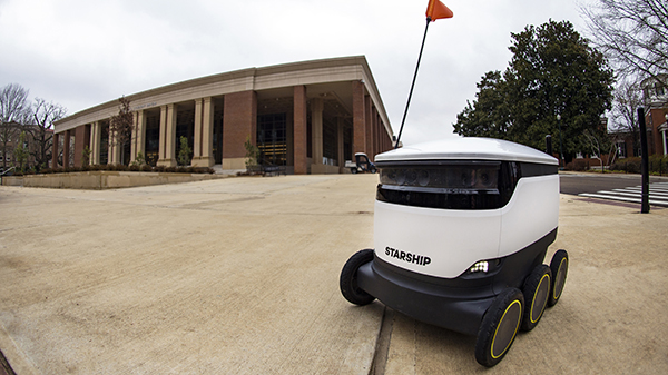
Photo: Christian Johnson/Ole Miss Digital Imaging Services

Photo: Christian Johnson/University of Mississippi

As University of Mississippi (UM) students resume classes for the spring semester, they are sharing the campus’ sidewalks with a fleet of robots that can deliver meals at the push of a button.

Starship Technologies has launched robot food delivery services at the university, the first in the Southeastern Conference to have autonomous delivery robots.

Beginning Jan. 22, Ole Miss students, faculty and staff can access the Starship Deliveries app (iOS and Android) to order food and drinks to be delivered anywhere on campus, within minutes from any of the 30 robots serving UM. The service will work in conjunction with student meal plans.

Ole Miss Dining is focused on the continued utilization of advanced technology to enrich the student, faculty and staff dining experience,” said Chip Burr, resident district manager of Ole Miss Dining Services. “We are excited about the expansion of our mobile ordering operation and the new opportunities this partnership creates.”

The robots use a combination of sophisticated machine learning, artificial intelligence and sensors to travel on sidewalks and navigate around obstacles. The computer vision-based navigation helps the robots to map their environment to the nearest inch. They can cross streets, climb curbs, travel at night and operate in both rain and snow.

A team of humans also can monitor their progress remotely and take control if needed.


By making food and drink more accessible, the Starship robots save time and reduce stress, aiming to make the busy lives of the Ole Miss community a little easier, Burr said.

Items can be ordered from Starbucks, Chick-fil-A, McAlister’s, Panda Express, Which Wich, Qdoba, Einstein Bros. Bagels, Raising Cane’s, Steak ‘n Shake, Freshii, Papa John’s and Sambazon. After choosing their items, users select their location by dropping a pin on the campus map where they want their food delivered.

The app allows users to watch the robot’s journey in real time through an interactive map. Once the robot arrives, the user will receive an alert and can meet the robot and unlock it through the app.

The delivery usually takes just minutes, depending on the menu items ordered and the distance the robot must travel. The robots can carry up to 20 pounds.

Starship Technologies operates commercially on a daily basis around the world. Its robots have traveled more than 350,000 miles and completed 100,000 autonomous deliveries.

“We’re honored to be able to help make lives a little bit easier for Rebels across the Ole Miss campus by offering the world’s leading autonomous delivery service” said Ryan Tuohy, senior vice president of business development at Starship. “Whether it’s getting breakfast delivered in the morning or having a late-night snack, our robots are here to serve students, faculty and staff at all times of the day.”

Publicerad den Lämna en kommentar

ION Fellows named: Rodriguez, Gao, Humphreys

The Institute of Navigation (ION) announced the recipients of the 2020 Fellow memberships during the ION International Technical Meeting (ITM) and Precise Time and Time Interval Systems and Applications (PTTI) held Jan. 21- 24 in San Diego, California.

Election to Fellow membership recognizes sustained professional accomplishments that have significantly contributed to the advancement of the arts and sciences of Positioning, Navigation and/or Timing (PNT) in the areas of technology, management, practice or teaching and a demonstrated and sustained impact on the PNT community.

Fellows have maintained an observable presence in the ION community over the long term, including contributions to ION programs and publications.

José Ángel Ávila Rodríguez has been elected for his pioneering contributions to the design of the Galileo signal plan, and leadership in the modernization of Galileo.

Yang Gao has been elected for significant contribution to the development, dissemination and commercialization of high-precision GNSS technologies; and for significant educational and training impact on navigation engineers and professionals.

Todd E. Humphreys has been elected for significant and fundamental contributions to PNT security and precise GNSS positioning for the mass market, and for dedication to GNSS education and outreach.

With their new Fellowship plaques are (from left) Gao, Humphreys and Rodríguez. (Photo: ION)

With their new Fellowship plaques are (from left) Gao, Humphreys and Rodríguez. (Photo: ION)