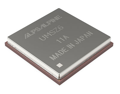
The GPS III government and industry team recently core mated GPS III Space Vehicle 10 (GPS III SV10) and, per tradition at the “birth” of a satellite, nicknamed it “Hedy Lamarr” after the actress and inventor. (Photo: Lockheed Martin)
The 10th and final GPS III space vehicle under the original GPS III contract recently completed a production milestone known as “core mate” to assemble it into a full satellite.
The satellite is named after Hedy Lamarr, the famous Hollywood actress and inventor who in 1941 patented frequency-hopping technology that laid the foundation for secure Wi-Fi, GPS and Bluetooth technologies used by billions worldwide today.
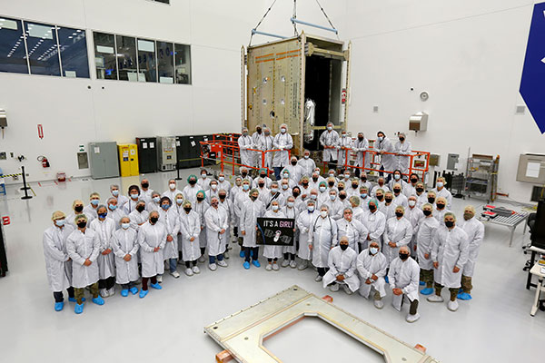
Traditionally, core mate marks the “birth” of a satellite and when it gets a nickname — chosen by the U.S. Space Force — to honor its completion. All nine previous GPS III satellites built by Lockheed Martin have been named after trailblazers, and GPS III SV10 is no exception. (See list below.)
“The core mating of GPS III SV10 is an important milestone in Lockheed Martin’s commitment to provide the U.S. Space Force with a modern, agile GPS satellite constellation that will assure mission success far into the future,” said Tonya Ladwig, vice president of Lockheed Martin Space’s Navigation Systems Mission Area. “With SV10, we’ve now assembled about a third of the satellites we need to modernize the current GPS constellation with new technology and greater warfighting capabilities.”
Along with Ladwig, Col. Edward Byrne, senior materiel leader of the Medium Earth Orbit Space Systems Division, and Scott Thomas, GPS III program manager, Space Systems Command, attended the final portion of the core mating event on Oct. 26 at Lockheed Martin’s GPS III Processing Facility (GPF), in Waterton, near Denver.
Core mating takes teamwork
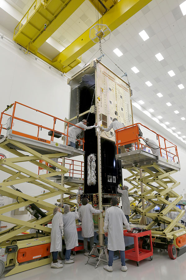
During the two-day core mate production event held Oct. 25-26, a 10-ton crane lifted and completed a 90-degree rotation of GPS III SV10’s system module assembly that holds the satellite’s operations and mission payload electronics. The crane then slowly lowered the system module the final 12 feet onto the satellite’s vertical propulsion core assembly.
Throughout the operation, technicians were strategically placed in elevated lifts 20 feet in the air to monitor the tight interfaces — within thousandths of an inch — and ensure a successful integration. Once the system module was fully seated, the technicians installed the nearly 200 screws bolting the two major components together. When the final screw was placed, the vehicle was officially mated. At that point all activity stopped and the newly assembled GPS III space vehicle was given its official name.
The core mate is one of the most intricate and critical operations of a satellite’s build. Completing the process requires teamwork and experience. Robert Peszek, GPS III operations manager, credited the culture of the GPS team for the core mating success and the success of the overall program. “This milestone is not something that many programs get to experience, with 10 satellites and the potential for more,” he said. “It comes down to our culture — people are not afraid to speak up, everybody has a voice, everybody has a role, and we respect everyone’s role.”
GPS III SV10 – the final space vehicle of the original GPS III contract – became a space vehicle when its system module assembly, which holds the satellite’s operations and mission payload electronics, was core mated with the satellite’s vertical propulsion core assembly. (Photo: Lockheed Martin)
Augmented reality
GPS III SV10 (and SV09 before it) also represent pivot points in digital transformation on the GPS III/IIIF production line. Some of the technologies used include 3D printed parts, HoloLens mixed-reality smart glasses, and model-based engineering images that were overlaid on top of the hardware.
“For these two vehicles, we have really done ‘crawl, walk, run’ for augmented reality,” Ladwig said. “They are transformational vehicles because we’re bringing that new technology, not just to the spacecraft, but also making it part of the production and build process.”
The digital transformation tools improved accuracy and cut production times. “Using the (HoloLens) we actually overlay design drawings onto the hardware, further ensuring that everything is done right,” Peszek said. In addition, the team cut the production schedule by 50% for SV09 and SV10, partly due to the use of augmented reality tools — and while working through the height of the COVID pandemic without missing any work days.
GPS III SV10 — the final space vehicle of the original GPS III contract — became a space vehicle when its system module assembly, which holds the satellite’s operations and mission payload electronics, was core mated with the satellite’s vertical propulsion core assembly.
GPS III satellite update
Of the other nine GPS III satellites, the first five — GPS III SV01-05 — have launched and been handed over to the Space Force for on-orbit operations. The next three — GPS III SV06-08 — have been completed and declared “Available for Launch” by the U.S. Space Force. Those satellites are in storage at the GPS Processing Facility until the Space Force determines their launch dates. GPS III SV09 is fully assembled and in final testing.
GPS III SV10 will undergo a comprehensive suite of system performance tests before moving to the critical thermal cycling and thermal vacuum test (TVAC) phase, which demonstrates the satellite’s ability to survive the thermal and pressure conditions of space.
After GPS III SV10, the GPS III Follow On (GPS IIIF) satellites will start to appear on Lockheed Martin’s production line. In 2018, the U.S. Air Force awarded Lockheed Martin a contract to build as many as 22 additional GPS IIIF space vehicles. GPS IIIF SV11–12 were part of that original contract. The government exercised options for GPS IIIF SV13–14 in 2020.
On Oct. 22, the U.S. Space Force exercised its second contract option valued at approximately $737 million for the procurement of three additional GPS IIIF space vehicles (GPS IIIF SV15–17) from Lockheed Martin.
Modernizing the constellation
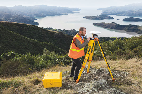
Lockheed Martin is building GPS III/IIIF satellites to help the Space Force modernize the current GPS satellite constellation with new technology and advanced capabilities. GPS III satellites are the most powerful GPS satellites ever designed. Compared to legacy satellites in the constellation, GPS III satellites are three times more accurate and have up to eight times improved anti-jamming.
GPS III satellites are also the first to introduce the new L1C civil signal, which will enable interoperability between GPS and international satellite navigation systems.
GPS IIIF satellites build off GPS III’s innovative, modular design. GPS IIIF satellites will add new capabilities and advanced technology, including Regional Military Protection (RMP); a safety-improving Search and Rescue payload; and an accuracy-enhancing laser retroreflector array. The RMP capability further reinforces GPS III/IIIF as a warfighting system, providing up to 60x greater anti-jamming for our warfighters operating in contested environments.
GPS IIIF SV13 and beyond will incorporate the company’s LM2100 Combat Bus, an enhanced space vehicle that provides even greater resiliency and cyber-hardening against growing threats, as well as improved spacecraft power, propulsion and electronics. LM2100 Combat Bus vehicles are also capable of hosting Lockheed Martin’s Augmentation System Port Interface (ASPIN), which would allow for future on-orbit servicing and upgrade opportunities.
Satellite names honor trailblazers
In honor of the last GPS III satellite in the SV01-10 series, here are the names they share with famous explorers:
- SV01 – Vespucci – Amerigo Vespucci, Italian navigator, explorer and merchant whose name is the origin of “America”
- SV02 – Magellan – Ferdinand Magellan, Portuguese explorer and leader of first expedition to circumnavigate the Earth
- SV03 – Matthew Hensen – First African-American Arctic explorer, part of the Peary expeditions.
- SV04 – Sacagawea – Lemhi Shoshone woman who served as translator and guide for the Lewis and Clark expedition
- SV05 – Neil Armstrong – Astronaut, first man to walk on the moon
- SV06 – Amelia Earhart – Daring pilot, first woman to fly solo across the Atlantic Ocean, attempted circumnavigation around the world.
- SV07 – Sally Ride – Astronaut, physicist and first American woman in space
- SV08 – Katherine Johnson – American mathematician, NASA employee whose calculations made human spaceflight possible
- SV09 – Onizuka – Named for Ellison Onizuka, astronaut, first Asian-American to reach space, crew member on the ill-fated Challenger space shuttle mission.
- SV10 – Hedy Lamarr – Famous Hollywood actress and inventor who patented frequency-hopping technology that led to today’s secure Wi-Fi, GPS and Bluetooth.
Gilla detta:
Gilla Laddar in …