Photo: Topcon
An electric cooperative that serves more than 33,000 member customers in Lakeside, Ariz. — including the White Mountain Apache Tribe — is using an unmanned aerial system (UAS) to enhance the utility’s GIS effort, working with UAS specialist Skynetwest. Noah Ruiz started Skynetwest in 2015 to provide aerial photographic and videographic services, but seeing the potential of UAS he began making the pivot to high-value data retrieval.
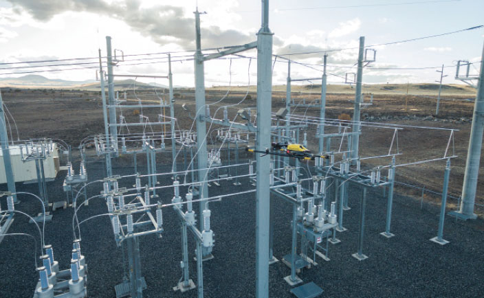
Initial work for the Navopache Electric Cooperative (NEC) included an inspection of an area’s substations. Conducted on a day in which the winds were blowing at 20+ mph, with most other aircraft, the flight would have been extremely risky if not scrapped.
Skynetwest used an Intel Falcon 8+ Drone, Topcon Edition. Windspeed limits for the Falcon 8+ in GPS mode are set at 26 mph; in height mode that threshold is extended to windspeeds as high as 35 mph.
The Falcon 8+ has triple-redundancy inertial measurement units (IMUs), double-redundant compasses, dual-constellation GPS, eight propellers and two batteries. Built into the aircraft’s software is an algorithm that detects the electromagnetic frequencies coming off of power lines and tells the IMUs which one it wants to switch from, which GPS it wants to use, and which compass it wants to use.
The aircraft’s stability is key not only for power line work but also for items like inspection of oil and gas components. For inspection applications — close-up inspections to detect millimeter-sized damage, fine hairline cracks, leaks or heat power losses, for example — the Falcon 8+ payload consists of a Panasonic Lumix DMC-ZS50 camera for true-color RGB images and the FLIRTau 2 640 thermal imaging camera for infrared imaging. The hybrid RGB + 14-Bit RAW data inspection payload combines a near-infrared camera with a high-resolution digital camera mounted in parallel.
The mapping package Skynetwest uses includes a 36-megapixel RGB camera (Sony Alpha 7R) and delivers both orthophotos and 3D models in Topcon ContextCapture software, powered by Bentley Systems.
Upon completion of the substation project, using ContextCapture and Agisoft PhotoScan software, Skynetwest stitched together all of the images it had gathered to create a georeferenced 3D model of that substation. NEC is looking into building more 3D representations of the entire grid and ultimately hoping to build a complete 3D spatial record down to nuts and bolts — all with survey grade data.