Publicerad den Lämna en kommentar

PCTEL unveils public-safety antenna platform for police

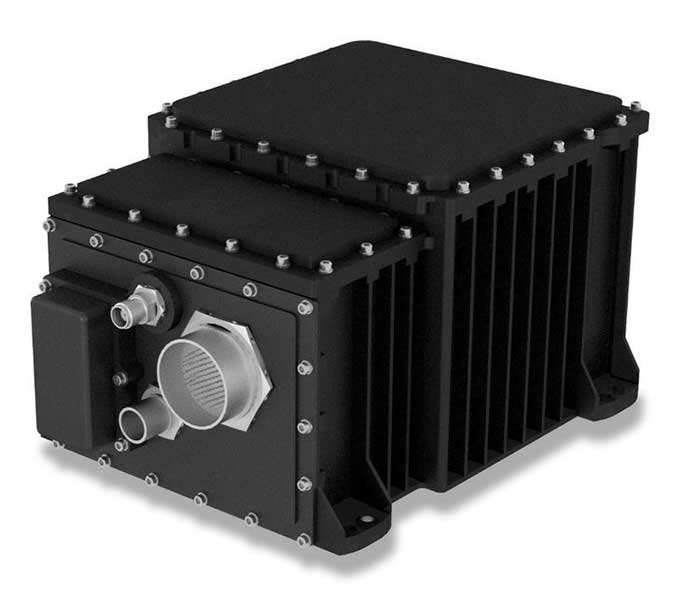
PCTEL has launched its  Trooper TRP-20INT platform, featuring models with a purpose-designed footprint to allow seamless installation on the leading 2020 police sports utility vehicles.
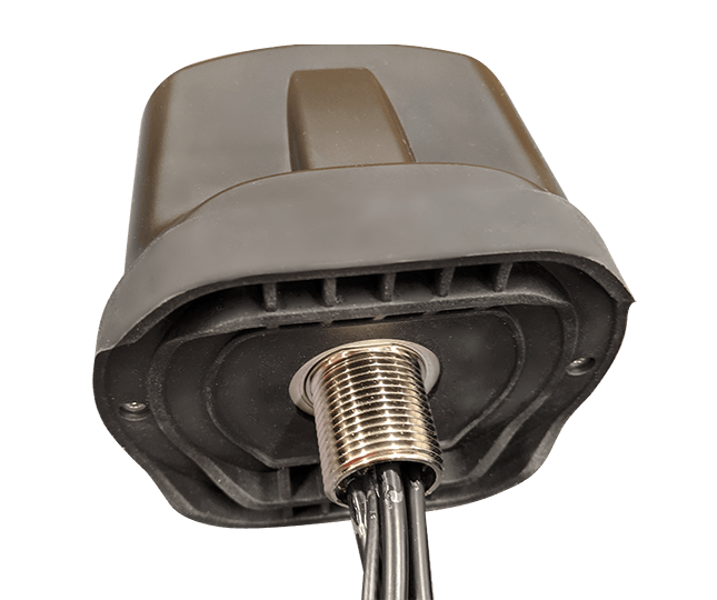
Photo: PCTEL

Photo: PCTEL

The Trooper TRP-20INT antenna platform supports the high-speed requirements of complex RF communication systems used for critical communications in FirstNet public safety and intelligent transportation systems (ITS).

These antennas feature two 5G elements compatible with leading cellular routers supporting 600-MHz to 6-GHz frequencies. In addition, PCTEL’s proprietary high-rejection multi-GNSS technology is included for high-precision tracking and asset management.

“In order to meet the communication demands of law enforcement, our Trooper TRP-20INT platform was specifically designed for installation on the raised ridges of police vehicle roofs. This method makes installation easier and optimizes RF performance,” said Rishi Bharadwaj, PCTEL’s chief operating officer.

“PCTEL brings strong RF and mechanical design capabilities to develop high-performance antenna systems for deployments in harsh environments in mission critical applications,” added Bharadwaj.

PCTEL also announced its new and improved PCTWSLMR-2 full-spectrum LMR mobile antenna, designed to support the leading OEM multi-band land mobile radios that enable interoperability among emergency management and response personnel. The new antenna incorporates a strong and ultra-flexible spring structure designed for maximum impact shock absorption, providing solid installation integrity even in low overhead-clearance situations.

PCTEL will showcase its new antenna platforms at IWCE, Aug. 24-28, at the Las Vegas Convention Center, Las Vegas, Nevada, booth 1215. Contact PCTEL for more details on product specifications and availability.

Publicerad den Lämna en kommentar

Helicopter navigation system powered by synthetic vision

Photo: Honeywell

Photo: Honeywell

Honeywell is providing Leonardo’s helicopter division with a significant cockpit upgrade — Honeywell’s innovative Primus Epic 2.0 — for its AW139 helicopters. Primus Epic 2.0 will deliver better maps, improved situational awareness at night and in marginal weather, and easier access through wireless connectivity, improving safety and saving time. It is track based, meaning navigation follows the actual path of the helicopter and accounts for wind and other environmental factors.

The “synthetic vision” system enables pilots to fly a variety of challenging approaches. Helicopter-specific missions supported include corporate VIP transport, emergency medical services, oil and gas, and search and rescue.

The SmartView synthetic vision system is usable all the way down into the hover, helping pilots navigate during low-visibility conditions. These missions can include steep 9-degree descents into landing areas in challenging terrain and oil-rig approaches. Flight crews will also benefit from a more user-friendly, iNAV map visual interface with easy-to-use displays and an improved cursor that makes map manipulation and menu navigation more comfortable.

“Technology innovations are crucial to reducing pilot workload and making flights safer for crew and passengers,” said Mike Ingram, vice president and general manager, Cockpit Systems, Honeywell Aerospace. “With the Epic 2.0 Phase 8 upgrade, AW139 pilots will not only reduce the time and cost of some operations, especially those in weather and around challenging terrain, they will also experience some of the best safety features available anywhere in the helicopter market.”

The Phase 8 upgrade also increases connectivity capabilities, with Wireless Data Loading that lets pilots access data at high speeds remotely without a hardwire connection, transferring flight plans wirelessly and accelerating preflight actions.

Publicerad den Lämna en kommentar

Anti-jam technology gets smaller with NovAtel system

Photo: NovAtel

Photo: NovAtel

Hexagon | NovAtel launched the GAJT-410ML GPS anti-jam system in 2019. The compact design of the new, smaller version of NovAtel’s GPS Anti-Jam Technology (GAJT) can be rapidly integrated into space-constrained military vehicles (see photo). The system is easy to use while protecting GPS-based navigation and precise timing receivers (including M-code) from intentional jamming and accidental interference, according to NovAtel.

Spoofing, or the ability to give false data to a receiver, is a different challenge from jamming, with potentially even graver consequences. The GAJT portfolio provides protection from both jamming and spoofing to best defend military systems.

Spoofing Detection. As a trusted partner for guidance, navigation and control, NovAtel is developing robust spoofing detection technology that will be available in the company’s product portfolio soon. The additional spoofing information empowers users to make informed decisions about the radio frequency environment they are operating in, alerting them if malicious actors are present. This provides actionable intelligence as part of a layered approach to defend against jamming and spoofing.

NAVWAR Support. NovAtel OEM components and military off-the-shelf items are engineered to deliver precise, assured positioning and timing. Deep GNSS expertise and lean manufacturing capabilities enable the effective delivery of high-performance products in large volumes with minimal production and delivery times. This approach is combined with a high level of support to achieve low product return rates.

Publicerad den Lämna en kommentar

Parker Lord launches all-in-one RTK system

Photo: Parker Lord

Photo: Parker Lord

Parker Lord has launched the 3DM-GQ7 dual-antenna RTK inertial navigation system with multiple integrated aiding sensors and support for external aiding.

It has two integrated real-time kinematic (RTK)-capable multi-band multi-constellation GNSS receivers, integrated barometric pressure sensor, magnetometer, and hardware support for wheel odometry. It also has an application programming interface (API) for external sensor measurements.

The 3DM-GQ7 offers advanced sensor fusion for accurate measurements in challenging environments. It provides seamless operation during temporary GNSS signal outages and online tracking of inertial measurement unit (IMU) error sources for superior dead-reckoning.

An optional network RTK receiver, the 3DM-RTK, allows users to connect and communicate to the company’s SensorCloud RTK Connection network. This makes for an all-in-one solution (GNSS-INS + RTK + SensorCloud RTK).

3DM-GQ7 Features

  • High quality position, velocity and attitude estimates at rates up to 1 kHz
  • 2-cm position accuracy (in good conditions with RTK corrections available)
  • 0.1 degree roll/pitch accuracy; 0.25 degree heading accuracy with dual-antenna GNSS, depending on conditions
  • All-in-one system solution (GNSS-INS + RTK + SensorCloud RTK)
  • Applications include drones, autonomous vehicles and legged robots
Publicerad den Lämna en kommentar

Raytheon M-code receiver deployment underway

Logo: Raytheon Technologies

In 2019, the U.S. Air Force certified the security architecture of Raytheon Intelligence & Space’s M-code modules and receivers as providers of secure and reliable access to modernized GPS. The resilient receivers are designed for high anti-jam performance.

Raytheon’s M-code application-specific integrated circuit (ASIC) chip is either integrated into a ground-based receiver card optimized for low dynamic applications, or used as an avionics/naval receiver card to support multiple end users.

“Our focus is on taking a comprehensive approach to resilient navigation,” explained Chad Pillsbury, director for Raytheon’s Secure Sensor Solutions. “We provide the complete family of PNT solutions. We start with the fundamental components, like the ASIC chip, and tailor our solution for the platform and mission requirements.”

Open Architecture. Raytheon successfully completed testing of the first M-code receiver onboard the U.S. Air Force’s B-2 bomber in 2017. “Since then, we’ve undergone a number of tests internally and with third-parties. Our M-code receivers have standard interfaces and open architecture protocols, enabling them to work with both U.S. and allied systems. By pairing our M-code receiver with our anti-jam electronics and antenna, our systems enable warfighters to combat the most advanced threats seen in the world today,” Pilsbury said.

The receiver is planned to be incorporated into many fighters, bombers and weapons systems across the U.S. Department of Defense. “We provide enhanced anti-jam, anti-spoof GPS capabilities, as well as alternate navigation and multi-constellation support that represent a significant improvement over the systems currently used by today’s warfighters,” Pillsbury said.

Meeting Advancing Threats. “The hardest part is meeting a changing threat target,” Pillsbury explained. “The fact is the threat is advancing at a rapid rate. Because of that, challenges are constantly evolving.

“That means we had to design solutions that were simultaneously robust and secure, but also flexible and open so we can continually upgrade them. That’s not an easy thing to do.

“But, by taking a comprehensive approach that looked at the whole problem rather than just part of it, we’ve developed systems that address these challenges and have the flexibility to address future challenges.”

Raytheon’s M-code products are now available to the U.S. military and its allies in accordance with International Traffic in Arms Regulations and the U.S. State Department.

Publicerad den Lämna en kommentar

AUVSI to host Xponential webinar series on unmanned systems technology

Photo by Allison Barwacz

Photo: GPS World Staff

The Association for Unmanned Vehicle Systems International (AUVSI) will host Xponential Virtual Sessions, a week-long webinar series, May 4-8.

According to AUVSI, the series will offer information, insights and insider knowledge covering a number of topics, including drone delivery, public safety, connectivity, and other aspects of the unmanned systems and robotics industry.

These webinars are being held because of the rescheduled Xponential 2020 conference. Xponential 2020 was originally scheduled to take place May 4-8 in Boston, but is now tentatively scheduled to take place Aug. 9-12.

AUVSI offered an overview of the webinars, which are all complimentary.

Digital Twins — The Future of Virtual and Mixed Reality Robotic Avatars
Date: Monday, May 4, 3-4 p.m. EDT
Speaker: Peter Haas, associate director, Humanity Centered Robotics Initiative, Brown University

Hass will describe how advances in mixed and virtual reality control will lead to a UX revolution for avatar-based robotic teleoperation, where the manipulation of digital twins will translate to manipulation of a robot — or robots — in the physical world. Register here.


Drone Delivery Supporting Public Health
Date: Tuesday, May 5, 3-4 p.m. EDT
Speakers: Eric Gardiner and Eric Lasker, federal business development, Zipline

Executives from Zipline will describe how drone delivery has evolved through the Federal Aviation Administration UAS Integration Pilot Program and is now being adapted to help community healthcare partners respond to COVID-19 in the United States. Register here.


NASA’s Vision and Role to Enable Urban Air Mobility
Date: Wednesday, May 6, 3-4 p.m. EDT
Speakers: Robert Pearce, associate administrator, NASA Aeronautics Research Mission Directorate, and Brian Wynne, president and CEO, AUVSI

Pearce will review initiatives to enable small UAS operating at low altitude through a UAS Traffic Management System and large UAS operating in higher altitude airspace with definitive flight experiments to validate key standards, such as detect-and-avoid technology. Wynne will host a discussion with Pearce about his full vision for future aviation, including what the next 50 years has in store for commercial airline travel and urban air mobility.
Register here.


Advancing Autonomy Through DARPA Challenge to Benefit First Responders
Date: Thursday, May 7, 3-4 p.m. EDT
Speaker: Dr. Timothy Chung, program manager, DARPA Tactical Technology Office

DARPA’s Subterranean Challenge engages international teams to deploy autonomous systems — rolling, walking, flying and floating — to remotely map, identify and report on artifacts discovered along underground courses. Chung will discuss persisting challenges with robotics, how teams are succeeding in competition while advancing unmanned capabilities and how these lessons can benefit first responders. Register here.


Aerial Connectivity Joint Activity — Bridging the Gap Between Cellular and Aviation
Date: Friday, May 8, 2-3 p.m.
Speaker: Mark Davis, technical lead, ACJA

Davis will explore the latest roadmap for aviation and cellular communications, including how recent initiatives such as Aerial Connectivity Joint Activity (ACJA) are aimed at providing a standards framework to enable unmanned aerial cellular. ACJA is a joint activity between GSMA, which represents the interests of mobile operators worldwide, and the Global UTM Association, a non-profit consortium of worldwide Unmanned Aircraft Systems Traffic Management stakeholders. Register here.

Publicerad den Lämna en kommentar

GNSS simulation critical for NAVWAR testing

The BroadSim Advanced GNSS Simulator (Photo: Orolia)

The BroadSim Advanced GNSS Simulator (Photo: Orolia)

Orolia Defense & Security offers a range of solutions that support critical positioning, navigation and timing (PNT) systems for Navigation Warfare (NAVWAR) domains. Orolia is approved to work on the full spectrum of U.S. government classified and unclassified projects and is positioned to support strategic partnerships in the development of key positioning, navigation and timing (PNT) technologies for the defense market.

BroadSim Advanced GNSS Simulator. Powered by the Skydel software engine, BroadSim provides software-defined features and benefits, with additional capabilities and specifications for applications requiring maximum security and compliance. With 100+ units fielded, BroadSim is trusted by the U.S. government, military and industry.

Broadsim supports encrypted signals (Y-code, M-AES, and M-MNSA) and provides advanced jamming and spoofing simulation. Scalable configurations for testing CRPA/antenna electronics systems (anechoic and wavefront) are available. BroadSim has four independent RF outputs and runs on a custom Linux operating system.

Interference Detection & Mitigation (IDM). Orolia’s IDM technology is patented, rigorously tested and field proven for more than a decade, while regularly updated to conform to new and emerging threats. BroadShield provides embedded GPS jamming and spoofing detection, serving as a kill switch. BroadSense offers mobile detection for situational awareness, and ThreatBlocker provides protection with in-line detection and suppression.

Resilient PNT. Orolia’s resilient PNT solutions improve the reliability, performance and safety of customers’ mission-critical operations for air, land, sea and space applications.

The 8230 AJ GPS/GNSS anti-jam outdoor antenna is a high-gain (40-dB) GNSS outdoor antenna with a unique conical pattern that rejects interference from the horizon. IP67-rated, it is designed for harsh environments.

The VersaPNT provides a rugged and resilient PNT source. The all-in-one customizable system delivers accurate, software-configurable PNT signals and high-performance for mobile applications in GNSS-degraded and denied environments.

Publicerad den Lämna en kommentar

DHS hosts 2020 GPS equipment testing event this summer

DHS logoThe U.S. Department of Homeland Security (DHS) Science and Technology Directorate (S&T) is hosting the 2020 GPS Equipment Testing for Critical Infrastructure (GET-CI) event. This event will take place during the summer of 2020.

The revised the due date for responses is May 8, 2020. Visit this site for more information.

S&T’s GET-CI events are a series of annual evaluation events intended for manufacturers of commercial GPS equipment used in critical infrastructure as well as critical infrastructure owners and operators.

DHS S&T recognizes the importance of accurate and precise position, navigation and timing (PNT) information to critical infrastructure and has a dedicated multi-year program to address GPS vulnerabilities in critical infrastructure, with a multi-pronged approach of conducting vulnerability and impact assessments, developing mitigations, exploring complementary timing technologies, and engaging with industry through outreach events and meetings.

Through these sustained efforts, the goal of the program is to increase the resiliency of critical infrastructure to GPS vulnerabilities in the near-term future.

Examples of measures that can be taken to enhance resiliency can be found in a DHS issued set of best practices released via ICS-CERT, titled “Improving the Operation and Development of Global Positioning System (GPS) Equipment Used by Critical Infrastructure.”

Publicerad den Lämna en kommentar

Industry perspective: Next-gen PNT needs careful assessment

With the first GPS Block III satellite SVN 74 being set as healthy and active in January, GPS has reached another important milestone. Setting the vehicle healthy and active makes the satellite available for use by military and civilian GPS users around the world. GPS has been a hugely successful system, consistently exceeding its performance specification and providing users with levels of accuracy and availability that would have seemed astonishing only a few short years ago.

Despite these successes, the limitations of GPS and other GNSS have been highlighted by a catalog of real-world well-documented jamming and spoofing incidents, some of which have had serious impacts. With this increase of incidents, the military and commercial worlds have become increasingly aware of the vulnerabilities of sole reliance on GNSS. Interference with GNSS is a critical risk to not only business continuity, but to the safety of the world.

Image: Spirent Federal

Image: Spirent Federal

Simply trusting the output from a GNSS receiver without question is no longer acceptable in safety- or liability-critical applications. The focus of many manufacturers and developers has been on assuring the integrity of reported GNSS PNT data.

Recently, more systems have begun using non-GNSS data sources to augment the GNSS solution. A GNSS receiver becomes one of the many sensors used in a system that combines their inputs to provide an assured, trustworthy source of precise positioning and timing data even when GNSS is disrupted. There are also active global initiatives in both commercial and military domains worldwide to seek and develop direct replacements for GNSS-based navigation and timing systems.These systems eliminate the use of GNSS completely and are termed “alternative navigation systems.”

Whether assured, augmented, or alternative, these PNT systems need careful assessment. Their performance, robustness and resilience need to be measured in normal conditions and with interference.

Spirent is actively working to develop new, relevant test frameworks and designing the next generation of PNT test equipment that can easily integrate with and assess more than one technology. From inertial integrated with GPS to a number of alternative PNT systems that are being analyzed by the U.S. government, Spirent is working to unlock the maximum benefits of the next generation of PNT solutions.


Roger Hart, director of engineering, joined Spirent Federal in 2015. He has worked in development of spacecraft navigation systems, including GPS, for civil, NASA and defense applications since 1986. Guy Buesnel is Spirent’s specialist PNT Security Technologist covering the areas of PNT threats and mitigation.

Publicerad den Lämna en kommentar

Northrop SeaFIND guides navies around the world

Photo: Northrop Grumman

Photo: Northrop Grumman

The SeaFIND inertial navigation system (INS) on April 1 received Type Approval from the U.S. Coast Guard, confirming that it meets an important international performance benchmark.

SeaFIND — Sea Fiber Optic Inertial Navigation with Data Distribution — was developed by Northrop Grumman for small- to medium-size combatant and auxiliary ships. With its small footprint, it can also be used on unmanned underwater and surface vehicles, or coastal and offshore patrol vessels.

SeaFIND builds from the software, algorithms and digital messages used on the MK39, a ring-laser INS installed around the world with the U.S. Navy and partner fleets. Instead of a ring-laser gyro, SeaFIND uses Northrop Grumman’s enhanced fiber-optic gyro technology (eFOG). eFOG maintains equivalent performance in a much smaller footprint — yet is more reliable.

“Fiber-optic technology is inherently more reliable with a higher mean time between failure rate than ring-laser gyro technology, which requires a high-voltage laser to operate and degrades over time,” explained Tom Disy, manager of Strategic Planning for Maritime/Land Systems & Sensors. An improved version of FOG, eFOG allows for the inertial measurement unit (IMU) within SeaFIND to achieve dependable navigation-grade performance, Disy explained.

SeaFIND’s embedded Navigation Data Distribution System (NAVDDS) software collects all the navigation data the ship receives, including SeaFIND and GPS data. NAVDSS then provides this data to other ship systems in a time-corrected, system-specific format. Time correction is necessary to maintain accuracy requirements, especially for applications requiring highly accurate dynamic attitude. NAVDDS’ low data latency allows the system to interface with any users that require accurate position and timing, such as combat systems or TACAN (tactical air navigation systems).

The SeaFIND INS complements the data received from GNSS. “Our inertial systems utilize GPS data when available; however, the SeaFIND INS also provides other key navigation data, including heading, roll and pitch,” Disy said. “The SeaFIND INS provides reliable position data for a significant period of time if the GNSS system data becomes unreliable or unavailable for any reason.”

SeaFIND is not subject to ITAR (International Traffic in Arms Regulations) and available for use by domestic and international navies.