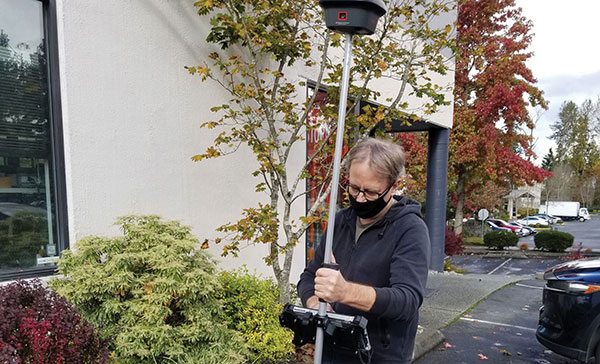
Photo: Gavin Schrock
Gavin Schrock, PLS, shared his thoughts on how the evolution of GNSS has affected surveying. Schrock is a practicing land surveyor, the operator of a cooperative real-time GNSS network in Washington state, and a technology writer.
Gavin Schrock has been using satellite navigation since the early days of GPS and the Doppler-based Transit system before that. “I am a bit of a dinosaur,” he said. “What I find interesting about the evolution of GPS, especially when it went to multi-constellation, is that it instills more confidence in what somebody is doing, in several ways.”
For commercial use of GPS, the first units were static and required post-processing. “If you were out in the wide open sky and could get your minimum of four to five satellites and observe enough data, you could process that and get outstanding precision — less than 3 cm in 3D in a reasonable amount of time with 95% confidence,” Schrock said. “Now, with more satellites, you can get it a lot faster and in more places.” Using certain procedures, early GPS adopters could get down to millimeters. “You can get that precision now, but you get there a heck of a lot faster.”
An obstructed view of the sky, tree canopy, multipath and other factors limit where surveyors can use GNSS. One of the ways the new constellations and signals help, Schrock explained, is through the evolution of processing. “I like to call it the fourth wave of GNSS field equipment for high precision — for surveying, machine control and construction. In just the past few years, many of the manufacturers have had to put huge processors in their high-end rovers to process many more satellites and signals, as well as new RTK [real-time kinematic] engines with improved onboard multipath mitigation.”
While some rovers built a decade ago could track and use many of these signals, this new wave of gear, with more powerful processing, takes much greater advantage of the multi-constellation. The updated interface control document (ICD) for BeiDou-3 was released just over two years ago; it may still take a lot of development work to enable older receivers to take advantage of it, if it is even possible, he said. By contrast, “Many newer units hit the ground running with full constellation capabilities.”
“Much of the new wave can do amazing things in the way they can mix and match signals, though there are different approaches to this,” Schrock said. “They can do such things as processing many satellites and multiple signals from each, under one filter for a more robust solution. You might have L1, L2, L5, B3, E1, E5a, and E5b in the mix, to name a few. Then you have the alternative BOC modulation (AltBOC), where it is kind of processed together to give a wide lane solution. That can really bring in your high precision a lot faster and, in many cases, improve on the high precision that you used to get with your old rovers.”
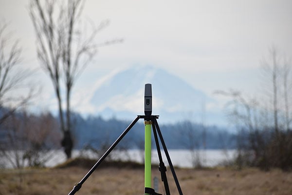
Mount Rainier (above) serves as the backdrop for a field project by Schrock (right). (Photo: Gavin Schrock)
How GLONASS Brought Change
Surveyors using equipment more than four years old, which Schrock calls “legacy gear,” often cannot take full advantage of the availability of multiple constellations. “Years ago, there was a mini-boost when manufacturers began to include GLONASS; you suddenly had more satellites. Early GLONASS was a mess, but it got better. It remains a little noisy, but you have extra satellites. When you are trying to get a minimum of five satellites to do your RTK or your network RTK, we really struggled when it was GPS only. GLONASS changed that. You could work in many more places, without worrying about the time of day and looking up what the satellite’s availability was going to be and have to plan ahead.”
The latest boost, thanks to the two new GNSS constellations, is “much more impactful” than the addition of GLONASS was, Schrock said. Galileo now has five or more usable signals, depending on how each manufacturer chooses to use them. In addition to the extra satellites, “you also have more modernized signals. They are not as noisy as the old GLONASS ones. GPS signals are still very clean, and about half of the GPS satellites now broadcast the L5 signal, which you can throw into the mix.”
RTK units now can mix and match satellites from different constellations in outstanding ways, Schrock said. “The advantages are great when you are struggling in canopy. You still must be cautious, but you can check repeatability much more quickly.”
In the old days, Schrock recalled, when surveyors used GPS only, carried giant receivers and huge antennas, and did long static sessions, they had to return to sites for repeat observations on different days and at different times.“The method was based on the premise that if you can repeat a solution with a different geometry, that gives you more confidence. Now you may have up to 40 satellites in view. In Asia, 50 in view is not uncommon, because they have India’s NavIC constellation and Japan’s QZSS in view as well. The rover will pick and choose the best ones to use for that solution. So now, instead of having to go back 40 minutes later or the next day to get a different geometry, in several of the manufacturers’ field software, you have a way to just ask it to pick different geometries.” Comparing these geometries to the results from repeated occupations on multiple days, Schrock saw no difference.
Some users of the network he operates are “over the moon,” he said. One construction company told him multi-constellation fundamentally changed the way it approaches parts of their construction projects and cited the confidence factor. Adding GLONASS and Galileo to their mix, users told him “I’ve been missing out all these years. I should have gotten into this earlier!” Schrock has not received as much positive feedback from end users as within the past few years. “[Multi-constellation] has made a lot of difference, including in the way I approach my own field projects.”