Publicerad den Lämna en kommentar

ESA hosts satnav summer school in Sweden

Image: ESA

Image: ESA

The European Space Agency (ESA) is hosting this year’s ESA/JRC International Summer School on GNSS in July in Kiruna, Sweden. The course will include an overview of satellite navigation from the theoretical basis of GNSS, their signals, and processing by receivers and more.

Elements of this year’s program will include details of low-Earth-orbit positioning, navigation and timing, navigation on the Moon, and Galileo’s Open Service Navigation Message Authentication. Exercises will include receiving signals from Galileo and other GNSS.

Participants will also learn about business aspects, intellectual property rights, and the future of satellite navigation systems, including Galileo second-generation.

Some of the world’s leading satnav and space experts will be giving lectures. Lecturers include Paul Verhoef, former director of navigation for ESA, and Jean-Jacques Dordain, former director general. The course will be opened by Anna Rathsman, Director General of the Swedish National Space Agency; Javier Benedicto, Director of Navigation at the European Space Agency; and Georgios Giannopoulos, head of the Technology Innovation in Security Unit at the Joint Research Centre.

The course is limited to 50 participants on a first-come, first-served basis and is open to graduate students, Ph.D. and postdoctoral researchers, as well as young engineers and academics working within industry or agencies, aged 38 or younger.

The summer school will take place July 17-28 in Kiruna, Sweden. Register before April 14 for a reduced early fee. For more information and to register, click here.

Publicerad den Lämna en kommentar

Taoglas invisible antennas available for IoT apps

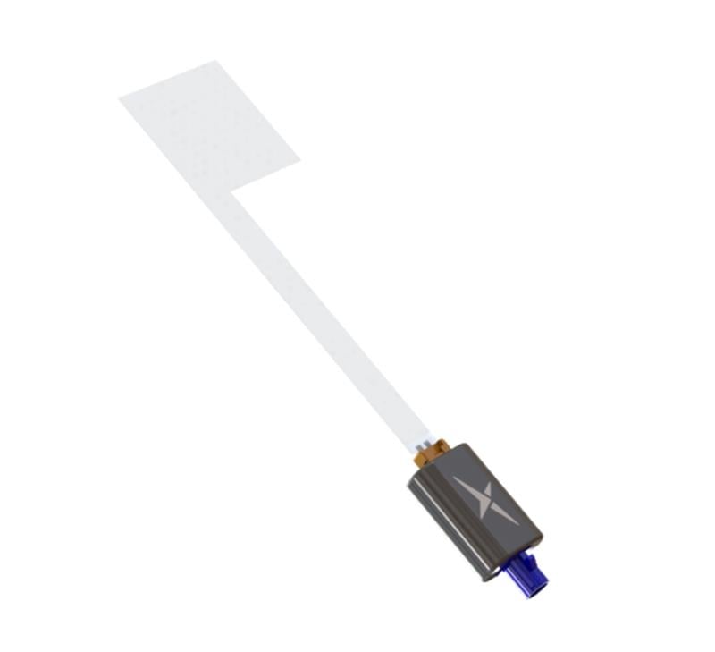
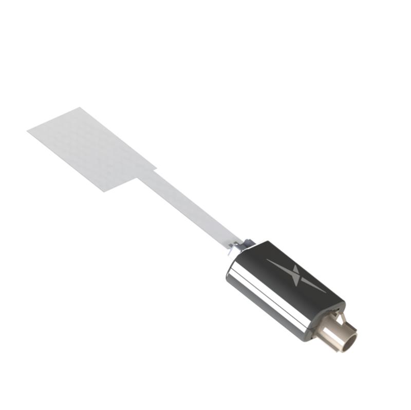
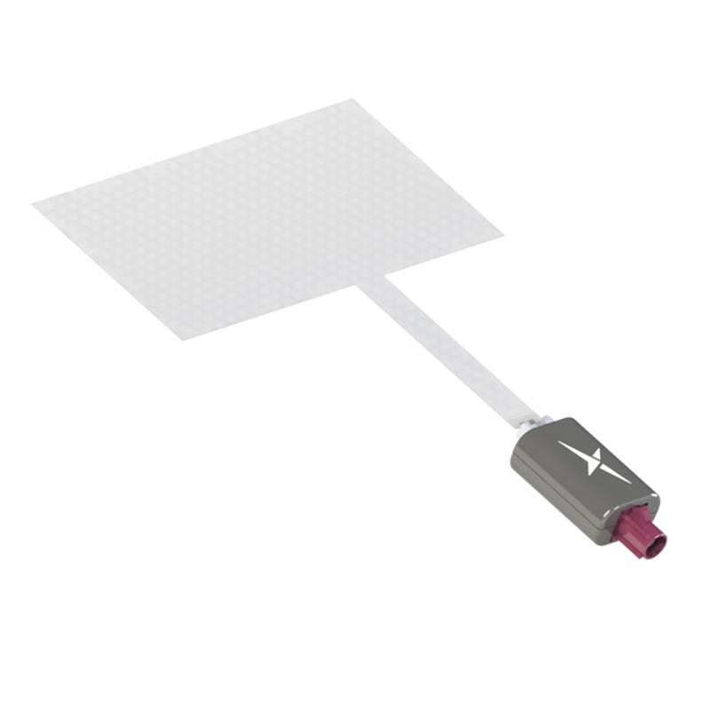
Taoglas has released three near-invisible antennas supporting cellular, Wi-Fi and GNSS technologies, the TFX62.A, TFX257.A and TFX125.A . With “peel and stick” mounting to any nonmetal surface, the TFX series antennas offer an alternative to standard opaque antennas.

The TFX62.A, TFX257.A and TFX125.A come with an adhesive and have an enclosed carrier terminated with a FAKRA connector for easy installation. The series leverages a sub-millimeter thick hybrid transparent conductive film that offers designers an invisible antenna solution.

The TFX series antennas are suitable for mobility, public infrastructure, medical devices, transportation and emerging IoT applications. Use cases for the antennas include electric vehicle chargers and parking meters, smart buildings and transportation vehicles.

The TFX series antennas are available now.

TFX125.A (Image: Taoglas)

TFX125.A (Image: Taoglas)

TFX257.A. (Image: Taoglas)

TFX257.A. (Image: Taoglas)

TFX62.A. (Image: Taoglas)

TFX62.A. (Image: Taoglas)

Publicerad den Lämna en kommentar

New feature in OPUS Projects: Using RTN vectors to support 2022 Transformation tool

February’s column focused on potential errors in orthometric heights using a digital barcode leveling system with multi-piece leveling rods. As stated in the column, businesses need to make decisions based on expenses and ultimately on the profit margin; but making a business decision that results in a bad technical outcome is never the right decision. This newsletter column is going to highlight a new feature in the National Geodetic Survey (NGS) Beta OPUS Projects 5.1 routine permitting the use of RTN vectors to support the development of the 2022 Transformation model.

On Jan. 12, NGS held a webinar titled “Using RTN Data in OPUS Projects 5 for GPSonBM.” Users can download the video and PowerPoint slides here.

I’ve been highlighting NGS’s GPS on Bench Mark program that supports the 2022 Transformation Tool in my columns since 2018. NGS delayed the completion date for the new modernized NSRS until 2025, so they have extended the cut-off date for submitting GPS on Bench Mark data for use in the 2022 Transformation Tool until Sept. 30.
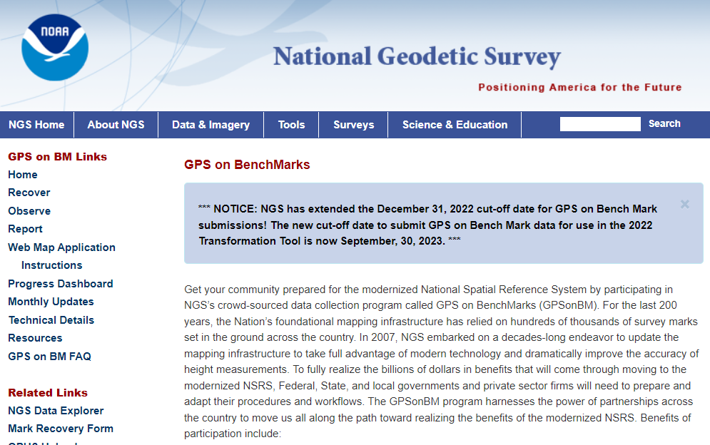
NGS GPS on BenchMarks Program (Image: NGS website)

NGS GPS on BenchMarks Program (Image: NGS website)

NGS has been developing tools that facilitate submitting data to the NGS GPS on BM campaign such as OPUS Share. The latest tool is the OPUS Project 5.1 routine that allows the use of RTN vectors. OPUS Projects 5.1 is a beta product, but NGS is now allowing users to use the routine to submit data for the GPS on BM campaign. My October 2021 column highlighted NGS’s Beta OPUS Projects 5.1.
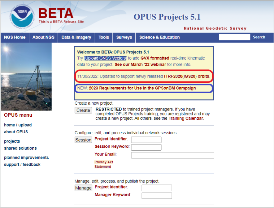
The 2023 requirements for using OPUS Projects in the GPS on BM program (Image: NGS website)

The 2023 requirements for using OPUS Projects in the GPS on BM program (Image: NGS website)

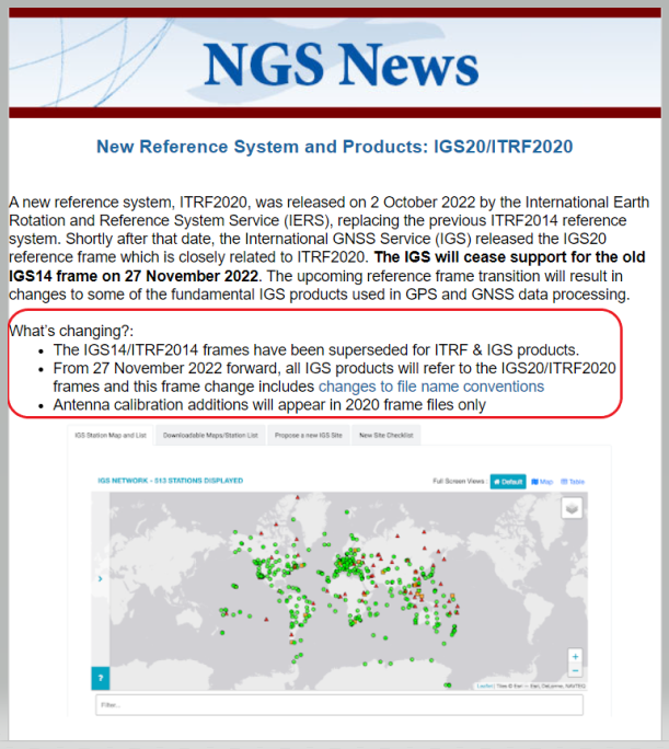
I’d like to note that OPUS has been updated to support the newly released ITRF2020 (IGS20) orbits. My October 2022column discussed the latest International Terrestrial Reference Frame of 2020 (ITRF2020) released by the International Earth Rotation and Reference System Service (IERS). A previous NGS news bulletin provided a statement about the new reference system and products.

Excerpt from NGS News Bulletin (Image: NGS website)

Excerpt from NGS News Bulletin (Image: NGS website)

Clicking on the link titled “NEW: 2023 Requirements for Use in the GPSonBM Campaign” on the OPUS Projects 5.1 webpage provides the requirements for using OPUS Projects 5.1 and Real-Time Network (RTN) data to support the 2022 Transformation Tool; that is the 2023 GPS on BM campaign. There are five sections in the writeup: Introduction, Project Planning, Equipment and Configuration, Field Requirements and Office Requirements. The Introduction section states that the requirements are limited to the GPS on BM Campaign and will be replaced, or superseded, when NGS finishes its new GNSS surveying specifications.
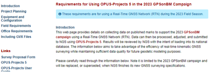
Introduction Section from Requirement Write Up (Image: NGS website)

Introduction Section from Requirement Write Up (Image: NGS website)

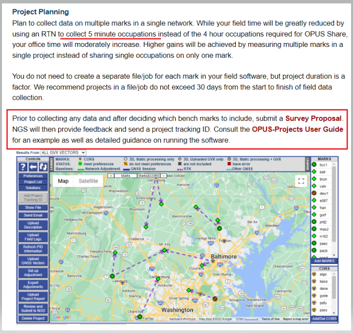
The project planning section of the announcement states that RTN vectors of 5-minute occupations can be used instead of the 4-hour occupations required for OPUS Share.

Project Planning Section from Requirement Write Up (Image: NGS website)

Project Planning Section from Requirement Write Up (Image: NGS website)

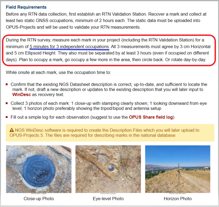
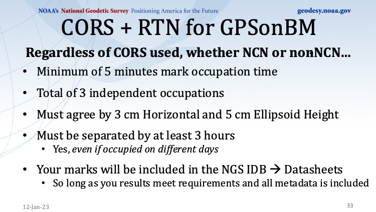
However, the Field Requirement section states that the mark must be occupied three different times.

“During the RTN survey, measure each mark in your project (including the RTN Validation Station) for a minimum of 5 minutes for three independent occupations. All three measurements must agree by 3 cm horizontal and 5 cm ellipsoid height. They also must be separated by at least 3 hours (even if occupied on different days). Plan to occupy a mark, go occupy a few more in the area, then circle back. Or rotate day-by-day,” the section states.

Field requirements Section from Requirement Write Up (Image: NGS website)

Field requirements Section from Requirement Write Up (Image: NGS website)

As stated in the section on office requirements for using OPUS-Projects 5 in the 2023 GPS on BM Campaign writeup,“The OPUS-Projects User Guide provides instructions on how to run the software and submit a project to NGS. The User Guide states to follow the steps in the order listed below, and it explains steps 1 – 7 and 9 – 11 in detail. For step 8 and when including GVX data in OPUS-Projects 5, refer to those portions of the User Guide’s Quick Start which are highlighted in yellow. NGS is working on fully updating the User Guide to include more details; for now, use the Quick Start Guide for assistance with GVX.”
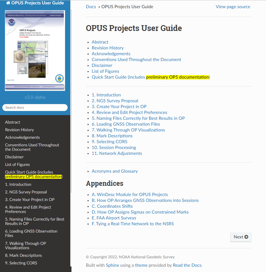
OPUS Projects User Guide (Image: NGS website)

OPUS Projects User Guide (Image: NGS website)

Quick start guide. (Image: NGS website)

Quick start guide. (Image: NGS website)

I recently used OPUS Projects to analyze some GNSS results using Harris-Galveston Subsidence District CORS and PAMS GNSS data. I want to emphasize that it may seem like a lot of work the first time you use the routine, but NGS makes it fairly simple to complete each task. The manual is very complete and does a good job of describing every step. The manual can be downloaded here. In my experience, the most time-consuming task is creating the descriptions. There are several items that must be correctly entered because the answer to some entries affect the answers to other entries. That said, NGS supports a description entry software called WinDesc that facilitates entering the appropriate information. The OPUS Projects User Guide provides an appendix that describes using the WinDesc module to enter description metadata.

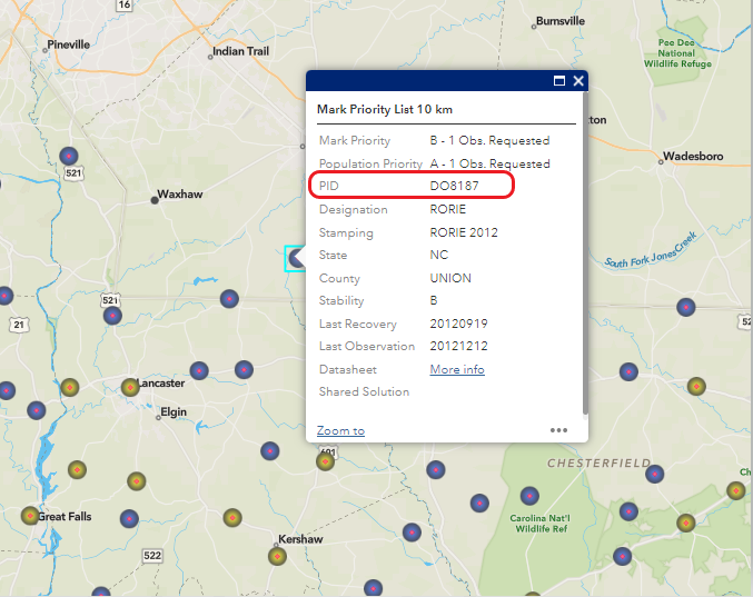
For marks that are in the NGS database, known as the NGS Integrated Data Base (NGSIDB), WinDesc will import information from NGSIDB, thereby decreasing the number of entries users need to address. In other words, if the mark has a PID then it should be in the NGSIDB. If you are occupying a mark that is part of NGS GPS on Bench Marks website then it probably has a PID and a description in NGSIDB.

Example of PID from Mark Priority List (Image: NGS website)

Example of PID from Mark Priority List (Image: NGS website)

I’ve included three slides from the Jan. 12 webinar that summarize the basic requirements.
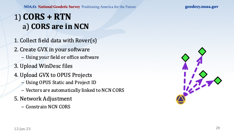
This slide is a depiction of how a CORS station must be connected to the RTN vectors. (Image: NGS website)
This slide is a depiction of how a CORS station must be connected to the RTN vectors. (Image: NGS website)

This slide provides the occupation and precision requirements. (Image: NGS website)

This slide provides the occupation and precision requirements. (Image: NGS website)

This slide provides a list of the required metadata for the project. (Image: NGS website)

This slide provides a list of the required metadata for the project. (Image: NGS website)

As for the requirement of at least three independent RTN occupations on different times, in my opinion at least one occupation should be on a different day. My October 2021 column addressed a study that reported on using RTN solutions to estimate accurate horizontal and vertical coordinates.

The report stated, “When differenced with coordinates from a static GNSS survey campaign, the horizontal and vertical RMSE of the NRTK-derived coordinates was 2.3 cm horizontally and 4.5 cm vertically at 95% confidence. Repetitive NRTK vectors on each baseline differed between ± 2.4 cm horizontally and ± 3.4 cm vertically at 95% confidence.”

The report also stated, “Adjustment of hybrid survey networks with four repeat NRTK vectors per bench mark produced network accuracies at 95% confidence for the adjusted coordinates at all bench marks less than 1 cm horizontally and 2 cm vertically (ellipsoid height).”

The requirements are limited to the GPS on BM Campaign and will be replaced, or superseded, when NGS finishes its new GNSS surveying specifications.
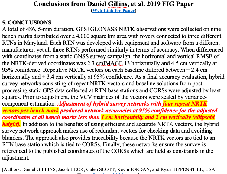
(Image: Screenshot of Accuracy of GNSS Observation from Tree Real-Time Networks in Maryland, USA)

(Image: Screenshot of Accuracy of GNSS Observation from Tree Real-Time Networks in Maryland, USA)

The paper by Gillins, et. al was presented at the 2019 FIG Working Week held in Hanoi, Vietnam, on April 22–26, 2019. The International Federation of Surveyors (FIG), involves a wide range of professional fields within the international surveying community; this includes surveying, cadastre, valuation, mapping, geodesy, hydrography, and geospatial and provides an international forum for discussion and development to promote professional practice and standards. FIG meetings are held all over the world. I’d like to highlight that the 2023 FIG Working Week is going to be held in Orlando, Florida, on May 28 – June 1, 2023.

NGS will be presenting a full-day worth of content on NSRS Modernization during the FIG Working Week 2023. For the first time in more than 20 years, this annual FIG gathering will take place in the United States, hosted by the National Society of Professional Surveyors (NSPS).

I’ve participated in several FIG meetings. I’ve learned a lot from presentations as well as holding hallway meetings with experts from the international surveying and mapping community. All geospatial users should plan on attending this event. I have provided information about the FIG commissions in my August 2021 newsletter. I would encourage everyone to visit the FIG website and review the information about the 2023 FIG Working Week. The a list of the FIG Commissions can be found here. More information can be obtained on each commission by clicking on its title.

Future columns will highlight the FIG Working Week as the agenda is developed. I would encourage everyone to check NGS’s Website for updates on Beta products and new surveying specifications. Geospatial users should also subscribe to NGS’s News Services at the following here. Check out the NGS News Services site for what’s available.

Publicerad den Lämna en kommentar

Furuno’s most advanced global timing module, supporting L1 and L5 GNSS signals

Image: Furuno Electric

Image: Furuno Electric

Furuno Electric has announced a new global timing solution, GT-100, compatible with all GNSS constellations. The GT-100 realizes the world’s highest robustness and standard of time accuracy and stability. Interruption of GNSS satellite signals is a major concern for critical infrastructure systems. The GT-100 features advanced multipath mitigation, anti-jamming and anti-spoofing as well as short-term holdover, ensuring superior performance even if only L1 or only L5 are jammed. 

The module delivers best-in-class nanosecond precision for 5G wireless systems, radio communications systems, smart power grids and grand master clocks. 

Along with the GT-100, our GT-9001 and GT-90 achieve a level of time stability of 4.5ns (1σ) and offer superior features and performance.

Image: Furuno Electric

Image: Furuno Electric

Image: Furuno Electric

Image: Furuno Electric

Publicerad den Lämna en kommentar

Getting ready for our user conference and contributor meeting in ‘s-Hertogenbosch

In a few weeks, our 25th Contributor Meeting and International QGIS User Conference uc2023.qgis.nl will take off on 18 April.

Register or become a speaker yourself. For details on all the exciting opportunities to get involved, check out the introduction by our awesome organizing team:

Nyhet från QGIS, orginal inlägg

Publicerad den Lämna en kommentar

ICA Summit 2023 registration now open

The third Innovative, Connectivity, Autonomous (ICA) Summit will take place May 15-16, 2023, in Frankfurt, Germany.

The ICA Summit 2023 will focus on the various levels of automated vehicles and how the industry is being redefined by fast-changing technology. Industry professionals will discuss how manufacturers and suppliers will integrate key connectivity requirements to achieve advanced levels of autonomous driving.

The closed-door ICA Summit will dive into innovative solutions and regulatory framework of development and validation. Attendees will have a chance to explore the latest developments in the industry and share their insights on the following topics:

• “Autonomous vehicles: Future is today”
• “Connectivity should not be an option for today’s vehicle”
• “ADAS: From ABS to level 5”
• “Software and hardware: The key to superior AI”

For more information and to register, visit the ICA Summit 2023 website.

Publicerad den Lämna en kommentar

STMicroelectronics releases ST87M01 for IoT devices

Image: STMicroelectronics

Image: STMicroelectron

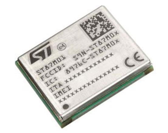
STMicroelectronics has released an ultra-compact, low-power, narrow-band internet of things (NB-IoT) industrial module with GNSS geo-location capabilities, the ST87M01. The fully programmable, certified LTE Cat NB2 NB-IoT industrial module covers worldwide cellular frequency bands and integrates advanced security features. 

The ST87M01 is an integrated native GNSS receiver with multi-constellation access, which ensures enhanced and accurate localization. The module has a diminutive 10.6 mm x 12.8 mm land grid array footprint, making it suitable for applications where a small form factor is key.  

The STM8701 offers flexibility for product developers, presenting a fully programmable IoT platform enabling users to embed their own code into the module for simple applications. A variety of protocol stacks are available to handle popular IoT use cases. 

The ST87M01 targets wide-ranging IoT applications that require ultra-reliable low-power wide-area network connectivity and has ultra-low power consumption with less than 2 µA in low-power mode and transmit output power up to +23 dBm.  

Suitable applications for the module include smart metering, smart grid, smart building, smart city and smart infrastructure applications, as well as industrial condition monitoring and factory automation, smart agriculture and environmental monitoring. The module can also be combined with a separate host microcontroller, permitting many more use cases. 

Publicerad den Lämna en kommentar

Final GPS III satellite available for launch

Image: SSC

Image: SSC

Space Systems Command (SSC) has declared GPS III Space Vehicle 10 (SV10) available for launch, marking completion of constellation modernization efforts and production for the GPS III program.

“The completion of the tenth, and final, GPS III space vehicle is a significant milestone for GPS modernization,” said Scott Thomas, GPS III program manager for the GPS Space Vehicles Acquisition Delta within SSC’s Military Communications and PNT directorate. “This would not have been possible without the collaboration, communication, and accountability of our industry and government partners. The GPS III program contributions underpin U.S. national security needs for our warfighters and for more than four billion GPS users worldwide.”

GPS III satellites deliver enhanced performance and accuracy through a variety of improvements, including increased signal protection with improved accuracy. GPS III also delivers a new L1C signal designed for interoperability with similar GNSS, and expands the civilian L5 signal, dubbed safety-of-life, which is not yet operational.

GPS III SV06 was launched on a SpaceX Falcon 9 Block 5 vehicle on Jan. 18, and Operational Acceptance was declared on Jan. 31. GPS III SV07, SV08, SV09 and SV10 are awaiting launch at Lockheed Martin’s GPS III processing facility in Waterton, Colorado.

Publicerad den Lämna en kommentar

Trimble dives into path planning tech

Image: Trimble

Image: Trimble

Trimble has released advanced path planning technology, which enables end users and equipment manufacturers to optimize and automate the trajectory, speed and path design of industrial equipment to increase efficiency.

The technology allows plans to be created in the office and adjustments made in the field or worksite. In addition, it is optimized for complex fields, unique site shapes, obstacles and avoidance zones. The software capability enables a broad range of autonomous applications across a variety of industries, including construction and agriculture.

The path planning technology gives users an easy-to-integrate, automated solution that works with Trimble systems and with equipment manufacturers’ existing systems. The technology will also be available within Trimble Connected Farm and Trimble Construction Cloud, offering a seamless, end-to-end experience to Trimble end users.

Trimble field tested the technology with Horsch, a company that specializes in agriculture, by integrating path planning technology into its self-propelled PT and VL sprayer series to provide an autonomous, four-wheel-drive solution. Trimble is also field testing this technology with Dynapac as part of its autonomous compactor for paving.

“Our new path planning technology is the next step in Trimble’s vision of making fully autonomous solutions available across industries, regardless of brand, type of equipment or use case,” said Finlay Wood, general manager, Off-Road Autonomy, Trimble. “With this easy-to-integrate solution, we’ve taken another significant step towards full autonomy.”

Publicerad den Lämna en kommentar

Phone location data is center stage at Murdaugh trial

Alex Murdaugh (Image: Pool reporter photo from trial)

Alex Murdaugh (Image: Pool reporter photo from trial)

Cellphone and vehicle location data is at center stage as former South Carolina attorney, Alex Murdaugh, takes the stand in the trial for the murder of his wife, Maggie Murdaugh, and son, Paul Murdaugh. Troves of data including call logs, text messages, steps recorded, app information, coordinates determined by GPS and more from Alex, Paul and Maggie, are being retrieved for the ongoing trial.

Records retrieved from Murdaugh’s cellphone show that after the murders occurred, he proceeded to Google an area restaurant, check group messages, and made other calls that night, which he testified were accidental, according to CNN reports. Vehicle location data was also pulled and presented at trial to identify a timeline of events for the court, according to reports from AP.

Location data retrieved from Murdaugh’s cellphone on the night of the double murders is not the only time this type of data comes into play for the Murdaugh family.

In February 2019, Paul Murdaugh and his friends were involved in a boating accident, which killed one of the boaters, Mallory Beach. In the new Netflix documentary regarding the Murdaugh family, Murdaugh Murders: A Southern Scandal, a relative of one of the boaters mentions in Episode 2 that Beach always wore an Apple Watch, and asked why investigators failed to look into location data to find her sooner.