Publicerad den Lämna en kommentar

Antenova adds Agosti antenna for scaled-down GNSS designs

Photo: Antenova

Photo: Antenova

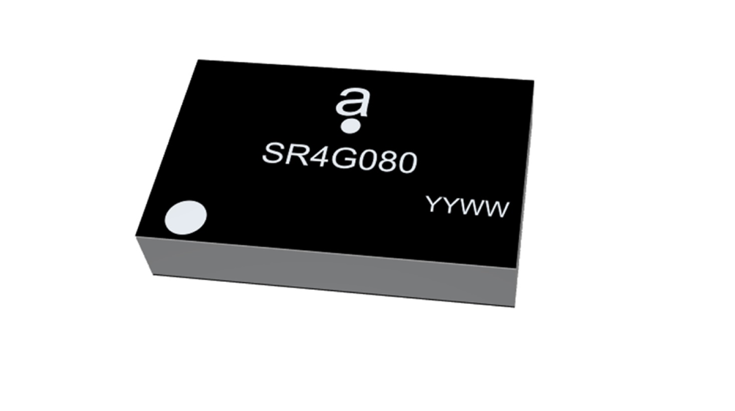
Antenova Ltd. is adding a new offering to its range of miniature surface-mount-designed (SMD) antennas and modules for GNSS applications. The new antenna, Agosti (part number SR4G080), measures 9.0 x 5.8 x 1.7 mm and operates with exceptional efficiency in a reduced space on a corner of a printed circuit board (PCB).

The key advantage of the Agosti antenna is its small ground-plane requirement. Most SMD antennas use the surface of the PCB around the antenna as a ground plane from which to radiate the signal — the ground-plane requirement, not the physical dimensions of the antenna, define the space it needs.

Antenova’s radiated measurement results show Agosti operating well on small ground planes of 40 x 20 mm, 70 x 25 mm and 80 x 30 mm, making it a suitable choice for small form-factor designs, such as small wearable devices, trackers and on-board diagnostics (OBDs).

Agosti is designed to integrate and co-exist with other antennas within the same device. OBDs and trackers often use 4G/LTE with A-GPS for fallback. The Agosti antenna has been tested with Antenova’s Pharoah antenna (part number SR4L073), which also has a very small ground-plane requirement. The two antennas have excellent isolation and can operate in close proximity to each other in a very small device without the 4G signal interfering with sensitive GNSS signals.

“Small SMD antennas such as Agosti are an exciting alternative to the common delicate ceramic patch antennas used in GNSS designs,” said Michael Castle, product marketing manager, Antenova. “This is not just because the SMD antennas are significantly smaller. It is also because they provide omni-directional performance.

“Patch antennas are typically 12 mm or 14 mm square, are heavier than SMD antennas, and need a much larger ground plane and keep-out area,” Castle said. “They also have to be placed in the center of a circuit board and only work well when they point at the sky. Antenova’s new generation of SMD antennas overcome all of these limitations and perform well regardless of position and orientation of the device.”

Publicerad den Lämna en kommentar

Launchpad: GNSS modules, 3D scanning, parking assistance

A roundup of recent products in the GNSS and inertial positioning industry from the August 2022 issue of GPS World magazine.


OEM

Receiver Module

Designed for autonomous applications

Photo: Trimble

Photo: Trimble

The Trimble BD9250 dual-frequency receiver module supports Trimble RTX correction services and is designed to deliver high-accuracy positioning for high-volume, autonomous-ready applications in agriculture, construction, robotics and logistics. The compact receiver has an industry-standard form factor and pinout, allowing for easy system integration and configuration. Equipped with Trimble’s advanced ProPoint positioning engine, the BD9250 delivers robust and accurate positioning. It is compatible with Trimble RTX correction services or real-time kinematic (RTK) and supports GPS, Galileo, GLONASS and BeiDou as well as QZSS and NavIC. Support for the Indian NavIC S-Band signal is also available.

Trimble, trimble.com

GNSS Receiver

For construction, mining and machine control

Photo: Septentrio

Photo: Septentrio

The AsteRx-U3 ruggedized GNSS receiver is the successor to the AsteRx-U for construction, mining and other machine control applications. It combines a triple-band precise positioning GNSS core with extended wireless communication features including Wi-Fi, UHF and 4G LTE, making it easy to fit it into any control system. The AsteRx-U3 offers low latency of under 10 msec with a high data rate, which allows machines to work rapidly and accurately. An IP68-rated housing, with fixing brackets and robust M12 connectors, enables quick installation.

Septentrio, septentrio.com

GNSS Module

Incorporates MediaTek flash chip

Photo: Antenova

Photo: Antenova

The M20071 integrated GNSS receiver module, measuring 9 x 9 x 1.8 mm, incorporates the MediaTek AG3335MN flash chip. The receiver tracks four GNSS constellations concurrently (GPS + Galileo + GLONASS + BeiDou). The 1.8-volt system power supply provides outstanding low power consumption. Its multipath algorithms improve position accuracy in inner-city environments. The onboard low noise amplifier provides good performance in weak signal environments such as wearable devices.

Antenova, antenova.com; MediaTek, mediatek.com

M-Code Receiver

For guided weapons and other small applications

Photo: BAE Systems

Photo: BAE Systems

The Strategic Anti-jam Beamforming Receiver – M-Code (SABR-M) enables precise geolocation and strike capabilities in highly contested battlespaces. It integrates receiver technology with advanced antenna electronics in a small, hardened package designed to meet challenging performance requirements. It delivers accurate position, velocity, altitude and timing data, as well as strong protection against GPS signal jamming and spoofing. At 4.5 x 6 x 1 inches, the SABR-M meets size, weight, power, cost (SWaP-C) and thermal requirements for space-constrained military applications. It uses advanced beamforming technology to improve GPS signal reception and counter threat signals.

BAE Systems, baesystems.com


TIMING

Anti-Jamming Kit

Protects against timing threats

Photo: Focus Telecom

Photo: Focus Telecom

The GPS Resilient Kit (GRK) is a cybersecurity device that comes with two antennas for monitoring and protecting time-critical infrastructures. It can be integrated with any GNSS receiver, either as a retrofit or in greenfield deployment. The GRK features a proprietary interference filtering algorithm for maximum protection, up to 40-dB attenuation of jamming signals with the premium option. It requires minimal power consumption while providing cloud-based monitoring with real-time reporting of jamming attacks. It protects GPS L1 (C/A code) with a latency of 100 ns ±15 ns (fixed).

Focus Telecom, www.pnt-security.com

GNSS Backup

GBaaS enables providers to combat PNT cyberattacks

Photo: ADVA

Photo: ADVA

GNSS-backup-as-a-service (GBaaS) enables service providers to help operators safeguard services that rely on positioning, navigation and timing (PNT). In-network timing based on network time protocols (NTP) and precision time protocols (PTP) are also increasingly vulnerable to cyber threats. GBaas is based on ADVA’s aPNT+ platform, which leverages a suite of technologies, including multi-band GNSS receivers and management software based on artificial intelligence and machine-learning. Service providers can offer ADVA’s aPNT+ protection as a subscription-based service as part of their service-level agreements.

ADVA, adva.com


SURVEYING

GNSS Receiver

Can be used as base station or rover

Photo: CHC Navigation

Photo: CHC Navigation

The i73+ pocket-sized receiver is a powerful and versatile receiver with an integrated UHF modem that delivers survey-grade accuracy in all jobsite configurations. It has 624 GNSS channels and the latest iStar technology and can be operated as either a base station or a rover. The i73+ is a highly productive NTRIP rover when used with a handheld controller or tablet and connected to a GNSS RTK network via CHCNAV LandStar field software. The receiver takes advantage of GPS, GLONASS, Galileo and BeiDou, in particular the latest BeiDou 3 signal, to provide robust data quality at all times.

CHC Navigation, chcnav.com

GNSS Receiver

Flexible accuracy-level options

Photo: Juniper Systems

Photo: Juniper Systems

The Geode GNS3 GNSS receiver allows users to collect real-time GNSS data with sub-meter, sub-foot and decimeter accuracy options. With a scalable accuracy platform, users can purchase what they need now, while having the option to increase accuracy in the future. It offers sub-meter accuracy with a single-frequency antenna, while its multi-frequency antenna supports all constellations on L1, L2 and L5. Atlas L-band corrections allow the Geode to be used in water utility locating, agriculture and irrigation mapping, as well as mapping projects in remote locations where other correction services are not available. The Geode GNS3 can be used with Windows, Android, iPhone and iPad devices.

Juniper Systems, junipersys.com


MAPPING

4K Attachment

Improved colorization to contextualize point clouds

Photo: GeoSLAM

Photo: GeoSLAM

The ZEB Vision is a camera accessory for the ZEB Horizon system that can be used to capture 360° panoramic photography in 4K definition for point cloud colorization. Data is captured as the user walks through the area of interest. The ZEB Vision uses GeoSLAM’s SLAM algorithm to automatically and accurately position panoramic photos on a point cloud for an interactive viewing experience. The ZEB Vision attaches easily to the ZEB Horizon. The 4K resolution increases feature definition of objects within the point cloud, allowing for a new perspective on data by navigating within a virtual representation of an environment. This means industries such as architecture, construction and facilities can add real-world context to point clouds for the creation of CAD/BIM models.

GeoSLAM, geoslam.com

Lidar sensor

Improves bathymetric lidar surveys

Photo: Leica Geosystems

Photo: Leica Geosystems

The Leica Chiroptera-5 is a high-performance airborne bathymetric lidar sensor for coastal and inland water surveys. It combines airborne bathymetric and topographic lidar sensors with a four-band camera to collect seamless data from the seabed to land. Compared to previous models, the Chiroptera-5 provides 40% higher point density, a 20% increase in water-depth penetration, and improved topographic sensitivity for generating more detailed hydrographic maps. Its high-resolution lidar data supports nautical charting, coastal infrastructure planning, environmental monitoring and landslide and erosion risk assessments.

Leica Geosystems, leica-geosystems.com

Visualization Software

For field data capture and collaboration

Photo: Clirio

Photo: Clirio

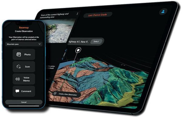
The Clirio application combines mobile lidar 3D scanning with smart remote collaboration tools to offer teams an end-to-end 3D solution to capture, organize, share and problem-solve. This is all based on real-time field observations and data, whether team members are on site or a continent away. Clirio is a set of mobile, web and VR/AR apps for instantly capturing, sharing, reviewing and resolving worksite field observations. At a field site, Clirio users collect notes, photos and 3D scans (using the laser scanner built into a new iPad Pro or iPhone Pro). These field observations are automatically geo-referenced within the map-based workspace and synced to a secure cloud workspace. An intuitive interface allows colleagues, managers, partners, or stakeholders to sort, review, compare, and act on field observations.

Clirio, www.clir.io


TRANSPORTATION

Parking Assist

Designed to meet scooter parking challenges

Photo: Bird

Photo: Bird

The Visual Parking System (VPS) by Bird is designed to keep track of scooter parking in a scalable, efficient and vandalism-immune way that requires zero infrastructure within a community. Powered by Google’s ARCore Geospatial API, VPS enables scooter parking with pinpoint accuracy. When parking a scooter, riders will be prompted to take a quick scan of their surroundings. The system seamlessly compares a rider’s images against Google’s data and Street View images in real time to produce the best available parking solution. Stationary objects such as buildings and signs are used as reference points, while more dynamic objects such as people and vehicles are disregarded. The near-instantaneous process results in a precise, centimeter-level geolocation that enables Bird VPS to detect and prevent improper parking with extreme accuracy, helping ensure Bird vehicles are only left in approved areas.

Bird, bird.co; Google, google.com

Tracking software

Supports Industry 4.0 with real-time visibility of assets

Photo: Pozyx

Photo: Pozyx

The Pozyx Platform is an asset tracking and identification solution for seamless indoor and outdoor tracking, following packages or other assets from trucks to their destination. It is based on the omlox hub, an open standard for real-time location systems that combines GPS data with data from ultra-wideband, 5G, radio-frequency identification, Wi-Fi and Bluetooth. The Pozyx Platform offers a seamless indoor/outdoor transition with zoom-in from a worldwide map to a detailed indoor map, showing highly accurate locations up to 10 cm. It is designed for smart manufacturing, providing a supply-chain solution that supports Industry 4.0. It tracks and identifies any asset, providing real-time data to facilitate warehouse and inventory control, keep track of critical tools, and slash lost asset costs.

Pozyx, pozyx.io

Publicerad den Lämna en kommentar

Increasing surveying accuracies and productivity

Land surveying is an ancient practice, dating back at least 5,000 years to when Egyptian rulers used it to tax land plots. Over the centuries, it has been repeatedly transformed by new technologies — the compass (about 200 B.C), the theodolite (1550s), Gunter’s chain (1620), the sextant (1757), electronic distance measurement (1950s), and total stations (1970s). Then came GPS, followed by the other GNSS and corrections services.

Now comes sensor fusion, which aims to compensate for the limitations of GNSS — orbit and satellite clock errors, ionospheric and tropospheric delays, multipath, dilution of precision, urban canyons, jamming, extremely weak received signal, etc. — by integrating it with other sources of positioning data, including inertial measurement units (IMUs), lidar sensors and cameras. Even crowdsourced geolocation data collected with cell phones help expedite surveys by guiding surveyors to landmarks.

In the following article, representatives of five companies share their perspectives on recent advances in surveying and the remaining challenges.

Many More Satellites
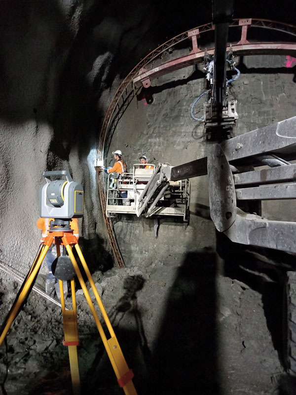
City Rail Link is New Zealand’s first underground rail network and the largest transportation project ever undertaken there. In this photo, taken at Karangahape Station, the Mined Tunnel Team installs a lattice girder secondary support structure using a Trimble SX12. (Photo: Link Alliance)

City Rail Link is New Zealand’s first underground rail network and the largest transportation project ever undertaken there. In this photo, taken at Karangahape Station, the Mined Tunnel Team installs a lattice girder secondary support structure using a Trimble SX12. (Photo: Link Alliance)

Compared to just a few years ago, there are many more GNSS satellites, signals and options for correction services. Over the past decade, the average number of satellites in view has more than doubled to more than 40 today. Some parts of the world have more than 70 satellites in view, said Boris Skopljak, vice president, Surveying & Mapping Strategy and Product Marketing at Trimble Inc.

“The developments in GNSS field systems have always been geared toward simplifying workflows, improving accuracies and increasing productivity,” Skopljak said. “In the last few years, we’ve seen that on a massive scale. In some of our materials, we no longer even quote how many signals our GNSS receivers are tracking.”

The vast increase in the number of satellites has extended high-precision applications to the robotics and automotive markets. The challenge now is “position solution,” not just GNSS, said Simon Peng, director of the Overseas Department at ComNav Technology. The improvements in the satellite constellations, antenna technologies and algorithms also enable surveyors and other users to obtain results faster and to operate in environments previously impervious to GNSS, such as under heavy canopy and very close to buildings.

“Our customers can now operate in environments where there is no virtual reference station (VRS) infrastructure or real-time kinematic (RTK), by leveraging precise point positioning (PPP) solutions, such as the Trimble RTX corrections service,” Skopljak said.

“Additional satellite signals and constellations (like Beidou),” Skopljak said, “improved antenna technology and continuously evolving algorithms are contributing to improving the RTX accuracy while bringing the convergence times to almost instantaneous in normal conditions and making technology available in more regions.”

“When I first started surveying, if we had a 12-channel receiver, that was doing very well,” recalled Jesse Huff, head of Sales and Marketing, JAVAD GNSS. “Now, we’re tracking 36 birds in the sky at one time with an 874-channel receiver. That’s phenomenal.”

Huff described a patent-pending feature called real-time post-processed kinematic (RTPK). “It combines RTK, PPK and PP techniques, with multiple core processing engines and a single solution coming out of that. It is impressive standing underneath a giant oak tree and surveying that monument with GPS and knowing what your accuracies are. We’re not even chasing RMS values; we can report the actual positional uncertainties, which is amazing.”

pole tilt compensation enables surveyors to precisely and easily localize points that are difficult or dangerous to access. (Photo: ComNav Technology Ltd.)

Pole tilt compensation enables surveyors to precisely and easily localize points that are difficult or dangerous to access. (Photo: ComNav Technology Ltd.)

“With so many signals and the new ways of how we compute positions based on PPP technology, we can almost globally get to centimeter-level positioning within a couple of minutes from just one global correction link,” said Bernhard Richter, vice president of Geomatics at Leica Geosystems AG, part of Hexagon. “Under optimum conditions, you can have almost an instantaneous global accuracy of a couple of centimeters.” In mature areas, he added, a local RTK network infrastructure enables achieving centimeter accuracy within a couple of seconds.

Galileo, Richter pointed out, will be fully operational in 2023 with great signals, though he’s “a bit skeptical” about the system’s target date for its high-accuracy service. “So, we will basically get global constellation corrections that allow us also centimeter-level positioning.” BeiDou has been fully operational since 2020. “GLONASS is more unpredictable,” Richter said. “It looks like modernization is slowing down a bit, in particular the CDMA developments.” Additionally, he pointed out, it is possible that one or more governments may decide not to use those signals, for military or political reasons. “It’s not the manufacturers who decide which signals to take.”

“In open-sky conditions, additional satellites have added redundancy — which is always good for position integrity — but it’s only when obstacles start to appear on the horizon, blocking out parts of the sky, that all-in-view RTK really comes into its own,” said François Freulon, Head of Product Management at Septentrio. When they did not have a full view of the sky, he recalled, GNSS users used to have to carefully schedule their work to coincide with times of high satellite visibility. “Nowadays, by using multiple constellations and signals, RTK can reach the parts that receivers in the past could not tread. More signals and constellations have also helped in easing the collection workflow for surveyors, making the capture of data in difficult conditions much quicker and more efficient.” New correction services are further simplifying the workflow “thanks to new positioning techniques, pricing business models and simplified network density.” However, corrections companies still face challenges in ensuring that centimeter accuracy can be uniformly achievable at a global scale.

Sensor Fusion

The ongoing evolution in computing power and communication technology “leads to many more sensor combinations,” Skopljak said. “We are not talking about GNSS alone anymore. We are talking about integrating a GNSS antenna, a receiver, an IMU, power and communications into a single compact housing.” The integration of inertial sensors makes it possible to localize the instrument rod tip when the pole instrument is tilted. “That allows our customers to measure more safely in dangerous environments.”

“We are reaching a maturity stage of what we can do only with GNSS,” said Richter. “It’s all about sensor fusion. The problem when signals are obstructed, that’s not solved, even though we can do positioning from Wi-Fi hotspots or from local pseudolites.” So, fusing data from cameras, lidar, GNSS and IMUs in better ways is the way to go and presents “a huge open research ground.”

For Richter, the challenge is not just positioning, the orientation of objects is almost as important as that, especially for such tasks as machine control. “It’s also about what you do with the data that you collect. Hexagon’s vision is of an autonomous future where we put data to work in connected ecosystems to boost efficiency.” However, he pointed out, this requires large amounts of data, such as those from aerial photogrammetry, lidar and mobile mapping systems used to create city models and digital twins of buildings. “If you really want a car to drive autonomously through a city with all the things that could happen, you must rely on a perfect replication of the real world,” he said. Other examples he cited are more efficient evacuation plans and flooding simulations. “GNSS will never be enough, but it will always be a very good enabler because it works.”

Classes of Receivers

JAVAD GNSS designed its TRIUMPH-LS Plus receiver to work under heavy tree canopy. (Photo: JAVAD GNSS)

JAVAD GNSS designed its TRIUMPH-LS Plus receiver to work under heavy tree canopy. (Photo: JAVAD GNSS)

Two decades ago, we would often group GNSS receivers by accuracy into three buckets: consumer grade, resource or mapping grade, and survey grade. As accuracy has increased for all GNSS receivers, the boundaries between those categories — especially between mapping and surveying — have blurred. “The performance of GNSS has increased so much that we are not using the traditional accuracy-based differentiation between surveying and GIS,” said Skopljak. “For mapping professionals, 10 years ago it was all about points, lines and polygons; now it is all about locating assets and adding the most accurate positions as attributes to those assets. For our survey and engineering customers, what matters is still geometry and working with the models to serve the connected construction in the field.” As for the pure GNSS technology stack, “we are seeing fewer differences between mapping and surveying receivers, but we are focusing on serving the customer in terms of product-as-a-service or as a productivity tool.”

Huff made two points. First, that “survey grade” does not necessarily equal RTK. “Some education needs to happen so that people understand RTK as a technique, not an accuracy. You can get poor accuracy and poor fixes with RTK, even when you’re using good techniques. So, when I say ‘survey grade’ I’m still talking about the full frequency receivers, using all available signals.” Second, that consumer-grade receivers, such as the chipsets in our phones and computers, do not require the same robustness as professional ones. “While they may be achieving the same precision, surveyors must be able to defend their position in a court of law.”

Crowdsourcing

Huff cited the “phenomenal” success of the simultaneous localization and mapping (SLAM) movement with all kinds of positioning challenges. “From a survey perspective,” he said, “we’re dealing with a much more feature-rich dataset than we were even just 10 years ago, with everybody having some type of GPS device on their phones. There are location tags on everything. That creates evidence for the surveyor to be able to go out and recreate things, reduce trips to the field, reduce rework times — all those things that make a surveyor’s life much easier.”

Surveyors now can fly aerial surveys of hundreds of acres in less than half an hour using drones with RTK, Huff said, instead of having to wait for the flying season with traditional airborne photos. If needed, they can pick a few ground-control points for ground truthing. “We’re able to do that with photogrammetry techniques, but using GNSS technology to position drones, whether it’s real time or post-processing, has definitely made surveying jobs easier.”

Correction Services
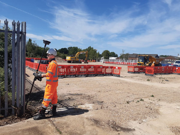
The adoption of GNSS in construction is growing and receiver manufacturers are making it easier to use their equipment in the field. (Photo: Leica Geosystems)

The adoption of GNSS in construction is growing and receiver manufacturers are making it easier to use their equipment in the field. (Photo: Leica Geosystems)

Correction services — such as satellite-based augmentation systems (SBAS), the ground-based Wide Area Augmentation System (WAAS) and the European Geostationary Navigation Overlay Service (EGNOS) — make a big difference along with PPP and similar techniques when base stations are not available. “We have the whole CORS network here in the United States,” Huff pointed out. “We also have services available from the National Geodetic Survey.”

Those who don’t want to have to fully engage in post-processing can upload their data to the Online Positioning User Service (OPUS), AUSPOS (a free online GPS data-processing facility provided by Geoscience Australia) or other corrections services that will post-process positioning data. “It has made it more accessible for all the surveyors all the way around, especially as the technology has improved and the cost barrier to entry into a survey-grade GPS receiver has come down significantly as well,” Huff said.

Growing Adoption of GNSS

The greater number of satellites in orbit significantly reduces convergence time and increases the accuracy of the solution, which makes the technology much more user-friendly for professionals and nonprofessionals alike.

For surveyors and mapping professionals, the increasing levels of GNSS performance means that “GNSS continues to be the dominant equipment and they can operate in challenging GNSS environments while still meeting the accuracy and precision requirements,” Skopljak said. GNSS usage is also growing in such industries as agriculture, construction, transportation and logistics. “Now, when farmers are on a combine, they don’t have to wait for an RTX or PPP solution to converge for 20 minutes. The solutions just work, and they can perform their task.”

Skopljak also pointed to “more flexible business models, such as pay-as-you-go or equipping seasonal workers or fleets of spatially enabled consumers to use GNSS,” that reduce the required upfront investment. “Surveyors now can go for longer and be productive in more areas where they could not use GNSS technology before. The non-surveying professionals — such as in natural resources, farming or construction — now can just turn on the machine and things work for them. They don’t have to worry about coordinate transformations and things like that.”

The Role of Total Stations

“Twenty years ago, when RTK and networks kicked in and then became popular, we were discussing whether it was the end of the automated total station,” Richter recalled. “Yet, the number of automated total stations has grown ever since.” To him, this is proof that GNSS alone will never solve all surveying problems. GNSS’ weak signal will always require surveyors to supplement it with other sensors, such as reflectorless total stations. “These instruments always need to work in harmony,” Richter said.

Success on both construction sites and in machine control require a very good robotic total station and a very good GNSS receiver, Richter said. “The simple problem of leveling a pole is actually solved, and we are using the technology that we developed for tilt-compensating GNSS receivers. We’re leveraging this now into the world of the total station.” This has solved one of the fundamental problems surveyors have long had, because they no longer need to level up and can measure tilted poles with a total station and with a GNSS receiver. “We have also made it very seamless for surveyors to switch between using GNSS receivers and total stations,” Richter said.

Featured Photo: Septentrio

Publicerad den Lämna en kommentar

Contrasting the use of drones on Mars and in Afghanistan

NASA and the European Space Agency (ESA) have been cooking up a way to get some of Mars back to Earth, so that samples can be analyzed in detail — just like the rocks the astronauts brought back during the Apollo missions, which gave us a deeper understanding of our Moon.

The Perseverance rover already on Mars has been seeking promising areas to investigate that might provide evidence of ancient past life, with the help of the Ingenuity helicopter drone. Recently, the two worked together to drive the rover to an old river delta, expected to be a prime location where such samples could be found.

The rover has been drilling and saving rock and dirt samples in onboard storage tubes. The difficulty is that getting them back to Earth requires another major undertaking.

Returning the Samples

Termed the “Sample Return Mission,” the two space agencies have been discussing for months how best to bring the samples back, and have now refined an approach. Given that Perseverance has been so good at the job it was given, the NASA/ESA team has decided that the rover should be used for the return mission in 2030 when things would be in operation on Mars. (We’re not sure if the warranty sticker on Perseverance will still be valid in 2030, but if past performance is an indication, all the rovers have significantly outlived their initial design lives.)

Its partner Ingenuity has graduated from proving it can fly in the thin Martian air to actually scouting routes for the large rover. Because Ingenuity has proven reliable and capable of traveling significant distances, NASA and ESA have decided that two new helicopter drones will become part of the return mission. They will be based on the successful Ingenuity design, but will be fitted with wheels, one on each of the four landing legs, to enable movement on the ground.

They will also be fitted with a device which is capable of picking up and carrying a sample tube. Since the prototype drone helicopter was designed to be as light as possible, this infers  a substantial increase in lift capacity will be required. The original mission included a sample-collection rover, but this task will now be assigned to Perseverance, with the two sample-carrying helicopters acting as backup, if needed.

An earlier concept had the rover dropping sample canisters behind it as it progressed around the surface for subsequent pick up. This concept appears to have been shelved for the moment. Keeping the canisters onboard the rover throughout perhaps simplifies transfer to the return lander.

NASA Return Sample concept illustration includes wheeled helicopters. (Image: NASA)

This NASA return sample concept illustration includes wheeled helicopters. (Image: NASA/JPL-Caltech)

The Mars Ascent Vehicle would then carry the samples into orbit, to a waiting Earth Return Obiter, where the samples would be transferred to a return system for onward transit and atmospheric re-entry to Earth. Some of these details are a little sketchy, but there sure are a lot of moving (autonomous, robotic?) parts. This, of course, means a lot of opportunities for something to go wrong. No doubt continuing refinement of the mission will reduce the risks. The Jet Propulsion Lab (JPL) and AeroVironment designed and built Ingenuity — they may face some challenges developing the successor helicopter drones.

Meanwhile, Here on Earth…

Drones led the news Aug. 1, when President Biden announced the killing of Ayman al-Zawahiri in Kabul, Afghanistan. Al-Zawahiri topped the U.S. 9/11 wanted list, and his removal was all about the offensive use of drones. Presumably fired from a General Atomics Reaper variant drone at quite some altitude, two Hellfire AGM-114R9X “knife bomb”missiles took out al-Zawahiri as he stood alone on the balcony of a home in Kabul.

This means that video/infrared from high altitude was sufficiently clear to determine that the man was alone on the balcony, presumably confirming information on the ground that his family was elsewhere. So long-distance, high-level authorization was then granted to fire on him in a foreign country now run by the Taliban.

Suspected damaged al-Zawahiri house in Kabul (Photo: Secunder Kermani/BBC News)

Suspected damage at the al-Zawahiri house in Kabul. (Photo: Secunder Kermani/BBC News)

To minimize inadvertent casualties, the Hellfire R9X missile was used, which lacks explosive armaments. The weapon is a nasty piece of work, weighing ~100 lb with an inert payload, and fitted with six long knives that deploy before impact. This missile has previously been used in perhaps 11 other instances to take out terrorist individuals and minimize collateral damage.

Bladed R9X missle lacks warhead (Image: Newsy/Bellingcat)

Bladed R9X missile lacks a warhead (Image: Newsy/Bellingcat)

This is another instance of how the U.S. use of military drones has become less devastating, but is still very deadly to the specific target.

To Sum Up

We’ve taken a quick glimpse at how NASA and ESA are planning more drones for the surface of Mars, and a much more aggressive use of drones here on Earth.

Publicerad den Lämna en kommentar

Tesla seeks to patent a better GNSS antenna for self-driving cars

Tesla has applied to patent a new multi-band GNSS antenna with increased precision for self-driving and navigation in its autos, reports electrek. The antenna would be positioned inside the rear-mirror enclosure, and the system would also provide a heating element.

While increasing precision, it is also designed to reduce power demand, noise and cost.

The automaker describes the new device in the abstract of the new patent application:

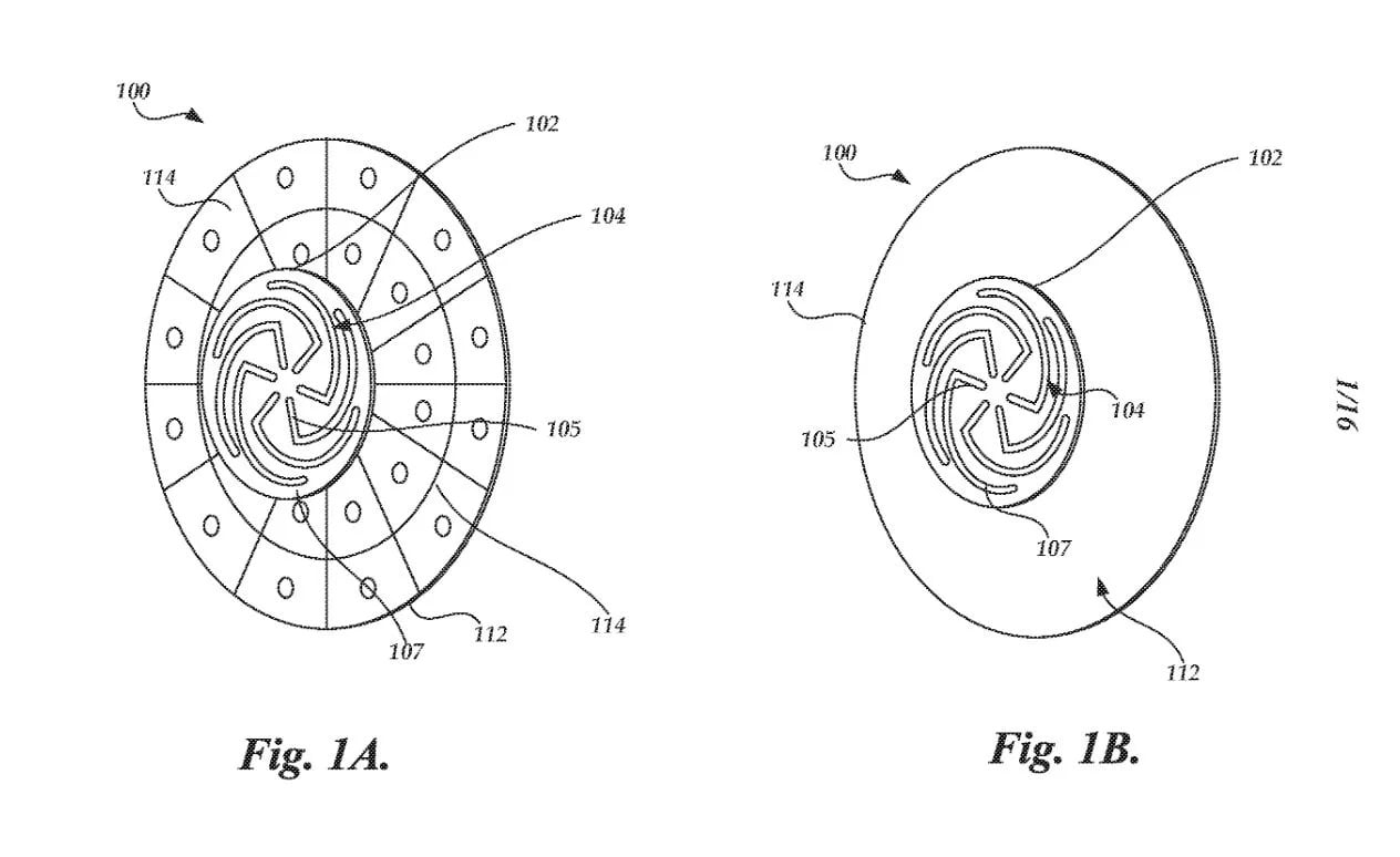
A multi-band antenna system is provided. The antenna system can be placed under and embedded within a glass exterior surface of a vehicle. Such an antenna system can include a capacitively coupled metallic element on or adjacent to the glass exterior surface, which can serve as both a parasitic element to enhance gain and as a heating element to melt snow and/or ice accumulation over the glass area that covers the antenna. In certain applications, the antenna’s structure itself can be used as a heater to improve performance in adverse weather conditions while the heating elements are positioned away from the thermally sensitive electronics. The antenna system with integrated heating can include a spiral antenna.

A diagram of the antenna provided with the patent application. (U.S. Patent Office)

A diagram of the antenna provided with the patent application. (U.S. Patent Office)

Publicerad den Lämna en kommentar

Lockheed Martin invests in Xona’s commercial navigation constellation

Xona Space Systems, a company developing navigation technologies from low-Earth orbit (LEO), has received investment backing from numerous companies, including Lockheed Martin. Its latest financing round was oversubscribed, bringing the start-up’s total funding to more than $25 million.

Xona is developing a high-performance commercial satellite navigation network, named Pulsar. Pulsar is a LEO system designed to provide resilient and trusted centimeter-level position anywhere on the globe.

Within the past year, Xona more than doubled its number of full-time employees, launched its first orbital mission, and signed agreements with major players across the GPS/GNSS ecosystem such as Hexagon | NovAtel and Spirent Federal.

Image: Xona Space Systems

Image: Xona Space Systems

The funding round was led by First Spark Ventures, who is joined by numerous new investors including Lockheed Martin Ventures, SRI Ventures (of SRI International), Velvet Sea Ventures, Gaingels, Airstream Venture Partners and Space VC. Existing investors also continue to show firm conviction in Xona’s accomplishments and market opportunity with participation from Seraphim Space, Toyota Ventures, 1517 Fund, MaC Venture Capital and Stellar Ventures.

The new capital will accelerate development of Pulsar through several critical design milestones by expanding the team and building out Xona’s new R&D and manufacturing facility in Burlingame, California. This will enable more rapid design cycles and prepare for production.

Xona’s first demonstration mission, Huginn, was successfully launched in May, and its second mission, Muninn, is planned to launch in 2023.

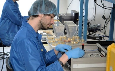
Xona Engineer Nick Manglaviti setting up hardware-in-the-loop testing at Xona’s R&D lab in San Mateo, California. (Photo: Xona Space Systems)

Xona Engineer Nick Manglaviti setting up hardware-in-the-loop testing at Xona’s R&D lab in San Mateo, California. (Photo: Xona Space Systems)

“Xona’s approach to GNSS is poised to enable a whole new class of robust and reliable solutions in everything from automotive to drones,” said Manish Kothari, managing director of First Spark. “This is a technically challenging problem — a problem the Xona team is uniquely qualified and experienced to address. We are very excited to be part of this journey with them.”

Xona’s core mission is to enable modern technology to operate safely in any environment, anywhere on Earth. To achieve this in industries such as automotive autonomy, drones and aerial mobility, precise knowledge of location and time is critical, and it must be robust against sources of potential interference or degradation. This is driving a need for global infrastructure that can support the demands of these applications as they continue to expand in both capability and geography.

“The massive domain expertise of our supporters in everything from scaling global companies to deep technical knowledge of GNSS is both a validation of our team’s capabilities and a catalyst that has been instrumental in our growth and speed,” said Xona CEO Brian Manning.

“As customer needs evolve, Lockheed Martin Ventures continues to work with companies we believe are on the forefront of emerging technology and that support increasingly resilient, hybrid systems,” said Chris Moran, vice president and general manager of Lockheed Martin Ventures. “We invested in Xona so they can continue to develop and build their commercial system to complement the greater GNSS architecture.”

“The world would look very different today without GPS,” said Xona CTO Tyler Reid. “The ubiquitous robust precision that Pulsar can provide has potential to make the same level of global impact, not only in present and emerging markets, but we believe this global high precision can also enable entirely new devices and apps that we haven’t even thought of yet.”

Publicerad den Lämna en kommentar

Lt Col Robert Wray takes command of GPS unit 2 SOPS

USSF Lt Col Robert Wray takes command of 2SOPS. (Photo: USSF/Dennis Rogers)

USSF Lt Col Robert Wray takes command of 2SOPS. (Photo: USSF/Dennis Rogers)

The 2nd Space Operations Squadron (2 SOPS), which oversees the GPS constellation, now has a new leader. Outgoing U.S. Space Force (USSF) Lt. Col. Michael Schriever relinquished command of the unit to USSF Lt. Col. Robert Wray.

The squadron conducted a change of command ceremony at Schriever Space Force Base, Colorado, on July 6, officiated by Space Delta 8 Commander Col. Matthew Holston.

As the new commander, Wray assumes the responsibility of overseeing the daily operations of a unit whose mission is to operate the GPS constellation, which provides global navigation, time transfer, and nuclear detonation detection.

Col. Matthew Holston honors Lt. Col. Michael Schriver for his 2SOPS service. (Photo: USSF/Dennis Rogers)

Col. Matthew Holston honors Lt. Col. Michael Schriver for his 2SOPS service. (Photo: USSF/Dennis Rogers)

Publicerad den Lämna en kommentar

Portable Time-Loader ready for field deployment

Image: Focus Telecom

Image: Focus Telecom

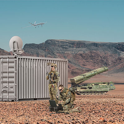
Focus Telecom has introduced a new timing product for defense and mission-critical applications, the Time-Loader.

The Time-Loader can be deployed in environments where GNSS signals are denied or disrupted, to support any ground, naval and airborne system that needs real time of day (TOD) and 1PPS external synchronization aligned to UTC or GNSS.

In this emerging era of rapid tactical deployment of defense systems, communications intelligence, missile defense systems, radar/electro-optical sensors and UAS batteries in the field are often in GNSS-denied or jammed environments. This situation creates challenges for access to real time and accurate time of day.

To solve this problem, the Time-Loader generates a GPS L1 C/A code RF output as if the signal were coming from a live-sky GPS antenna. It provides full-constellation GPS output and is compatible with external GNSS receivers. It encodes times with nanosecond accuracy for GPS timing receivers.

The Time-Loader’s GPS-disciplined oscillator (GPSDO) is the Microsemi MAC-SA53/55, which provides excellent UTC accuracy with outstanding hold-over rubidium clock performance.

The Time-Loader is the size of a suitcase, hand-carried and easily deployed. It activates quickly from a cold start or when sensors are deployed for the first time.

Included in the Time-Loader is a self-contained, miniature GPS simulator that provides real-time extremely accurate signals. The 18-channel full-constellation simulator stores location/time/date data in internal memory and stores complex vector data to simulate dynamic scenarios. The simulator also can be used to transcode NMEA or SCPI position/velocity/time (PVT) data into GPS RF signals.

Learn more about the Time-Loader.

Publicerad den Lämna en kommentar

Editorial Advisory Board Q&A: The role of AI and ML

What role do artificial intelligence (AI) and machine learning (ML) play in analyzing GNSS signals? How might that evolve?


Ellen Hall

Ellen Hall

“ML is gaining adoption across many GNSS application areas due to its ability to extract data and classify signal information often within complex operational environments. By combining ML with AI, systems are now able to characterize receiver correlator outputs and ranging residuals, and then fuse this with identified environmental features — all potentially increasing GNSS accuracy, integrity and availability. As AI and ML mature, we can expect to see new novel methods to optimize PNT sensor-fusion engines. This will include the combination of GNSS signals with other sensor signals such as inertial and vision.”

— Ellen Hall
Spirent Federal Systems


Bernard Gruber

Bernard Gruber

“AI will come to the battlefield and I would like to think that AI and ML will play a large part in GNSS solutions and specifically protection from adversaries in the future. As AI can ‘anticipate’ threats (i.e., spoofing, jamming, poor coverage) based upon what it sees and knows one should be able to reduce the cycle time to combat that threat (e.g., find/fix/identify and then target, change frequencies, evade). Seeing this data, ML can adapt to morphing threats as well as ‘fuse’ data from all different domains (air, space, sea and land) to provide solutions.”

— Bernard Gruber
Northrop Grumman


Jules McNeff

Jules McNeff

“I would like to turn the question around and ask ‘How does GNSS contribute to enabling AI and ML to function in physical space?’ Many AI and ML experts don’t think about this aspect of the technologies. Of course, timing is essential to AI and ML operation, but both must be spatially oriented as well if they are to interact effectively with things in the ‘real world.’ The more complex the interactions, the higher the need for precise, continuous PNT information. Depending on the applications, the relationships can become synergistic.”

— Jules McNeff
Overlook Systems Technologies


Greg Turetzky Principal Engineer Intel

Greg Turetzky

“AI and ML have a great opportunity to fundamentally change the way GNSS signals are used for positioning. In particular, the new modernized signals with wider bandwidths and higher chipping rates create a fundamentally richer data set than classic range/range rate measurements. By analyzing the channel response and using AI/ML techniques, the entire signal environment of LOS and NLOS signals can all be used to make more accurate measurements. In fact, in deep urban canyons with appropriate training, it is even possible to accurately position using only multipath signals such that more multipath makes the position more accurate, not less.”

— Greg Turetzky
oneNav

Publicerad den Lämna en kommentar

Geneq launches SXBlue SMART compact survey receiver

Photo: Geneq

Photo: Geneq

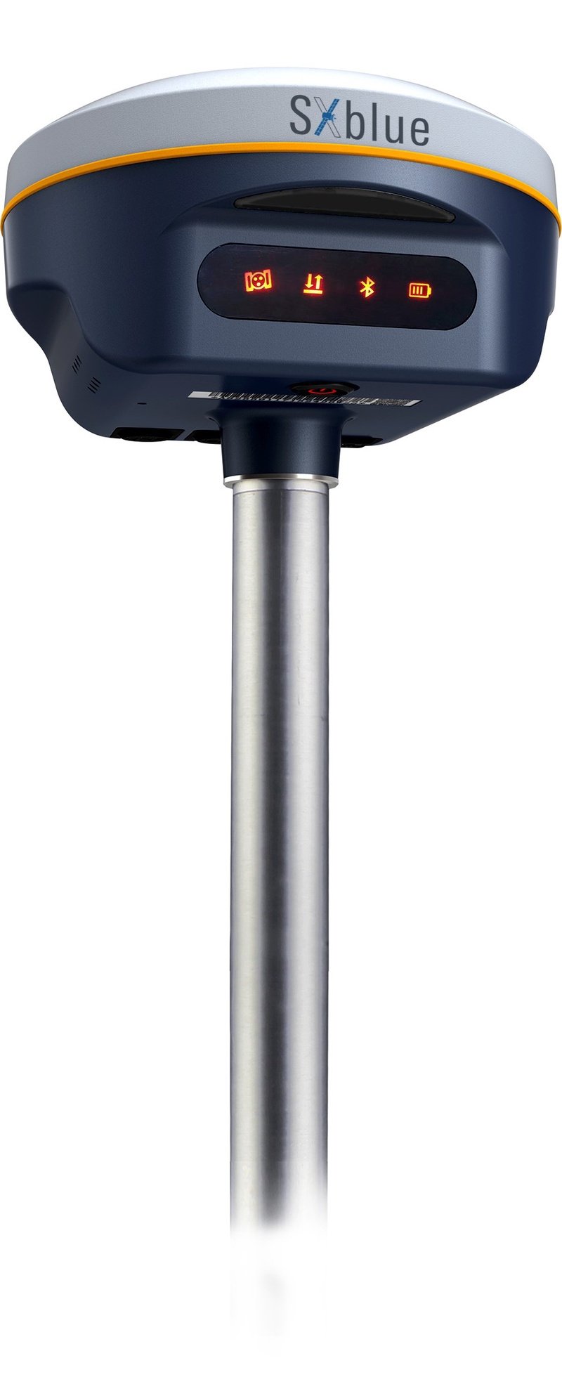
Geneq Inc. has released the SXblue SMART to meet the requirements of professionals looking for an accurate, flexible smart antenna for field work.

The SXblue SMART features a GNSS engine capable of quickly tracking all-in-view GNSS signals. Its design includes interference mitigation technology and optimization for handling a wide frequency band.

Weighing 850 g including battery, the SXblue SMART is compact, supplying the accuracy, ruggedness and maneuverability needed by surveying professionals. Its radio link is based on the Farlink protocol that allows a range of up to 8 km, a performance  achievable while reserving a wide bandwidth for transmission of real-time kinematic (RTK) data.

In addition to a tilt sensor for measurements in hard-to-reach places, the SXblue SMART features a high-performance attitude measurement module that can detect and measure movement of the device. An integrated inertial measurement unit provides even more accurate and stable measurements and increased productivity. The SXblue SMART also has a built-in thermometer for monitoring and controlling its internal temperature.

Compared to the company’s previous products, the SXblue SMART has improved communication features, including near-field communication that facilitates close communication with a controller or mobile phone equipped with this technology.