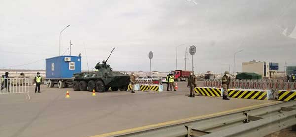
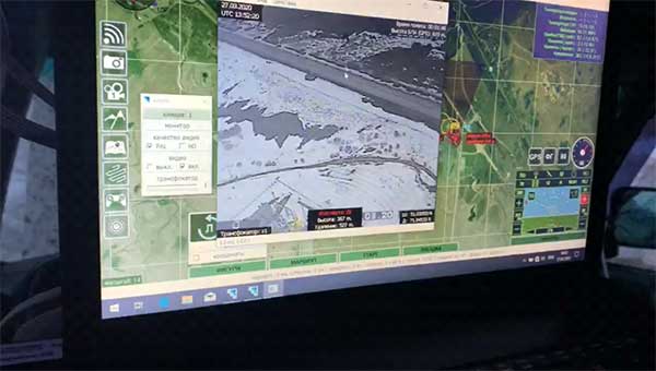
Publicerad den Lämna en kommentar

New Topcon Talks aimed at professionals at home during COVID-19

Photo: Topcon

Photo: Topcon

New series of free webinars for construction, geopositioning and agriculture facilitate learning

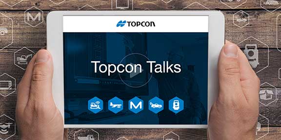
Topcon Positioning Group is launching a free webinar program for the construction, geopositioning and agricultural sectors, exploring key topics affecting the industry and providing the latest updates and project management solutions.

The Topcon Talks series, consisting of numerous informative webinars, has been created in response to the ongoing COVID-19 pandemic and aims to provide those working from home with valuable educational resources, while maintaining steady communication with Topcon customers, dealers and the wider industry.

The webinars will focus on a range of topics such as improving productivity using digital construction workflows, overcoming barriers to technology adoption, and more practical how-to sessions for customers and dealers on specific Topcon solutions.

The webinars will be delivered by a range of Topcon experts, with input from several other industry specialists, and cover a multitude of topics including:

  • Always One Step Ahead – an overview of Topcon’s latest product developments, market focuses and acquisitions
  • State of the Industry series – looking at the barriers to technology adoption in construction, such as attracting talent and bridging the skills gap
  • Detailed technical sessions showcasing latest hardware, software and web services to get the most out of Topcon solutions

The content series is live on the site, with new sessions taking place regularly over the coming weeks. All sessions are free to attend, and those wanting to participate will first need to register on the Topcon website.

“Everyday life has changed very quickly, and businesses across the world are having to adapt. At Topcon, we are working tirelessly to help the industry weather this storm. We’re aware that at this time, the majority of people are working from home, and we want to continue to support our customers and colleagues as much as possible,” said Ron Oberlander, vice president of global professional services at Topcon Positioning Group. “That’s why we’ve developed this webinar series — to provide an opportunity for continued professional development so that professionals can remain as productive as possible during this challenging time and be in the best position possible to accelerate the industry’s recovery when we come out the other side.”

The webinars are also recorded and uploaded to the site once complete, so those who are unable to attend the session can access the content in their own time.

Publicerad den Lämna en kommentar

Kazakhstan uses drones to patrol capital during COVID-19 lockdown

Terra Drone group company KazUAV has helped Nur-Sultan police to use drones to patrol and monitor illegal border movement and slow the spread of coronavirus in Kazakhstan

KazUAV, Kazakhstan drone service provider and a member of Japan-based Terra Drone Corporation, has been working at the frontlines to keep communities safe amid the COVID-19 pandemic outbreak.

Providing direct support to the operational headquarters set up to prevent the spread of coronavirus in Kazakhstan, KazUAV has been helping the Nur-Sultan Police Department to patrol the borders of the locked-down capital city with drones, ensuring “contactless” surveillance and fast-paced operations.

Nur-Sultan is the capital city of Kazakhstan.

The Central Asian nation closed its borders and locked down its main cities, including Nur-Sultan, after confirming the first coronavirus case on March 16. The oil-rich country that borders Russia and China also announced a state of emergency, set to last until April 15, adopting tough measures to combat the pandemic.

Some of the guidelines put forth by the Kazakh authorities include country-wide travel restrictions, suspension of public gatherings, and implementation of stringent sanitation and anti-epidemic measures.

A checkpoint on the border of Nur-Sultan. (Photo: TerraDrone)

A checkpoint on the border of Nur-Sultan. (Photo: Terra Drone)

All entrances and exits from Nur-Sultan have been completely blocked as part of these measures, mobilizing multiple law enforcement agencies of the Republic of Kazakhstan. Armored vehicles, barriers, and concrete blocks are being used to man the movement from the surrounding villages of Talapker, Karaotkel (Ilyinka), Koyandy, Kosshy and Zhibek-Zholy, on the Nur-Sultan-Petropavlovsk highway.

An additional post has been set up by the municipal government of the Akmola region in Shubary to ensure there are no cases of non-compliance by the Kazakh population.

KazUAV has been directly involved in the collection of information, operational monitoring, and coordination of actions of the Police Department and the Coronavirus Spread Prevention Operational Headquarters for all these areas.

A KazUAV drone takes off to monitor the borders of the Kazakh capital of Nur-Sultan. (Photo: TerraDrone)

A KazUAV drone takes off to monitor the borders of the Kazakh capital of Nur-Sultan. (Photo: Terra Drone)

Using drone-mounted cameras with both visible and infrared sensors, the KazUAV team has completed hundreds of flight hours, broadcasting all captured data, as well as the exact coordinates of objects of interest, directly to the operational headquarters command center. This has led to the authorities discovering multiple bypass roads and irregularities in the locked-down area – without which, the quarantine measures could not have proven effective.

When it comes to remote monitoring of vast areas, unmanned aerial vehicles are one of the best tools available to public safety agencies today. As a leading drone service provider in Kazakhstan, KazUAV not only gave Kazakh first responders access to cutting-edge drone technology, the company also assisted the enforcement agencies with the vast experience of its team of specialists, trained to operate day and night in the toughest of weather conditions.

The UAV ground control station at the Coronavirus Spread Prevention Operational Headquarters in Nur-Sultan. (Photo: TerraDrone)

The UAV ground control station at the Coronavirus Spread Prevention Operational Headquarters in Nur-Sultan. (Photo: Terra Drone)

“As international experience has shown, restrictions introduced to prevent the spread of the coronavirus are the most effective measures to fight it,” said Dmitry Ivanov, development director, KazUAV. “Of course, it’s hard for everyone now; it is a challenging time for each one of us. But the call to stay home is more relevant than ever in the context of drones. We are familiar with carrying out critical tasks like monitoring floods or patrolling important events, but this was an emergency request which needed an immediate response.”

Publicerad den Lämna en kommentar

36th Space Symposium rescheduled due to COVID-19

Logo: 36th Space Symposium

The Space Foundation has decided to reschedule the 36th Space Symposium for Oct. 31 to Nov. 2. It will still take place at The Broadmoor in Colorado Springs.

According to the Space Foundation, the 36th Space Symposium was originally will gather leaders, innovators and entrepreneurs from the civil, commercial, military, research and international sectors to share, explore and partner on efforts that will impact our lives beyond Earth and upon it.

“Working with our partners, The Broadmoor, the City of Colorado Springs, our corporate members and other key stakeholders, we look forward to welcoming everyone back to Colorado Springs to celebrate one of the world’s most inventive and impactful communities,” said Rear Admiral Tom Zelibor, CEO of the Space Foundation. “We will continue to monitor all of the public health reports and adhere to all of the federal, state and local orders regarding public assemblies but we have confidence in planning ahead for a future that brings our community safely back together in Colorado Springs.”

As a result of the date and timing changes for this year’s symposium, attendees will find a revamped agenda from what was originally scheduled for this spring, the Space Foundation said. Scheduled changes can be found here.

In addition, registration fees paid to attend the 36th Space Symposium will be automatically transferred to the rescheduled program. Those choosing to not attend the rescheduled Symposium are requested to notify support@spacefoundation.org to receive a full refund of registration fees paid.

Publicerad den Lämna en kommentar

GPS tracking need not sit out COVID-19 because of privacy laws

Photo: AntonioGuillem/iStock / Getty Images Plus/Getty Images

Photo: AntonioGuillem/iStock / Getty Images Plus/Getty Images

Commentary by Jeremy Meisinger

The scale and speed of the COVID-19 crisis has left policymakers searching for new tools to address an unprecedented challenge. Everything from faster testing to new treatments to more supplies for frontline providers is needed, and smart deployment of these resources requires an ability to track infections that is not yet available for a problem of the scale of COVID-19.

The recent economic stimulus package passed by Congress — the Coronavirus Aid, Relief, and Economic Security Act (“CARES Act”) – looks to fund this kind of tracking. Among its many priorities, the CARES Act appropriates half a billion dollars to the Centers for Disease Control and Prevention (CDC) for modernization of its public health data surveillance capabilities, and specifically directs the CDC to report to Congress on the development of a “public health surveillance and data collection system for coronavirus within 30 days.”

The legislation does not give much in the way of additional direction to the CDC, meaning that the CDC is likely to think expansively and look for proven models in other highly developed public health systems.

Disease surveillance efforts around the world have taken a variety of approaches, in many cases informed by experience in battling prior pandemics. Public health systems in places such as South Korea, Singapore and China were built on the lessons of the outbreak of Severe Acute Respiratory Syndrome (SARS) and similar conditions over the past several years.


Location-based tracking using GPS provides greater insight and precision than, for example, asking an infected patient to remember and re-trace his or her steps.


Among many other elements, these systems frequently employ GPS-enabled smartphone apps both to gather information and to target alerts to local populations. Location-based tracking using GPS provides greater insight and precision than, for example, asking an infected patient to remember and re-trace his or her steps.

As discussions of similar solutions have begun in the United States, privacy advocates have rightly pointed out the risks inherent in systems that necessarily gather and communicate health information and pair that information with location-based information provided by GPS. But both legally and practically, there need not be an exclusive choice between health information privacy and using GPS and other technology to gather and provide information about COVID-19.

On the legal front, HIPAA broadly exempts disclosures of protected health information for public health activities, allowing disclosures to public health authorities without first obtaining patient consent. Similarly, HIPAA permits data to be de-identified — subject to recognized standards laid out in regulations and guidance — and thereafter shared and used for research purposes, including public health research and similar purposes.


Legal avenues certainly exist to permit significant information sharing about COVID-19 in order to help protect public health.


Furthermore, federal authorities tasked with enforcing HIPAA have already signaled in guidance that they will take a flexible approach to enforcement in order to meet the exigencies of the crisis. Thus, while it is true that HIPAA has not been applied directly to a public health emergency on the scale of COVID-19, legal avenues certainly exist to permit significant information sharing about COVID-19 in order to help protect public health.

On the practical front, HIPAA also points the way to sensible decision-making that balances privacy interests with the needs of the crisis. First, de-identification provides a significant opportunity to share data in a way that is protective of privacy. Second, we should not assume that widespread participation — both in information gathering and information dissemination — must be involuntary in order to be widely adopted.

Smartphones users can — and should — be given a choice before enabling tracking features on their devices, just as they can and should be informed in a transparent way about what data would and would not be shared. HIPAA establishes a “minimum necessary” standard that should provide the guiding principle here: no more information should be shared than is necessary to accomplish the intended objective.

As we search quickly for tools to enable the kind of tracking that we have not undertaken before, we should be careful not to construct a false dilemma between privacy and efficacy — the two go hand in hand. Strong and transparent privacy protections are both possible and necessary to secure the public buy-in that is necessary to make public health surveillance work.


Jeremy Meisinger is a Boston-based attorney at Foley Hoag LLP.

Publicerad den Lämna en kommentar

Esri to provide US school data during COVID-19 pandemic

Location intelligence company Esri will be making data layers available on U.S. school closures during the COVID-19 pandemic, through a new partnership with MCH Strategic Data.

To help educational organizations as well as families across the nation better understand the situation in their communities, Esri and MCH have made school closure data accessible from a public dashboard.

Information on K-12 public and private schools include whether they are closed, plans for reopening school buildings, and the type of instruction they are offering during closures due to the epidemic.

MCH Strategic Data compiles and provides institutional information for the education, healthcare, government, and religious sectors.

“These datasets are useful for governments, school officials, and businesses providing leadership, resources, and community programs during the COVID-19 response,” said Ryan Lanclos, Esri director of public safety solutions. “But of utmost importance, this is a source of critical information for the community. It provides transparent and useful information that can help families develop a personal plan when they are feeling their most vulnerable.”

“Our customers depend on us to provide insight to the school market so they can respond effectively and appropriately during this challenging time,” said Kelly Holder, MCH chief information officer. “Our ability to rapidly compile and normalize changing data against our comprehensive U.S. database provides timely insight during an important time in the school planning cycle. This free map and database puts information into the hands of organizations who want to help schools and families now and in the coming months.”

As the COVID-19 outbreak has escalated rapidly across the globe, and with municipalities struggling to respond, MCH and Esri have built out additional resources like the MCH School Status Updates to help organizations quickly visualize and understand the current situation, as well as identify potential community risk areas when schools begin to open back up, and estimate the capacity needed to respond.

The Esri COVID-19 GIS Hub provides much of this essential data, along with case locations and social vulnerability, that communities and health organizations can use to inform their response.

For more information on Esri’s disaster relief support, visit esri.com/disaster.

Screenshot: Esri, USGS, MCH

Screenshot: Esri, USGS, MCH

Publicerad den Lämna en kommentar

Georgia county provides grocery store app for residents

Screenshot: Cobb County

Screenshot: Cobb County

Cobb County, Georgia, is providing its residents with an app that tracks what grocery stores are stocking which essential goods, such as paper products, cleaning items and fresh produce.

The Cobb COVID-19 Grocery Stores and Inventory app gathers input from users, and the data is posted anonymously. Stores can be sorted by distance, senior hours and crowds. Cobb County is a suburb of Atlanta.

The Cobb County Geographic Information System (GIS) department created the app using Esri ArcGIS.

Publicerad den Lämna en kommentar

Coronavirus delays GPS III SV03 launch until June

The United States Space Force’s Space and Missile Systems Center (SMC) has decided to reschedule the launch of GPS III SV03 (GPS III-3) from Cape Canaveral Air Force Station to minimize the potential of COVID-19 exposure to the launch crew and early-orbit operators.

Originally scheduled for late April, the launch is now projected for no earlier than June 30, pending a reevaluation in May.

“We do not make this decision lightly, however, given our GPS constellation remains strong, we have the opportunity to make a deliberate decision to maintain our mission assurance posture, without introducing additional health risk to personnel or mission risk to the launch,” said Lt. Gen. John F. Thompson, SMC commander and program executive officer for space.

The Lockheed Martin-built GPS III satellite will be the second GPS satellite launched on a SpaceX Falcon 9 rocket. It will be the first National Security Space Launch mission where SpaceX will attempt to recover the booster, reports Space News.

GPS III-3 brings the third modernized GPS III satellite to the operational GPS mission, and the team remains ready to execute. GPS III will bring three times better accuracy and up to eight times improved anti-jamming capability than its predecessor.

The current constellation is healthy with 31 satellites on orbit, allowing the team to take this strategic pause without gaps in coverage or capability.

“The GPS system supports vital U.S. and allied operations worldwide, unabated. As the COVID-19 pandemic is a threat to national security, likewise, rescheduling the launch is in the interest of national security,” said Gen. Thompson. “We have to get it right the first time, and protecting our people is just as important as cost, schedule, and performance.”

SMC still plans to complete the next three GPS launches this year. The team is taking the necessary steps to protect the health of personnel to allow a swift return to the mission.

“Some of the steps include procedural and facility modifications at the GPS III Launch and Checkout Capability (LCC) operations center and reducing the onsite crew size to provide adequate physical distancing, per CDC guidelines,” said Col. Edward Byrne, chief of Medium Earth Orbit Space Systems Division. “Once these efforts are completed, and the crews have rehearsed and are deemed proficient and ready to execute under these modified conditions, we fully intend to return to our launch cadence for deploying GPS III satellites.”

A leader of GPS III acquisition, SMC’s Production Corps is the United States Space Force’s acquisition office for producing and delivering GPS satellites, ground systems and military user equipment. The Production Corps’ agile program management techniques, smart business approach and close teaming with Lockheed Martin Space are enabling the production and delivery of GPS III’s new civil and warfighting capabilities by 2023. GPS delivers the “gold standard” of space-based positioning, navigation, and timing services vital to U.S. and allied operations worldwide, and underpins critical financial, transportation, and agricultural infrastructure that more than four billion users have come to depend on daily.

SMC’s Launch Enterprise, located at Los Angeles Air Force Base, California, is responsible for the acquisition and operation of launch vehicles, which includes mission assurance and launch safety. The Launch Enterprise is also responsible for leading the effort to certify new entrants to provide launch services for National Security payloads.

GPS III SV03 will be launched into operational orbit by a SpaceX Falcon 9 rocket. GPS III SV03 will be the second National Security Space Launch (NSSL) mission to be launched on a SpaceX Falcon 9 rocket and the first NSSL mission where a Launch Service Provider is recovering a booster.

The Space and Missile Systems Center is the U.S. Space Force’s center of excellence for acquiring and developing military space systems. SMC’s portfolio includes space launch, global positioning, military space vehicle communications, defense meteorological space vehicles, range systems, space vehicle control networks, space-based infrared systems, and space situational awareness capabilities.

SMC continues to deliver vital capabilities to the warfighter and the world, despite the challenges of COVID-19. Recent examples include the successful launch of AEHF-6 on March 26, Operational Acceptance of GPS III SV02 by Space Operations Command on March 27, and the inclusion of SV02 into the operational GPS constellation on April 1.

SpaceX’s Falcon 9 rocket orbited the first GPS III satellite on Dec. 23, 2018. (Photo: SpaceX)

SpaceX’s Falcon 9 rocket orbited the first GPS III satellite on Dec. 23, 2018. (Photo: SpaceX)

Publicerad den Lämna en kommentar

United Technologies and Raytheon complete merger

logosRaytheon Technologies Corporation announced the successful completion of the all-stock merger of equals transaction between Raytheon Company and United Technologies Corporation on April 3, following the completion by United Technologies of its previously announced spin-offs of its Carrier and Otis businesses.

Headquartered in Waltham, Massachusetts, Raytheon Technologies is one of the largest aerospace and defense companies in the world with approximately $74 billion in pro forma 2019 net sales and a global team of 195,000 employees, including 60,000 engineers and scientists.

Raytheon Company shares ceased trading prior to the market open on April 3, and each share of Raytheon common stock has been converted in the merger into the right to receive 2.3348 shares of United Technologies common stock (previously traded on the NYSE under the ticker symbol “UTX”).

Upon closing of the merger, United Technologies’ name has changed to “Raytheon Technologies Corporation,” and its shares of common stock will begin trading today on the NYSE under the ticker symbol “RTX.” United Technologies shareowners will continue to hold their shares of United Technologies common stock, which now constitute shares of common stock of Raytheon Technologies Corporation.

Raytheon Technologies has a large, talented workforce to address the rapidly evolving needs of customers globally. The combined company expects to introduce breakthrough technologies at an accelerated pace across high-value areas such as hypersonics, directed energy, avionics and cybersecurity.

In addition, Raytheon Technologies has a strong balance sheet and cash flows to support critical business initiatives, including company and customer-funded R&D.

“Raytheon Technologies brings together two companies with combined strengths and capabilities that make us uniquely equipped to support our customers and partners during this unprecedented time. We will also play our part in the war on the COVID-19 pandemic, including doing everything we can to keep our employees around the globe safe and well,” said Greg Hayes, CEO of Raytheon Technologies. “As we move forward, Raytheon Technologies will define the future of aerospace and defense through our focus on innovation, our world-class people and our financial and operational strength to create long-term value for our customers and shareowners.”

“Today, we introduce Raytheon Technologies as an innovation powerhouse that will deliver advanced technologies that push the boundaries of known science,” said Tom Kennedy, executive chairman of Raytheon Technologies. “Our platform-agnostic, diversified portfolio brings together the best of commercial and military technology, enabling the creation of new opportunities across aerospace and defense for decades to come.”

Structure and Leadership

Raytheon Technologies has four market-leading segments focused on high-priority areas for
customers. (Note: 2019 net sales are prior to intercompany eliminations.)

  • Collins Aerospace Systems specializes in aerostructures, avionics, interiors, mechanical systems, mission systems and power controls that serve customers across the commercial, regional, business aviation and military sectors. The segment is led by President Stephen Timm, headquartered in Charlotte, North Carolina, with approximately $26 billion in 2019 net sales.
  • Pratt & Whitney designs, manufactures and services the world’s most advanced aircraft engines and auxiliary power systems for commercial, military and business aircraft. The segment is led by President Chris Calio, headquartered in East Hartford, Connecticut, with approximately $21 billion in 2019 net sales.
  • Raytheon Intelligence & Space specializes in developing advanced sensors, training, and cyber and software solutions — delivering the disruptive technologies its customers need to succeed in any domain, against any challenge. The segment is led by President Roy Azevedo, headquartered in Arlington, Virginia, with approximately $15 billion in pro forma 2019 net sales.
  • Raytheon Missiles & Defense provides the industry’s most advanced end-to-end solutions to detect, track and engage threats. The segment is led by President Wes Kremer, headquartered in Tucson, Arizona, with approximately $16 billion in pro forma 2019 net sales.

Raytheon Technologies’ executive leadership team is comprised of Tom Kennedy, executive chairman, Greg Hayes, chief executive officer, and Toby O’Brien, chief financial officer. Additional leadership biographies are available on the company’s website.

Raytheon Technologies Investor Call

Raytheon Technologies will hold an investor call to discuss United Technologies and Raytheon Q1 results on May 7 at 8:30 a,m. The call details will be provided prior to the results announcement, and the call will be webcast on the Raytheon Technologies investor relations website.

Publicerad den Lämna en kommentar

2020 US Census Data now available in Maptitude

Image: Caliper

Image: Caliper

The Maptitude 2020 U.S. Census Blocks Groups data is now available for the entire United States, according to software provider Caliper.

The small-area Census Summary Level is packed with neighborhood information essential for making accurate geography-based decisions. Maptitude users can explore locations by income, income growth, daytime population, age, race, gender, ethnicity, buying power, occupation, employment status, housing characteristics, citizenship counts and more.

The wealth of data can be leveraged by data scientists and market research analysts using Maptitude mapping software, a comprehensive application for data exploration.

The 2020 Block Groups are priced at US$250 on the Caliper Store, and are also available as shapefile, KML, KMZ or GeoJSON for an additional fee. If you have any questions about Maptitude or data availability contact the Maptitude team.

Publicerad den Lämna en kommentar

Spirent SimHIL tests GNSS/sensor fusion for auto industry

New hardware-in-the-loop application programming interface (API) for GNSS simulators enables greater accuracy, integrity and control for growing sensor fusion testing needs

Image: Spirent

Image: Spirent

Spirent Communications plc has released SimHIL, an integrated hardware-in-the-loop (HIL) testing software API for Spirent GNSS simulators.

SimHIL brings high-fidelity GNSS signal simulation with low latency to automotive industry HIL testbeds, the company said.

Spirent’s SimHIL software has been developed to meet the automotive industry’s growing need for realistic positioning, navigation and timing (PNT) testing for sensor fusion. As customers apply increasing pressure on car manufacturers for more advanced driver-assistance system (ADAS) features and advanced infotainment systems, test labs need to be able to combine Wi-Fi, camera, lidar, radar, inertial and GNSS data that power these advanced automotive systems.

SimHIL helps test engineers bring accurate, controlled and coherent data from GNSS and inertial sensors to their sensor-fusion algorithms within HIL test environments. Facilitating the ultra-low latency, complete control, enhanced realism, and ease of use and setup of Spirent GSS7000 and GSS9000 GNSS simulators, SimHIL is suitable for OEMs and tier-one suppliers developing ADAS, V2X and sensor-fusion engines.

The new SimHIL API enables:

  • external motion input – real-time direct motion and trajectory data input from simulators
  • sensor fusion – introducing GNSS signals into sensor-fusion engines
  • V2X testing – validation and performance benchmarking of V2X applications
  • infotainment system testing – real-time scenario feedback to system and driver responses
  • vehicle-in-the-loop (VIL) – final production form product testing
  • accurate testing – reliable results supported by ultra-low latency simulation. Criticality of ADAS features, such as lane assist and automatic braking, mean that 3+ metres of uncertainty introduced by higher latency systems is not sufficient.

“With our SimHIL software and GNSS simulators, test engineers can bring realistic, controlled GNSS simulation to their HIL testing environments – a vital requirement in a world where ADAS features are relying more heavily and critically on accurate positioning,” said Martin Foulger, general manager of Spirent’s PNT business.

Spirent has worked with leading suppliers to ensure SimHIL is compatible with their HIL platforms, and because of its open API, there’s broad scope for additional custom third-party integrations.

“When used with our GSS7000, SimHIL latency is less than 40 ms from motion command to RF output and supports all GNSS and SBAS signals,” said Ricardo Verdeguer Moreno, product manager for Connected and Autonomous Vehicles at Spirent. “SimHIL is also compatible with all the options and features available in Spirent’s GNSS simulators, including ionospheric and tropospheric modeling, antenna patterns, date and time settings, and obscuration and multipath effects via Sim3D.”

Users can easily configure and control both the GNSS scenarios, and signal generation and vehicle motion from within the HIL simulator graphical user interface — saving time and the possibility of error.

Spirent is also offering three service packages alongside SimHIL to help customers mitigate project risk and reduce the time from delivery to useful deployment.

For more information about Spirent’s SimHIL integrated testing for Spirent GNSS simulators, visit the SimHIL information page.