Canada is leveraging advanced surveillance capabilities to enhance safety and efficiency by implementing a new mandate that will require aircraft operators flying in certain domestic airspace to meet Automatic Dependent Surveillance – Broadcast (ADS-B) Out performance requirements.
ADS-B uses GNSS technology to calculate an airplane’s precise location, speed and direction. This information is transmitted twice per second, providing greater situational awareness for air traffic controllers. It also provides increased flexibility to accommodate airline and customer preferred routes.
The mandate will take effect in Class A and B Canadian airspace above 12,500 feet on Feb. 23, 2023.
“ADS-B is a foundational building block for our future airspace and operations,” said Raymond G. Bohn, president and CEO of Nav Canada. “The Canadian equipage mandate — when combined with Nav Canada’s space-based surveillance capabilities — will enhance safety and service.”
“The aviation sector plays an essential role in connecting Canadians to each other and the world,” said the Honourable Omar Alghabra, Minister of Transport. “We welcome advancements and innovation that enhance the safety and environmental sustainability of our transportation networks and supply chains.”
The equipage requirements of Canada’s ADS-B mandate are in line with a growing number of other countries in the world, and the adoption of satellite-based surveillance technology ensures long-term alignment with the global aviation system.
Space-based ADS-B is already being used and delivering safety and efficiency benefits to suitably equipped aircraft over Hudson Bay, the North Atlantic and in domestic airspace above 29,000 feet in Canada. In December 2021, Nav Canada began providing service to appropriately equipped aircraft below 29,000 feet in the Montreal Flight Information Region and plans to expand to the Edmonton and Winnipeg Flight Information Regions later this year, prior to the mandate going into effect in 2023.
Future implementation of a mandate in areas within Class C, D and E will leverage a phased approach to help achieve the maximum benefits of a performance-based mandate for Canadian airspace. Aircraft operators and owners will have adequate time to meet the equipage requirements to use space-based ADS-B technology across the country. Implementation in these classes of airspace, to occur no sooner than 2026, will be determined pending further assessment.
About the ADS-B mandate
To meet the ADS-B Out mandate, aircraft will be required to:
- Be equipped with an appropriate transponder with ADS-B Out capabilities and performance with the applicable standard of Radio Technical Commission for Aeronautics (RTCA) DO-260B, “Minimum Operational Performance Standards” or newer.
- Have antenna capability for broadcast toward space-based ADS-B receivers emitting 1090 MHz extended squitter. This requirement can be met either through antenna diversity (the use of a top and a bottom antenna) or with a single antenna capable of transmitting both toward the ground and up toward satellites.
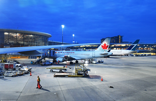
Photo: MJ_Prototype/iStock Editorial/ Getty Images Plus/Getty Images