Publicerad den Lämna en kommentar

Kansas to fly BVLOS drone with onboard systems only

Kansas receives approval for first beyond-visual-line-of-sight drone flight in the nation using only onboard detect and avoid.

The Kansas Department of Transportation (KDOT) has received permission to conduct the first beyond-visual-line-of-sight (BVLOS) drone operation in the nation leveraging only onboard detect-and-avoid systems.

This is the first U.S. Federal Aviation Administration (FAA) authorized operation to fly without a requirement for visual observers or ground-based radar. It is the result of the 31-member Kansas UAS Integration Pilot Program (IPP) team efforts to advance drone technologies.

In a collaborative effort among Kansas State University Polytechnic Campus (K-State Polytechnic), Westar Energy, Iris Automation and KDOT, the Kansas IPP team will fly a nine-mile track to evaluate technologies to inspect power lines in rural Kansas. This approval is the first of its kind for long line linear infrastructure and is the first step to enable routine commercial infrastructure inspection across the state.

This is the first unmanned aerial vehicle (UAV) flight to leverage onboard sense and avoid systems alone for collision avoidance. It also marks the first required automated avoidance action.

Historically, all FAA-issued Part 107 BVLOS waivers have required visual observers or ground-based radar. These mitigations limit the possibility of true BVLOS flights, as they are typically prohibitively expensive and limit operations to pre-defined corridor areas with radar coverage.

This important milestone is facilitated by Kansas UAS IPP partner Iris Automation’s Casia onboard collision-avoidance system.

“The UAS industry has worked over 10 years to demonstrate the most significant commercial benefit of drone operations within the United States,” said Bob Brock, KDOT director of aviation. “We are proThe Applied Aviation Research Center on the K-State Polytechnic Campus, which assisted in development of the safety case that ultimately led to FAA approval, will be responsible for the training and flight operations with a cross-functional team from the KDOT IPP. Flights will take place over the next few months, providing the FAA with much-needed data on true BVLOS activity.d of the joint state, university and industry team that made this landmark decision possible.”

“The ability to fly BVLOS missions without ground-based radar or visual observers is a significant advancement, and Westar Energy views this as an opportunity to play a key role in shaping the future of UAS operations within the utility industry,” said Mike Kelly, Westar Energy Senior UAS coordinator. “Being able to operate under this waiver allows the Kansas IPP team the ability to research and develop truly scalable BVLOS UAS operations for the automated inspection of linear infrastructure.”

“We look forward to leveraging this waiver to integrate UAS technology into the transmission line inspection process,” said Kurt Carraway, UAS Executive Director of the K-State Polytechnic Applied Aviation Research Center. “We are certain that utilities will be able to quickly realize a return on investment while mitigating safety to their maintenance personnel and increasing the reliability of their infrastructure to the general public.”

“Flying rural missions like these without a human pilot onboard or costly radar on the ground is exponentially safer and more cost effective,” said Iris Automation CEO and Co-Founder Alexander Harmsen. “The FAA is trusting us to pave the way for a safer, scalable future together with this precedent-setting second approval of our system.”

The U.S. Department of Transportation selected Kansas Department of Transportation as one of nine participants in the FAA UAS IPP. This program allows state, local and tribal governments to conduct advanced UAS operations to gather data to assist the rulemaking process that will set the boundaries for UAS operations in the United States.


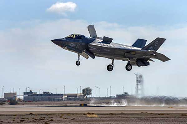
Feature photo: Kansas UAS IPP

Publicerad den Lämna en kommentar

Second GPS III satellite tops rocket at launchpad

The second GPS III satellite — nicknamed Magellan — is now at the launchpad at Cape Canaveral Air Force Station, Florida, in preparation for liftoff on Aug. 22.

United Launch Alliance tweeted out an image of the encapsulated satellite on its way to the rocket.

The Lockheed Martin-built satellite was originally scheduled for launch on July 25, but the launch was pushed to Aig. 22 because of “an anomaly during component testing at a supplier that created a cross-over concern. Upon further evaluation, additional time is needed to replace and retest the component on the launch vehicle,” ULA said.


Launch Updates

The launch window on Aug. 22 will open at 9 a.m. EDT (1300 UTC) and extend to 9:27 a.m. EDT (1327 UTC),a duration of 27 minutes. ULA’s live countdown blog begins at 11:45 p.m. EDT (0345 UTC) on Aug. 21. The launch webcast starts at 8:40 a.m. EDT (1240 UTC).

Those interested can dial the ULA launch hotline at 1-877-852-4321 or join the conversation at www.facebook.com/ulalaunch, twitter.com/ulalaunch and instagram.com/ulalaunch; hashtags #DeltaIV #GPSIIISV02.


GPS III SV02 will be the 29th and final flight of the Delta IV Medium rocket, the 73rd GPS launch by a ULA or heritage vehicle and marks ULA’s 135th mission.

GPS III SV02 is named Magellan in honor of the Portuguese explorer who led the first expedition to circumnavigate the Earth.

The satellite, encapsulated in the 4-meter-diameter composite payload fairing, was moved overnight last week from its processing facility to the seaside launchpad at a top speed never exceeding 5 mph.

The satellite was hauled by a motorized KAMAG Elevating Platform Transporter (EPT) that provided hydraulic leveling and precision positioning capabilities along the route. The EPT also towed a Portable Environmental Control System (PECS) trailer to supply conditioned air to the payload fairing during the trip.

Once parked in the hoistway on the backside of the Mobile Service Tower (MST), technicians used the crane system in the gantry the next morning to carefully lift the satellite onto the Delta IV rocket’s second stage to complete a successful vertical integration of the launch vehicle and payload. The fully assembled rocket now stands 207 feet tall.

A tip-to-tail electrical test of the combined payload and launch vehicle will occur next, an operation known as the Integrated Systems Test (IST). Once that is completed, the comprehensive process to verify flight readiness will begin in parallel to final vehicle closeouts for the launch targeted for Aug. 22 at 9 a.m. EDT (1300 UTC).

ULA rockets have successfully launched 70 GPS satellites since 1978.

ULA technicians transport the GPS III satellite to the Delta IV launchpad.( Photo: United Launch Alliance)

ULA technicians transport the GPS III satellite to the Delta IV launchpad.( Photo: United Launch Alliance)

The Delta IV rocket leaves the the Horizontal Integration Facility (HIF) aboard a 36-wheel, diesel-powered transporter on May 28 and traveled to Space Launch Complex-37. The trip took 40 minutes. (Photo: ULA)

The Delta IV rocket leaves the the Horizontal Integration Facility (HIF) aboard a 36-wheel, diesel-powered transporter on May 28 and traveled to Space Launch Complex-37. The trip took 40 minutes. (Photo: ULA)

Publicerad den Lämna en kommentar

GNSS experts: The GSA wants you for Fundamental Elements

Screenshot: EU Science & Innovation video

Screenshot: EU Science & Innovation video

The European GNSS Agency (GSA) is looking for experts with a high level of expertise in navigation satellite systems to assist it with tasks related to the implementation of the Fundamental Elements funding mechanism.

The GSA is interested in experts with professional experience in specific market segments such as aviation, location-based services, agriculture, surveying, rail, road, maritime, and timing and synchronisation and/or with hi-tech business building skills.

Specifically, the GSA would like to involve business and technical experts with proven experience in one or more of the following areas:

  • E-GNSS signal processing;
  • Development (hardware, software/firmware algorithms etc.) of E-GNSS receivers and antennas;
  • Applications, services and products in the area of E-GNSS;
  • E-GNSS technologies state of the art boosting, particularly E-GNSS differentiators.

Experts assist in:

  • Evaluation of proposals, prize applications and tenders
  • Monitoring of actions, grant agreements, public procurement contracts

Experts also provide opinion and advise on preparation, implementation and evaluation of EU programmes and design of policies.

No deadline, but apply early

To select experts, the European Union Institutions regularly publish calls for expression of interest detailing the selection criteria, the required expertise, the description of the tasks, their duration and the conditions of remuneration.

The call for expression of interest is permanently open, so there is no application deadline. However, early application is encouraged because the first experts should be appointed in the third quarter of 2019. Anyone interested can register here.

Experts who have already registered in the Participant Portal expert database are invited to log-on here to declare their interest in Fundamental Elements assignments and to update their area(s) of expertise.

For more information and to download the call, click here.

Fundamental Elements

Fundamental Elements is an EU R&D funding mechanism supporting the development of EGNSS-enabled chipsets, receivers and antennas. Fundamental Elements projects are part of the overall European GNSS strategy for market uptake, led by the GSA. The objectives of the programme can be summarised as follows:

  • Facilitate the adoption of EGNSS, building on innovative services and differentiators;
  • Improve the competitiveness of EU industry ;
  • Address user needs in priority market segments ;
  • Maximise benefits to European citizens.

The total budget for projects to be carried out in 2015-2020 is EUR 111.5 million.

Publicerad den Lämna en kommentar

Garmin launches GNC 355 GPS/comm radio with LPV approaches

The GNS 355 is a GPS navigator with localizer performance with vertical (LPV) approach guidance and a built-in communications radio. (Photo: Garmin)

The GNS 355 is a GPS navigator with localizer performance with vertical (LPV) approach guidance and a built-in communications radio. (Photo: Garmin)

Garmin International Inc. has launched the GNC 355 — a GPS navigator with Localizer Performance with Vertical (LPV) approach guidance, with a built-in communications radio.

With the GNC 355, pilots can take advantage of the benefits of WAAS/SBAS GPS guidance, while also incorporating a modern comm radio into their existing avionics stack.

Intended for Class I/II aircraft that weigh 6,000 lbs./2,721 kg. or less, as well as experimental/amateur-built (EAB) aircraft, the GNC 355 Supplemental Type Certification (STC) is imminent and will be available in August for more than 700 aircraft makes/models.

“Based on the popularity of legacy products like the GX 60 and the GNC 250/300XL, as well as customer excitement for our new GPS 175 and GNX 375, we’re pleased to bring the GNC 355 to market,” said Carl Wolf, Garmin vice president of aviation sales and marketing. “The GNC 355 gives value-minded customers a simple upgrade path to a GPS navigator with a number of capabilities including WAAS/LPV approach guidance, wireless connectivity, a modern Comm radio, and with its standard mark-width form factor, pilots can easily add the GNC 355 without overhauling the panel of their aircraft.”

Aircraft owners can incorporate the GNC 355 into an existing avionics stack because of its standard 6.25-inch wide by 2-inch tall design. A vibrant, colorful and responsive touchscreen display boasts a familiar Garmin user experience, while a dual concentric knob and home button offer added versatility when interfacing with the touchscreen.

The user interface has been optimized for the screen size of the display, while also retaining a familiar menu structure similar to other Garmin products. Pilots can quickly access direct-to functionality, moving map, flight plan, nearest, procedures, waypoint and terrain pages, as well as frequency information using the touchscreen, and create customizable data fields and shortcuts for quick, one-touch access to important information.

Fully WAAS/SBAS IFR-approach-capable, the GNC 355 gives pilots the benefit of flying LPV, as well as Area Navigation (RNAV) approaches. Many approaches offer vertical approach guidance as low as 200-feet above ground level (AGL).

Pilots can also leverage the touchscreen and moving map to generate customized holding patterns over an existing fix in the navigation database or over a user-defined waypoint and easily insert it into a flight plan. Visual approaches are also available within the GNC 355 and provide lateral and vertical approach guidance in visual flight conditions.

Two versions, the GNC 355 and GNC 355A, are available with 25 kHz and 8.33 kHz frequency channel spacing respectively. Using the internal frequency database, airport, weather, Air Route Traffic Control Center (ARTCC) and Flight Service Station (FSS) frequencies are easy to find and can be loaded to the standby position by selecting the frequency from the airport information page. Recent, nearby and saved frequencies also offer easy access to frequency information. For example, with built-in standby frequency monitoring, pilots can listen to ATIS while monitoring tower frequency simultaneously. The airport identifier and frequency type are also displayed below the frequency so pilots can communicate with confidence.

An array of interface options includes the G3X Touch flight display for experimental and certificated aircraft, the G5 electronic flight instrument, the GFC 500 and GFC 600 autopilots, as well as select third-party autopilots. Course deviation and roll steering outputs can also be coupled to the GFC 500/GFC 600 autopilots and select third-party autopilots so procedures such as holds, radius-to-fix (RF) legs and missed approaches may be flown using the autopilot. Aircraft owners can also retain many of their existing flight instruments, audio panels and many legacy CDI/EHSI indicators such as the KI 208/209 products.

Additional interface options include pairing the GNC 355 with a dual-link Garmin Automatic Dependent Surveillance-Broadcast (ADS-B) solution, such as the GTX 345 or GDL 88. When paired with these products, the GNC 355 is capable of displaying subscription-free Flight Information Service-Broadcast (FIS-B) weather and ADS-B traffic targets, which includes patented TargetTrend and TerminalTraffic.

Wireless Connext devices running the Garmin Pilot and FltPlan Go applications. Pilots can also use the Flight Stream 510 to access the wireless benefits of Garmin’s Database Concierge, which uploads aviation database information from the Garmin Pilot app to the GNC 355 in minutes.

The GNC 355 provides a number of additional benefits, including graphical flight plan editing, allowing pilots to more easily edit their flight plan based on an ATC amendment or weather. Features such as FastFind simplify flight plan entry by applying predictive logic to suggest airports and waypoints using current GPS location, while Smart Airspace makes it easier to identify pertinent airspace on the moving map.

The addition of SafeTaxi airport diagrams displays runways, taxiways, Fixed Based Operators (FBOs), hangars and more relative to the aircraft’s location on the airport surface.

The GNC 355 and GNC 355A can be purchased through the Garmin Authorized Dealer network at that time starting at a list price of $6,9951 and $7,6951 respectively.

European Union Aviation Safety Agency (EASA) validation is expected at a later date.

A free GNC 355 trainer app is also available for download on Apple mobile devices, which allows customers to explore the feature set.

Publicerad den Lämna en kommentar

Editorial Advisory Board PNT Q&A: How mapping improves PNT tech

How have improvements in mapping data-collection advanced other PNT technologies?

Photo: Nearmap

Tony Agresta

“Real-time positioning, navigation and timing (PNT) benefit from high-resolution aerial maps captured and published on a consistent basis. With sub 3-inch aerial photographs streamed through custom applications or instantly accessible solutions, governments and commercial use cases apply these maps for emergency 9-1-1 dispatch, routing guidance, and new information applications to inform citizens.”
Tony Agresta
Nearmap


Ismael Colomina

Ismael Colomina

“In principle, PNT shall be based on linear/angular motion sensors. However, since the origins of aerial triangulation down to contemporaneous hybrid multi-sensor systems, mapping and motion sensors have cooperated in PNT tasks. Current visual- and lidar-odometry are brilliant examples thereof.”
Ismael Colomina
GeoNumerics


Members of the EAB

Tony Agresta
Nearmap

Miguel Amor
Hexagon Positioning Intelligence

Thibault Bonnevie
SBG Systems

Alison Brown
NAVSYS Corporation

Ismael Colomina
GeoNumerics

Clem Driscoll
C.J. Driscoll & Associates

John Fischer
Orolia

Ellen Hall
Spirent Federal Systems

Jules McNeff
Overlook Systems Technologies, Inc.

Terry Moore
University of Nottingham

Bradford W. Parkinson
Stanford Center for Position, Navigation and Time

Jean-Marie Sleewaegen
Septentrio

Michael Swiek
GPS Alliance

Julian Thomas
Racelogic Ltd.

Greg Turetzky
Consultant

Publicerad den Lämna en kommentar

Raytheon M-code receivers certified by US Air Force

New technology makes GPS more secure and reliable for military systems.

Raytheon has received security certification for new GPS modules and receivers from the GPS Directorate at the U.S. Air Force Space and Missile Systems Center.

The new modules and receivers will give military aircraft, ships, ground vehicles and weapon systems secure and reliable access to modernized GPS.

“Because GPS is under constant attack, we worked with our government partners to create new M-code modules and receivers that give the military secure and resilient navigation systems,” said Eric Ditmars, vice president of Raytheon’s Secure Sensor Solutions. “And since the tech is platform agnostic, it will work on a wide-range of platforms in the air, on the ground or at sea.”

Raytheon’s military code common GPS module was certified, along with its ground-based GPS receiver, or GB-GRAM, and the avionics GPS receiver, or GRAM-S/M. GB-GRAM and GRAM S/M are jointly developed with Trimble, while General Dynamics provides cryptographic capabilities for the modules.

“Operators need a system that is flexible and fast,” said Chad Pillsbury, director of Resilient Navigation at Raytheon Space and Airborne Systems. “We’ve designed these GPS systems with a common security architecture — meaning we can get this capability in the hands of operators faster and eliminate the need for additional security certifications.”

Publicerad den Lämna en kommentar

Europe chooses Airbus for SMILE space weather satellite

Image: European Space Agency

Image: European Space Agency

The European Space Agency has chosen Airbus to build the European component of the SMILE satellite (Solar wind Magnetosphere Ionosphere Link Explorer).

SMILE will be the first joint satellite mission between the European Space Agency (ESA) and the Chinese Academy of Sciences (CAS), following on from the success of the Double Star/Tan Ce mission which flew between 2003 and 2008.

The objective of SMILE is to study and understand space weather. Specifically, it will look at the physics behind continuous interaction between particles in the solar wind and Earth’s magnetosphere, the magnetic shield that protects the existence of life in our planet.

Space weather can interfere with GNSS signals.

The mission is now entering a four-year period of manufacturing, testing and integration of the payload module and the platform. In launch configuration, these two components will form a 3.15-meter-high stack.

The spacecraft will have a mass of 2,200 kg and will travel in a highly elliptical orbit around the Earth. Its perigee will be at a distance of 5,000 km (from where it will download data to the Troll ground station in Antarctica and the CAS ground station in Sanya, China), while the apogee will be as far as 121,000 km (almost one third the distance to the Moon). At this vantage point the satellite will have a prolonged view of the Earth’s northern polar regions, to enable the boundary of the Earth’s magnetic field and the Northern Lights, or aurora borealis, to be imaged.

Payload in Madrid, platform in Shanghai. The payload module will be built at the Airbus site in Madrid, where the instruments will be integrated. The platform will be built in Shanghai. Both, the payload module and the platform will be integrated and tested at ESA’s European Space Research and Technology Centre facilities by a multinational team.

The science payload consists of four instruments:

  • The Soft X-ray Imager will obtain unique measurements of the regions where the solar wind impacts the magnetosphere.
  • The Ultra-Violet Imager will study the global distribution of the auroras.
  • The Light Ion Analyser will measure the energetic particles in the solar wind.
  • The Magnetometer will assess changes in the local magnetic field.

“Today, we are able to predict the weather on Earth; now it’s SMILE’s turn to help us understand space weather around the Earth and who knows? Probably one day, we will have enough data to be able to forecast dangerous solar storms that could disrupt our systems in space and on the ground,” said Fernando Varela, head of Airbus Space Systems in Spain. “We thank the Spanish Administration for their decisive and continued support to scientific missions.”

Other ESA missions, built by Airbus, such as Cluster that studied the Earth’s magnetosphere, and SOHO that studied the Sun, have already improved understanding of space weather.

Under the current plans, the spacecraft will be launched by a European Vega-C or Ariane 62 rocket in 2023.

Publicerad den Lämna en kommentar

Iran jams GPS on ships in Strait of Hormuz

Ships sailing through the Strait of Hormuz and the Persian Gulf have been experiencing GPS interference that U.S. officials suspect is the work of the Iranians, according to CNN.

The U.S. Department of Transportation’s Maritime Administration issued an advisory on Aug. 7 to ships traveling in the Persian Gulf, Strait of Hormuz, Gulf of Oman, Arabian Sea and Red Sea. Ships have reported GPS interference, bridge-to-bridge communications spoofing and jamming, and other problems.

Iran’s goal is for ships and aircraft to wander into Iranian waters or airspace, justifying a seizure, a U.S. defense official told CNN. He said Iran has placed GPS jammers on Iran-controlled Abu Musa Island, which lies in the Persian Gulf close to the entrance of the Strait of Hormuz.

“Heightened military activity and increased political tensions in this region continue to pose serious threats to commercial vessels,” reads the advisory. “Associated with these threats is a potential for miscalculation or misidentification that could lead to aggressive actions. Vessels operating in the Persian Gulf, Strait of Hormuz, and Gulf of Oman may also encounter GPS interference, bridge-to-bridge communications spoofing, and/or other communications jamming with little to no warning.”

In at least two incidents, vessels reported GPS interference. One vessel reportedly shut off its Automatic Identification System (AIS) before it was seized, complicating response efforts.

Vessels have also reported spoofed bridge-to-bridge communications from unknown entities falsely claiming to be U.S. or coalition warships.

Since May 2019, the following maritime incidents have occurred in this region:

  • Six attacks against commercial vessels.
  • Shoot-down of U.S. Navy remotely piloted aircraft over international waters
  • Attempted at-sea interdiction of Isle of Man-flagged M/V British Heritage (oil tanker)
  • Seizure of ex-Panama-flagged M/V Riah (oil tanker)
  • Seizure of U.K.-flagged M/V Stena Impero (oil/chemical tanker)
  • Detention and subsequent release of Liberian-flagged M/V Mesdar (oil tanker).
Photo: Igor Grochev/Shutterstock.com

Photo: Igor Grochev/Shutterstock.com

Publicerad den Lämna en kommentar

MicroSurvey releases FieldGenius for Android

FieldGenius for Android, v1. (Image; Hexagon)

FieldGenius for Android, v1. (Image; Hexagon)

MicroSurvey Software, part of Hexagon, has released its new field data-collection software platform for Android users.

FieldGenius for Android, version 1.0, is first release of the company’s new multi-platform field software built on the Android platform. It supports most popular GNSS sensors on the market today.

FieldGenius is third-party, brand-neutral data-collection software used by many surveyors. The new release builds on decades of innovation MicroSurvey has invested into the original FieldGenius software, providing users with an easy-to-use and intuitive mobile data-collection software package for the next generation.

New features include dynamic data panels synchronized with the map views. A fresh user interface provides familiarity for existing FieldGenius users while offering new tools, simplified workflows and readily available data that surveyors require at the point of work to make informed decisions in the field.

“Surveyors, dealers, and distributors from every corner of the world have been demanding an Android based version of MicroSurvey FieldGenius for years,” said Marc Veinotte, global sales and OEM manager at MicroSurvey. “This is the first release of our new multi-platform field data collection software that will provide a consistent user experience across a wide cross section of data collection devices. MicroSurvey continues its hardware neutrality strategy offering support for almost every brand of popular and upcoming GNSS receiver on the market today.”

Early adopters of FieldGenius for Android will receive additional benefits and participate in the newly created MicroSurvey Technology Innovation Group (MTIG).

Publicerad den Lämna en kommentar

uAvoinix developing transponder for space-based ADS-B surveillance

Photo: uAvionix

Image: uAvionix

uAvionix is developing and testing skyBeacon X, a wingtip mounted 1090MHz Mode S ADS-B OUT transponder designed to meet the update rate performance required when used in conjunction with the Aireon satellite-based global ADS-B air traffic surveillance system.

According to the company, skyBeacon X is similar to the original skyBeacon in that it is an ED position light replacement with an integrated 1090MHz transponder, GPS position source, barometric altimeter, and LED position and anti-collision lights.

In January 2019, NAV CANADA revealed that it will be implementing an ADS-B Performance Requirements mandate in three phases. Phase 1 includes Class A airspace and Class E airspace above FL600 by Jan 1, 2021. Phase 2 includes Class B airspace which in Canada extends from FL125 to FL180, and requires equipage by Jan 1, 2022. Phase 3, to be implemented no sooner than 2023, will require General Aviation (GA) aircraft to equip with transponders which employ antenna diversity — an antenna installed on both the bottom and the top of the aircraft — in order to achieve acceptable performance to provide Air Traffic Services.

uAvionix plans for skyBeacon X to serve as a low-cost, diversity-compatible system for Canadian users to meet these requirements.

“Many of our ANSP customers would like to provide air traffic control services at lower altitudes and to all types of aircraft in controlled airspace, including GA,” said Cyriel Kronenburg, Aireon’s Vice President of aviation services. “We are excited to participate in testing and validation with uAvionix to ensure skyBeacon X meets performance requirements to be used with the Aireon system. We believe these transponders offer an affordable, reliable solution for ADS-B OUT equipage that would help many of our international ANSP customers and regulators increase equipage rates for GA aircraft. This will also allow GA to leverage both the safety and operational benefits of a space-based surveillance system.”

skyBeacon X is expected to be certified and available in 2021. According to the company, skyBeacon X will be uAvionix’s first global GA product operating on 1090MHz. While it will not be available in time for U.S. users to meet the deadline for the FAA’s mandate, it will be available and TSO certified for the Canadian projected mandate date of 2023, uAvionix added.

The company also recently expanded into two new facilities: one in Leesburg, Virginia, and one in Columbia Falls, Montana.