Publicerad den Lämna en kommentar

Mapping Marvel: Ukraine war moment by moment

Screenshot: Liveuamap

Screenshot: Liveuamap

A mapping service provider birthed during the 2014 Ukraine conflict is tracking the current war through crowdsourced photos, Tweets, posts, news and other channels.  

The Live Universal Awareness Map was founded by a team of software developers and journalists to inform the world about the Ukraine conflict. By viewer request, it quickly expanded to cover other regions, including Syria, Israel-Palestine and “Islamic State war” news. Today, it covers more than 30 regions and topics, offers translations in several languages, and can be used on mobile browsers via its own Android and iOS apps. 

The independent global news and information site is dedicated to factual reporting of important topics such as conflicts, human rights issues, protests, terrorism, weapons deployment, health matters, natural disasters and weather-related stories from a vast array of sources.  

Its map-centric approach to the organization of information allows viewers to quickly find relevant stories in geographies of their interest. Events are archived, and can be reviewed for analysis or historical trends. “Through our big-data analysis methods, we aim to help predict and prevent future conflicts, minimize the impact of disasters, and assist travelers around the world in making conscious decisions about their security throughout their journeys,” the service states. 

Liveuamap uses proprietary software tools, such as artificial-intelligence web crawlers, to find newsworthy stories. These sources are then forwarded to a group of expert analysts for fact checking. In the final step, editors decide which facts and stories should be displayed on the map to minimize spam.  

An improvement under development will enable viewers to create and manage their own maps. 

Publicerad den Lämna en kommentar

DroneShield releases major firmware release for its C-UAS devices

DroneShield RfPatrol body-worn C-UAS device with enrolled firmware upgrades. (Photo: DroneShield)

DroneShield RfPatrol body-worn C-UAS device with enrolled firmware upgrades. (Photo: DroneShield)

DroneShield has begun releasing a software update across its counter-unmanned-aerial-system (C-UAS) devices, including portable, vehicle-based and fixed-site devices. The devices are used by the military, the intelligence community, U.S. Homeland Security, law enforcement, critical infrastructure and others.

The updates will be rolling out across DroneShield devices globally in the coming week, with heightened urgency given the widespread use of drones in Ukrainian and Middle Eastern conflicts. The technology upgrade is validated by deployments with the U.S. Air Force and Australian Army.

Enrolled devices receive quarterly firmware updates of the proprietary DroneShield RFAI artificial intelligence engine. Some of these updates are major enhancements, such as this 2Q22 release.

Major upgrades include:

  • Site Install Wizard. The new Spectrum Viewer mode, in which C-UAS detection devices scan the deployment area for optimal sensor placement
  • Machine Learning in the Loop. This option enhances the RFAI engine from the data received by the user.

Both features were added in response to end-user requirements.

Publicerad den Lämna en kommentar

Honeywell expands navigation portfolio with new HGuide products

New offerings will deliver accurate navigation to industrial applications even in areas where GPS is unavailable

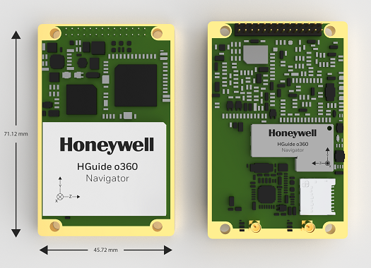
The HGuide o360 Navigator. (Photo: Honeywell)

The HGuide o360 Navigator. (Photo: Honeywell)

Honeywell has expanded its HGuide industrial navigation portfolio with three new technologically advanced navigation systems — the HGuide o360 INS/GNSS navigator, HGuide n500 inertial navigator and the HGuide g080 GNSS receiver.

The new HGuide products are designed for a wide array of industrial and autonomous applications across air, land and sea vehicles and related equipment.

The HGuide o360 navigation system is a compact single-card, all-attitude inertial navigation system (INS) GNSS navigator that can deliver an accurate and robust position and attitude navigation service, even through GNSS-challenged or denied environments, to industrial and autonomous applications. It provides the features and compatibility needed for a simple integration.

“The HGuide o360 is an engineering marvel and a technological breakthrough. There are no similar competing products in the industry today that can achieve such a high-performance level at this price point and size,” said Matt Picchetti, vice president and general manager, Navigation & Sensors, Honeywell Aerospace. “The entire HGuide product line is suitable for a wide range of industries, including autonomous vehicles, marine and a host of industrial applications where accurate positioning and attitude information is required in real time.”

The HGuide o360 INS/GNSS navigator contains a powerful dual antenna, multi-frequency, multi-constellation, real-time kinematic (RTK) GNSS receiver, Honeywell’s i300 inertial measurement unit (IMU) technology, and a high-grade calibrated magnetometer.

The HGuide o360 is designed for platforms that require high-performance navigation data in an ultra-low size, weight and power (SWAP) package.

The HGuide n500 inertial navigator is a navigation-grade bring-your-own-GNSS all-attitude navigator that supports continuous position and attitude navigation even during prolonged GNSS outages. The HGuide n500 is built on Honeywell’s HG4930 IMU plus the Honeywell HGuide Sensor Fusion software.

The HGuide g080 GNSS receiver is a dual-antenna, triple-radio frequency, all-constellation GNSS receiver that delivers heading and positioning down to sub-centimeter levels even in GNSS-challenged environments. It includes an onboard IMU to allow tracking during short GNSS outages and enable smooth and fast reacquisition. The product is available with or without RTK functionality.

Inertial navigation systems are highly critical in navigation and comprise an IMU, a GNSS receiver and sensor fusion software. These components work together to calculate position, orientation and velocity to deliver critical navigation information in GNSS-denied areas such as urban canyons, bridges, tunnels, mountains, parking garages and dense forests.

Publicerad den Lämna en kommentar

Russia’s attack raises vulnerability concerns

Matteo Luccio

Russia’s brutal aggression on Ukraine changed the world in a few days. Devastation and displacement in Europe already are on a scale unseen since World War II, and the risk of a catastrophe greater by orders of magnitude has not been as high since the Cuban Missile Crisis of 1962, the year I was born. Given the long production timeline of a monthly magazine, I will not venture a guess as to what the headlines will be on the day you read this.

The Russian assault has sharply raised concerns about GNSS vulnerabilities. In a March 17 bulletin, the European Union Aviation Safety Agency (EASA) warned of a GNSS outage leading to the degradation of navigation and surveillance. Reports analyzed by EASA indicate that since Feb. 24, GNSS spoofing and jamming has intensified in the Baltic Sea, neighboring states, Eastern Finland, the Black Sea and the Eastern Mediterranean. “The effects of GNSS jamming and/or possible spoofing,” the bulletin stated, “were observed by aircraft in various phases of their flights, in certain cases leading to re-routing or even to change the destination due to the inability to perform a safe landing procedure.”

Russia already has aided in the proliferation of handheld GPS jammers, the deployment of road-mobile jammers, and even development and testing of space-based jammers. Now, it could turn its substantial cyberspace hacking capability against the ground-control segments of GPS and Galileo.

When Russia tested an anti-satellite weapon on Nov. 15, 2021, the Kremlin claimed on state television that this capability “means that if NATO crosses our red line, it risks losing all 32 of its GPS satellites at once.” This threat was particularly dangerous because GPS satellites carry, as a secondary payload, the U.S. nuclear detonation detection system.

At a panel discussion about resilient GPS that I moderated at the International Wireless Communications Expo in Las Vegas on March 24, Diana Furchtgott-Roth, an adjunct professor at George Washington University and former deputy assistant secretary for Research and Technology at the U.S. Department of Transportation (DOT), titled her presentation “Russia Proves America Needs Backup GPS.” She cited the National Defense Authorization Act of 2017, the National Defense Authorization Act of 2018, and the National Timing Resilience and Security Act of 2018, which instructed DOT to provide a complement and backup for civilian GPS. The legislation required the Secretary of Transportation to put in place a backup system for GPS by the end of 2020, subject to congressional appropriations. However, she pointed out, these funds have not yet materialized.

Multiple technologies can and should be used to complement GPS. Several of them are mature and commercially available, including signals from low Earth orbit satellites and terrestrial broadcast stations.

Meanwhile, the United States should accelerate the launch schedule for GPS III satellites already produced. They provide better accuracy, anti-jamming capabilities, and opportunities for civilian connectivity that could offer critical assistance to its European allies.

Matteo Luccio | Editor-in-Chief
mluccio@northcoastmedia.net

Publicerad den Lämna en kommentar

90 groups mark 2-year Ligado Order anniversary with new letter

A new letter has been sent to both President Biden and congressional leadership by 90 groups opposed to Ligado’s plans to launch a terrestrial network in the L-band used by GPS.

The letter, dated April 25, marked the two-year anniversary of a controversial decision by the U.S. Federal Communications Commission (FCC) to adopt the Ligado Order.

The 90 groups represent companies, organizations and associations united in their grave concerns over “imminent — but preventable — harm from Ligado’s proposed terrestrial network.” These groups have serious concerns about how Ligado’s plan threatens to interfere with services provided by the GNSS, aviation and real-time environmental satellite-data communities.

Staying the order is necessitated by the clear bipartisan will of Congress. After adoption of the order in 2020, Congress mandated an independent technical review to further assess the harmful interference that would be caused by Ligado’s proposed network and required the Department of Defense to brief federal representatives across the government “at the highest level of classification” on the potential for widespread harm from Ligado’s proposed terrestrial operations.

On this basis alone, the FCC should stay the order to adequately consider the material new information that will be uncovered as a result of these ongoing Congressionally mandated processes, according to the letter writers.

Their concern was made even more real following the announcement by Ligado that the company intends “to commence operations in the 1526-1536 MHz band on or after Sept. 30, 2022.”

Image: A-Digit/DigitalVision Vectors/Getty Images

Image: A-Digit/DigitalVision Vectors/Getty Images

Publicerad den Lämna en kommentar

Microchip Technology offers GridTime 3000 for utilities

The GridTime 3000 GNSS time server meets rugged international environmental standards for power plants and substations

The GridTime 3000 GNSS time server. (Photo: Microchip)

The GridTime 3000 GNSS time server. (Photo: Microchip)

Microchip Technology Inc. has announced its GridTime 3000 GNSS time server, a software-configurable solution providing power plants and substations with a new level of redundancy, security and resiliency to protect against surges, adverse weather and cyberattacks targeting critical infrastructure.

Meeting the Need

Power plants and substations rely on high-speed communications networks to transmit critical data including operability metrics, network health, fault monitoring, power measurement and usage trends. To synchronize communications and ensure continuity across these networks, substations require secure, precise timing and synchronization to avoid false tripping and to provide accurate time-stamping of substation data including system faults, power-measurement data and substation status information.

The launch of the Microchip GridTime 3000 GNSS Time Server assists power-grid operators to meet these requirements.

The GridTime 3000 system generates precise time and frequency signals to synchronize analog and digital communication systems. This resilient timing platform incorporates multiple timing inputs for protection in the event of a GNSS signal disruption caused by severe weather, environmental disturbances or signal jamming or spoofing.

Publicerad den Lämna en kommentar

SBG Systems launches Quanta Micro INS

Photo: SBG Systems

Photo: SBG Systems

SBG Systems has announced a new inertial navigation system (INS) named Quanta Micro, completing its Quanta product line.

The Quanta Micro GNSS-aided INS offers a unique combination of navigation performance and low size, weight, power and cost (SWAP-C).

Quanta Micro leverages a survey-grade inertial measurement unit (IMU) for optimal heading performance in single antenna applications, and high immunity to vibrating environments. An optional secondary antenna enables fast heading initialization in low dynamic applications.

Main Features

  • Accuracy: 0.015° roll/pitch, 0.035° heading, 1 cm position (PPK)
  • Integrates a survey-grade IMU: 0.8°/h gyro bias instability
  • Versatile INS/GNSS to suit land, air or marine applications
  • Highly tested and calibrated from -40°C to 85°C
  • Robust to vibrating environments
  • Quad-constellation multi-band RTK GNSS receiver
  • Smooth post-processing workflow with Qinertia software
  • Major size reduction with no compromise on performance.
Publicerad den Lämna en kommentar

Tallysman adds XF antennas to helical line

The HC885EXF embedded helical antenna. (Photo: Tallysman)

The HC885EXF embedded helical antenna. (Photo: Tallysman)

Tallysman Wireless has added the housed HC885XF and embedded HC885EXF dual-band eXtended Filtering (XF) antennas to its line of helical antennas.

The antennas receive GPS/QZSS L1/L5, GLONASS G1/G3, Galileo E1/ E5a/b, BeiDou B1/B2/B2a and L-band corrections services.

Historically, dual-frequency antennas and receivers commonly supported GPS L1 and L2 and GLONASS G1 and G2. In recent years, GPS, GLONASS, Galileo, BeiDou and NavIC have added GNSS signals in the L5 frequency band (1160-1217 MHz).

As a result, the new dual-frequency GNSS standard has become L1 and L5.

Tallysman’s new HC885XF antenna has been tuned to provide optimal support for the entire L1/G1/E1/B1/L-band correction and L5/G3/E5/B2 bands.

The radio frequency spectrum has become congested worldwide as many new LTE bands have been activated, and their signals or harmonic frequencies can affect GNSS antennas and receivers. In North America, the planned Ligado service, which will broadcast in the frequency range of 1526 to 1536 MHz, can affect GNSS antennas that receive space-based L-band correction service signals (1539-1559 MHz). New LTE signals in Europe [Band 32 (1452-1496 MHz)] and Japan [Bands 11 and 21 (1476-1511 MHz)] have also affected GNSS signals. Tallyman’s XF models mitigate the effects of these new signals.

The Tallysman HC885XF housed helical antenna weighs ~42 g and is enclosed in a robust, military-grade IP67 plastic enclosure. The antenna base has an integrated SMA connector, a water-proofing O-ring, and three screw holes to enable secure attachment.

Tallysman’s embedded HC885EXF helical antenna weighs ~8 g. It is easily mounted with an optional embedded helical mounting ring, which traps the outer edge of the antenna circuit board to the host circuit board or any flat surface. An MCX connector is installed in the base of the antenna.

Tallysman HC885EXF and HC885XF antennas are suitable for a variety of applications, including lightweight unmanned autonomous vehicle navigation (land, sea, and air), land survey devices, automotive positioning, timing and other precise-positioning applications.

Publicerad den Lämna en kommentar

Analog Devices converter sets performance benchmarks for harsh environments

Radio frequency analog-to-digital converter sets performance benchmarks for space and harsh environments

Photo: Analog Devices

Photo: Analog Devices

Analog Devices has released the AD9213S-CSH, a highly integrated RF analog-to-digital converter (ADC). The ADC is a 12-bit, 10.25 giga samples per second (GSPS) ADC in high-reliability packaging, with advanced production screening and quality inspection.

It is the company’s fastest ADC available for the space environment.

The AD9213-CSH enables the next generation of software-defined systems for satellite communications, radar and remote sensing, driving greater system integration, lower costs, reduced power consumption and decreased size, weight and power (SWaP).

Additionally, a high sample rate and integrated post-processing enable further performance gains for narrow-band applications.

The AD9213-CSH provides space customers with greater flexibility and the ability to process larger sections of the spectrum for electronic support measures, as well as increased-resolution radar designs.

The wider Nyquist bandwidth allows satellite-communications customers to deliver products with increased bandwidth. In addition, wide input bandwidths combined with high sample rates enable new wideband digital predistortion architectures communications applications.

Publicerad den Lämna en kommentar

Bad Elf unveils base/rover feature for survey-grade GNSS accuracy anywhere

Photo: Bad Elf

Photo: Bad Elf

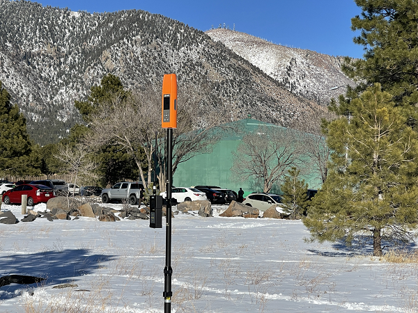
Bad Elf has introduced a base/rover feature built upon its Bad Elf Flex GNSS receiver. The new base/rover feature brings affordable centimeter-level accuracy to surveyors and geospatial professionals working anywhere in the world.

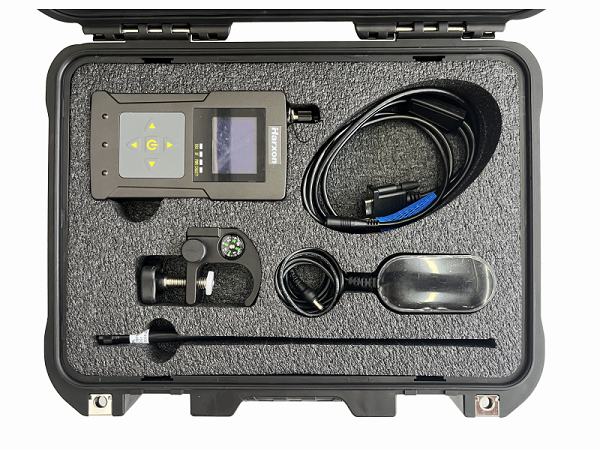
The solution consists of two Flex GNSS receivers and two UHF radios, allowing customers to perform high-accuracy field data collection in areas where traditional real-time kinematic (RTK) corrections or cellular coverage is not available. Existing Flex customers can upgrade by adding Flex radio kits.

Bad Elf designed the base/rover feature with emphasis on accuracy, affordability and versatility. The Bad Elf Flex enables reliable data collection either as a standalone receiver or paired with apps on iOS or Android phones and tablets. A checklist-based workflow ensures consistent results and eliminates many common issues associated with setup and deployment of a base/rover solution.

Photo: Bad Elf

Photo: Bad Elf

“The Bad Elf app walks the user through these steps and more, and it doesn’t let the project proceed until each checklist is complete,” said Larry Fox, vice president of Marketing and Business Development at Bad Elf. “The automated checklists simplify every process, so that geospatial professionals and surveyors of every experience level get reliable results.”

The base feature requires only one Flex Extreme and a radio kit. Customers may choose to use either Standard or Extreme Flex with a radio kit for rovers. Using Flex Standard and one daily token provides access to the rover feature.

Bad Elf’s flexible hardware-as-a-service model provides a mechanism for customers to further reduce the capital cost of a complete base/rover system. In addition, customers can deploy multiple rovers in either configuration for larger projects.

“For about one-third of the purchase price of competing products available today, our base/rover feature makes survey-grade one-centimeter accuracy a reality worldwide,” said Fox. “And our pay-as-you-go Flex Token model dramatically reduces operating expenses by allowing users to activate — and pay for — just the service levels needed on a given day.”

Complete base/rover kits are available immediately, along with à la carte options for existing Flex customers. The Flex base/rover solution is compliant with FCC operating standards in the United States. Bad Elf provides customers with complete instructions for acquiring a radio operator license and call-sign designation.