Publicerad den Lämna en kommentar

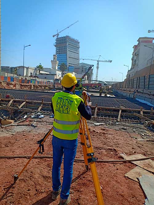
Casablanca’s Medina buildings monitored during tunnel construction

Photo: ETAFAT/Spectra Geospatial

Photo: ETAFAT/Spectra Geospatial

Engineers are monitoring in real time the effects on Casablanca’s aging buildings during tunnel construction using a Spectra Precision GNSS receiver.

Vibrations during the construction of a new 1,890-meter tunnel adjacent to Casablanca’s Old Medina, the 250-year-old section of the famed Moroccan city, challenged the stability of its historically important buildings.

To monitor in real time the effects on the Medina’s aging buildings and to confirm that the construction work meets all engineering standards and guidelines, ETAFAT, a geospatial information acquisition and processing company, used the Nikon XF Total Station to perform more than 100 daily inspections. The ETAFAT team relied on optical targets placed on building facades whose coordinates were determined by forced centering to complete the inspections.

The new Les Almohades tunnel, beneath the Boulevard des Almohades, runs parallel and adjacent to the old Medina. Together with its 380 meters of access roads, the twin-tube tunnel, which carries traffic in two unidirectional lanes in each tube, was constructed to reduce traffic congestion.

According to ETAFAT engineers, the Nikon XF 1” with its fast autofocus function, saved considerable field time. The Nikon XF enabled fast collection of highly accurate observations throughout the monitoring and control of the planimetric and altimetric locations of the structure. The monitoring of the buildings during the various phases of the tunnel’s construction generated a large amount of data essential for understanding the consequences of the work and defining any necessary corrective measures.

The Nikon FX 1,” with its advanced options and Survey Pro software, enabled survey teams to quickly yet accurately perform a variety of other essential field tasks.

These tasks include digital terrain modeling (DTM), cubature calculations, coordinate geometry (COGO) topometric calculations and layout control with customized report generation. The use of Survey Pro software enabled ETAFAT engineers to fully integrate their total station work with their fleet of Spectra Geospatial SP60 GNSS receivers.

The Nikon XF 1” is a mechanical total station that stands up to tough worksite conditions. It is designed to quickly capture accurate measurements, and it offers crisp, clear optics for sighting in both bright and low-light conditions.

Its dual-color touchscreen displays run Survey Pro, Survey Basic and Layout Pro.

It is also equipped to take advantage of the optional Trimble Protected L2P device for asset security to locate lost, stolen or missing equipment. Its hot-swappable batteries reduce downtime and a PIN enhances security in the field.

Publicerad den Lämna en kommentar

Augmented satnav meeting focuses on future development

The 6th Satellite-Based Augmentation Systems Interoperability Working Group (SBAS IWG) recently took place in Delhi, India.

During the meeting, SBAS developers and operators were joined by users of the systems, with representatives of airlines, aircraft makers and avionics manufacturers. About 50 people in total attended the meeting.

“Satellite-based augmentation systems deliver the necessary accuracy, integrity, availability and service continuity for aircraft to be able to rely on them though all phases of flight, from cruising in the air to being guided down for landing,” said navigation engineer Didier Flament, head of the European Space Agency’s (ESA) EGNOS and SBAS division, representing ESA at the SBAS IWG.

The meeting covered the Southern Positioning Augmentation Network (SPAN), which had been born since IWG’s previous gathering six months ago. SPAN, a regional SBAS program, covers Australia and New Zealand.

The meeting also covered the progress of the four SBAS currently under definition or development: China’s Beidou SBAS, BDSBAS, represented by the China Satellite Navigation Office; South Korea’s KASS, represented by the Korea Aerospace Research Institute; the African and Indian Ocean SBAS, represented by the Agency for Aerial Navigation Safety in Africa and Madagascar; and the Russian Federation’s System for Differential Corrections and Monitoring (SDCM), represented by Russian Space Systems, RSS.

Current systems are mostly based around the U.S. GPS system (except for SDCM using Russia’s Glonass and BDSBAS using China’s Beidou) but plans are being laid to move to a dual-frequency, multi-constellation version making use of Europe’s Galileo, China’s Beidou and Russia’s Glonass satnav systems later this decade, IWG said.

Finally, the meeting touched on SBAS research and development, including applying SBAS to Europe’s railways.

Today, there are 10 satellite-based augmentation systems for satnav that are either in operation or active development, IWG added. The group is working to ensure that the future evolutions of all these systems will operate on a similar basis with common technical requirements, allowing the easy transition of continent-crossing air traffic from one system to another.

Publicerad den Lämna en kommentar

GPS data help warn of rare tsunamis

Using data from GPS receivers and seismographs, three seismologists may have found a way to identify tsunami earthquakes in time to warn people

A few times a century, a medium-sized earthquake causes a large and devastating tsunami. The most recent occurrence was in 2010, when a magnitude 7.8 earthquake off the Mentawai Islands in Indonesia set off a tsunami that was more than 50 feet high in some places, killing 509 people and displacing 15,000.

While rare, these tsunami earthquakes are particularly dangerous because they can hit coastal communities within five to 15 minutes, before officials can issue a warning. Now, however, using data from GPS receivers and seismographs near the 2010 Mentawai event, three seismologists — Valerie Sahakian and Diego Melgar at the University of Oregon and Muzli Muzli at the Earth Observatory of Singapore — may have found a way to identify tsunami earthquakes in time to warn people.

Very large earthquakes under an ocean break both the deeper part of a subduction zone, where one tectonic plate is sinking beneath another, as well as its shallow part, in a rapid motion that creates a tsunami. Tsunami earthquakes, on the other hand, happen almost entirely in the soft, weak section of a fault, moving slower and creating much more movement on or near the sea floor compared to earthquakes of the same size that happen in rigid rock. This creates much larger tsunamis than expected. A tsunami earthquake might have the same magnitude as an earthquake that occurs in rigid rock but produces much less of what seismologists call high-frequency energy.

Currently, officials issue tsunami warnings within tens of minutes of detecting an earthquake above a certain magnitude within a certain distance of a coastal area. This method, however, fails in the case of tsunami earthquakes, which produce tsunamis that are disproportionate to their magnitude.

Indian Ocean (Jan. 2, 2005): A village near the coast of Sumatra lays in ruin after the Tsunami that struck South East Asia. (Photo: U.S. Navy/Photographer's Mate 2nd Class Philip A. McDaniel)

Indian Ocean (Jan. 2, 2005): A village near the coast of Sumatra lays in ruin after a tsunami struck South East Asia. (Photo: U.S. Navy/Photographer’s Mate 2nd Class Philip A. McDaniel)

Traditionally, scientists have detected tsunami earthquakes by comparing their seismic magnitude with the amount of high-frequency energy they radiate, both recorded by distant stations. Tsunami earthquakes have a very low ratio of energy to magnitude; their energy, instead of strong shaking, produces a large slow movement of the seafloor.

In the past, scientists had to measure this ratio using seismic waves that had traveled from the earthquake’s epicenter to seismographs hundreds or thousands of miles away. This did not give them enough time to identify tsunami earthquakes and warn people before the tsunami’s wave hit the coast.

The recent analysis, however, enabled scientists to figure out a faster way to identify these rare tsunami earthquakes by using two proxies:

  • data from seismic stations onshore near the epicenters of 16 earthquakes that measured directly how much the ground shook in each case, to determine the amount of high frequency energy in each earthquake, and
  • data from GPS stations close to the earthquakes, to measure the magnitude of each one on the basis of how much it moved the ground.

The GPS stations used in this study were from the Badan Informasi Geospasial (BIG) network from Indonesia. The data were acquired in real-time but processed with final orbits and clocks using precise point positioning (PPP). The scientists averaged the 3-component displacement, using centimeter-level solutions, and saw 3-10 centimeter vertical displacement.

This methodology, using data available during and immediately after an earthquake, enables scientists to compare the amount of energy in each earthquake with its magnitude, without waiting for their seismic waves to travel to distant measuring stations. Seismologists will be able to use this approach to identify tsunami earthquakes immediately and warn nearby coastal communities before a tsunami wave reaches them.

Citation. Sahakian, V. J., Melgar, D., & Muzli, M. (2019). “Weak near-field behavior of a tsunami earthquake: Toward real-time identification for local warning.” Geophysical Research Letters, 46(16), 9519–9528.

Publicerad den Lämna en kommentar

How machine control and precision agriculture are changing job sites

Photo: Trojak Communications

Photo: Trojak Communications

GNSS, coupled with inertial systems and software, is enabling greater accuracy in construction and agriculture. Other markets using machine control include unmanned vehicles, mining, surveying, mapping and defense.

At construction sites, GNSS receivers can be found in heavy equipment such as bulldozers, excavators, graders and pavers. On farms and in orchards, GNSS increases productivity of machines ranging from tractors to UAVs.

A new MarketsandMarkets report predicts the machine control system market will grow to $6.6 billion by 2024, a compound annual growth rate (CAGR) of 8.16%.

For precision agriculture, the outlook is even brighter. Grand View Research anticipates the market will reach $12.9 billion by 2027, a CAGR of 13% over the period.

Machine control speeds projects and increases efficiency under tight timelines. Using GNSS to guide the heavy lifting also alleviates safety concerns related to workers and construction machinery, and provides situational awareness to field operators.

In this month’s feature, we share case studies from companies that specialize in these markets, provide product details, and review the status of real-time kinematic (RTK) GNSS in agriculture.

Check out some use cases for how GNSS, inertial systems and software are enabling greater accuracy in construction and agriculture.

Publicerad den Lämna en kommentar

GNSS key to farm of the future

Photo: Kamada Kaori/iStock / Getty Images Plus/Getty Images

Photo: Kamada Kaori/iStock / Getty Images Plus/Getty Images

GPS World spoke with Guillermo Perez-Iturbe, Trimble’s marketing director – agriculture, about the challenges for farms in adopting precision agriculture, including time, cost and connectivity issues in rural areas.

What technical challenges are faced in applying GNSS?

GNSS technology is at the center of precision agriculture and is one of the key enablers for the farm of the future. GNSS helps boost productivity, environmental sustainability and economic competitiveness.

Trimble’s GNSS agriculture solutions provide reliable, accurate positioning that can be tailored to meet specific needs, including different crops (broadacre vs. row crops) and activities (such as tilling, planting of fertilization.). Trimble’s portfolio connects farming operations and includes guidance and steering; grade control, leveling and drainage; flow and application control; irrigation; harvest solutions; desktop and cloud-based data management; and correction services.

However, one of the challenges to fully realize the benefits of the future farm is connectivity. Typically, ag customers are in rural areas, where the available communications infrastructure to support Wi-Fi or cellular data communications varies widely. This can impact the ability to share information between field and office as well as between machines in the field.

But connectivity challenges have a lower impact on GNSS positioning. For example, farmers can leverage satellite-delivered corrections provided by Trimble RTX correction services using a compatible GNSS receiver and subscription service. This plays an important role in areas such as Latin America. In many areas in Europe and North America, farms can utilize a virtual reference station (VRS) for precise GNSS. There are also farms globally that operate their own GNSS reference networks or base stations to support accurate, high-precision, real-time positioning.

What are the remaining obstacles to adoption?

There is little resistance to the technology per se. The performance and value of precision farming are well known. Adoption rates can range from 80% to less than 40%, depending on geographic location, farm size (small family or large corporate farm), types of machines or crops, and etc.

Obstacles can come from multiple forms. For example, in some parts of the world farm staff may lack the skills or qualifications needed to operate the systems efficiently. To lower the barrier to entry, Trimble has designed intuitive user interfaces and displays based on an Android operating system. In some regions, taxation and import restrictions hinder attempts to implement GNSS into precise farming. There are also business-related issues. For example, a smaller farm must prioritize its investments, and improving or repairing a planting machine might be more important than installing GNSS technologies.

What does VerticalPoint RTK offer?

Trimble developed VerticalPoint RTK Grade Control to help farmers mitigate issues in water management and land forming. It provides centimeter accuracy in the vertical component. This accuracy level enables the precise grading needed to provide shallow flow and slow water movement.

When using VerticalPoint RTK, the GNSS rover receives and combines data from multiple reference stations to develop precise vertical measurements. It provides high confidence and can be used for grading, levees and berms, tile applications, and ditches. For larger-scale land forming based on precise terrain mapping, machines using VerticalPoint RTK can reduce the number of passes needed to bring the land to the designed grade and shape.

Do you have any other RTK services for precision ag?

The RTK technology used in Trimble agriculture solutions is consistent with RTK across other segments (construction, surveying, mapping and more). The differences are in the application and location, where we provide a variety of receivers, user displays, machine interfaces and software to produce accurate, reliable performance. The activities can range from tillage and grading to planting, adding inputs such as fertilizer or weed control — all the way through harvest. It is just a matter of talking with the farmers to understand their operations; we can then select and integrate components to optimize the solution.

As part of this, farms using Trimble RTX correction services can choose different levels of service based on their needs. This approach enables farmers to achieve (and pay for) only the accuracy they need. For example, some basic tillage operations can use ViewPoint RTX with good results. Other applications, such as fertilizing row crops, may require the 2-centimeter accuracy provided by Trimble CenterPoint RTX corrections service.

Publicerad den Lämna en kommentar

Precision agriculture grows with RTK

The John Deere StarFire 6000 RTK receiver operating in the field. (Photo: John Deere)

The John Deere StarFire 6000 RTK receiver operating in the field. (Photo: John Deere)

Precision agriculture — the practice of optimizing inputs of seed, water, and fertilizers while maximizing yields by mapping variations in soil characteristics and guiding machinery accordingly — began in the United States in the early 1980s and has been growing steadily. Key components include soil mapping based on sampling and remote sensing, proximal sensing of soils and crops, variable rate irrigation and variable rate spraying of fertilizers and herbicides, and automatic tractor navigation.

“GNSS-based guidance is probably the most highly adopted precision ag technology, followed by variable rate and section control,” said John Fulton, associate professor at The Ohio State University. “I suspect that somewhere around 40% of those GNSS receivers use RTK-level corrections — which provide sub-inch accuracy — and that number is increasing.”

Need for sub-inch accuracy

Water runs downhill, of course, which makes vertical accuracy critical for hydrology. “AgLeader builds a plow to put tile in soil to drain water,” said Bill Cran, AgLeader Technology’s GNSS product specialist. “It might only be 4 inches round; so, if we are off by 2 or 3 inches vertically, that affects where water can run.” To get the best vertical accuracy possible, he recommends farmers install a base station in the field where they are operating.

Sub-inch accuracy also enables farmers to determine where to plant each seed, rather than monitoring planters at the row level. “That may not be a requirement today, but it is certainly coming,” Cran said.

Market demand for RTK in agriculture is increasing, an important factor for drone guidance or machine control, said Gustavo Lopez, market access manager at Septentrio. “The robots are very close to the crops. When small robots are working in a corn field, the corn plants are causing multipath or shadowing GNSS signals,” Lopez said. “You need either a good RTK or GNSS-INS, because if you lose satellite lock you can still coast for a while with an IMU.”

Services and options

AgLeader’s displays have a built-in networked transport of RTCM via internet protocol (NTRIP) client that enables it to connect to NTRIP networks and CORS networks, as well as other free and subscription-based networks. “That allows us to get RTK from the internet for customers that want to go that route,” Cran said. Alternatively, the company offers NovAtel GPS receivers, including Satel- or Freewave-based RTK options with 400 MHz and 900 MHz radio options that can communicate with a similar base station. This spring, it will begin to offer NovAtel’s TerraStar-X service. “We are calling that ‘RTK from the sky,’” Cran said. “The expectation is sub-inch accuracy, with a convergence time of less than one minute. Many of our customers and dealers are very excited about that option.”

Septentrio’s GNSS modules for agriculture are used mostly in mapping drones, Lopez said. The modules mitigate interference and spoofing. “We have also been quite successful in robotics for agriculture,” Lopez said. Septentrio is working closely with the French agriculture robotics company Naïo Technologies, which integrates its robots with Septentrio’s smart antenna GNSS products, providing a full RTK solution as well as autonomy.

For areas without RTK networks, some farmers buy and install Septentrio base stations that provide corrections to their robots or UAVs. Septentrio provides agricultural mapping software for post-processing data gathered without RTK. Also on offer are L-band receivers — while not as accurate as a local RTK network and possibly with higher convergence time, the relative accuracy of L-band corrections is more than good enough for many ag robots, Lopez explained.

On the baseline

The vegetable weeding robot Dino — shown here operating in Yuma, Arizona — uses a Septentrio GNSS receiver. (Photo: Septentrio/Naio Technologies)

The vegetable weeding robot Dino — shown here operating in Yuma, Arizona — uses a Septentrio GNSS receiver. (Photo: Septentrio/Naio Technologies)

Most RTK users are on a short baseline — under 5 miles from the base station to the rover, according to Al Savage, manager of John Deere’s StarFire network. Medium baseline is about 5–8 miles, and long baseline is up to 12 miles. In 2015 John Deere released its Base Station Manager, which enables dealers to remotely upload firmware, upkeep the rover access list, and monitor their base stations.

As dealerships and their RTK networks merged and farms expanded, it became difficult for farmers to keep track of which base station to use. So, in 2019 John Deere released an Automatic Base Station Switching feature that links the RTK radio configuration to the field boundary in its Generation 4 display.

Also new: A John Deere StarFire receiver can continue to operate if it loses connection to a base station using the RTK Extend feature. The StarFire SF6000 rover receiver can continue operating with RTK-like accuracy for up to 14 days without connecting to an RTK base station, compared to only 14 minutes for a previous receiver, Savage explained. The increase “was very well received by customers, especially those operating in areas challenged by line of sight or trees and foliage on field boundaries.”

In South America, John Deere’s RTK Flex feature, “will automatically switch between RTK and SF3 during a time in the day when scintillation causes the greatest interference,” Savage said, enabling farmers “to continue working with similar accuracy when RTK is unavailable due to scintillation.”

Remaining obstacles to adoption

Despite’s RTK’s growing popularity, there are a few remaining obstacles to its adoption.

Cost. “Though the cost has been greatly reduced over the years, RTK is still more expensive than other correction signals out there,” Fulton said. Part of the cost is due to the hardware, Cran pointed out. “There are rover and base station radios, there are towers to put up. On the NTRIP side, there are cell modems to put in vehicles, and they require keeping a data plan active.” The agriculture market traditionally has been very cost-sensitive and conservative, Lopez said. “Farmers expect to implement very low-cost solutions. They want to know whether they will have an ROI (return on investment) on these solutions.”

Satellite services offer a cheaper alternative to RTK. TerraStar-X, for example, gets rid of the cell modem hardware and the requirement for base station hardware, Cran said. “At a lower accuracy level, there are other satellite-based TerraStar signals: TerraStar-C and TerraStar-C Pro, which get an accuracy maybe under 5 to 20 cm. Those are less-expensive alternatives that growers are using without making the leap to RTK.”

Lack of Internet Connectivity. While most RTK services, including NTRIP, require an internet connection, many rural areas have limited broadband and even cellular connections. Some areas lack support for RTK, Fulton said.

Lack of cross-platform compatibility. Farmers with a mixed fleet want to run a mix of receivers. “For example, John Deere and Trimble RTK do not work together,” Cran said. “It is still very manufacturer-specific. I cannot take a NovAtel receiver that is AgLeader branded and use it with a John Deere RTK network.” NTRIP partially enables cross-platform mixing and matching. “We’re excited about TerraStar-X, too, because, while it is specific to NovAtel receivers, it is not tied to any base station hardware,” Cran said. “So, a John Deere guy can put an AgLeader receiver on their vehicle and use TerraStar-X and still get that accuracy without being tied to the Deere RTK network.”

Liability. While safety is not nearly as big an issue as it is with autonomous vehicles on the roads, liability questions will soon loom. “If, for example, a robot destroys a whole plantation, someone must be liable,” Lopez pointed out. “Was it the robot? The GPS receiver? Other sensors? The farmer? What if there is a spoofing attack and the robot goes to a neighbor’s field?” Such challenges are slowing adoption. “That is where the reliability of the GNSS is becoming important,” he said.

The future

Soon, satellite-based internet connections could make RTK correction more widely available and give more growers the option of using NTRIP, though at a cost. WAAS, a free service of the U.S. government, is broadcast by satellites but does not achieve the accuracy level of RTK. “RTK is still a localized correction,” Fulton said. “We may see that shift to satellite, but it will more likely be an online or some other type of communication.

“Once farmers start using RTK, it is very unlikely that they will ever revert to another type of correction,” he added.“RTK is a very addictive correction service for folks.”

Savage concurs. “RTK is addictive because of its accuracy, efficiency and repeatability.” Ultimately, however, to achieve universal adoption, RTK solutions will need to work everywhere, with little intervention by the farmer.

Publicerad den Lämna en kommentar

Septentrio receiver tackles machine control in challenging environments

Image: Septentrio

Image: Septentrio

Septentrio has added to its integrated GPS/GNSS receiver portfolio with the AsteRx SB ProDirect, which delivers reliable high-accuracy positioning for machine navigation and control in challenging environments.

The AsteRx SB ProDirect dual-antenna receiver is designed as an “install-and-forget” device to provide continuous positioning for demanding industrial applications, Septentrio said. It gives machines and robotics access to heading and pitch or heading and roll information immediately on power-up. This allows for trajectory path optimization and fully informed navigation from mission start.

The AsteRx SB ProDirect is designed to provide the GNSS positioning and position-independent heading needed for robotics, machine control and similar applications. It uses either a single or dual antennas and is designed for quick integration into any machine monitoring or control system.

Contained in a single, waterproof ruggedized box, the robust receiver uses Septentrio’s LOCK+ technology, optimizing positioning and heading performance under intense mechanical vibrations, shakes or shocks.

Septentrio also offers housed GNSS/INS receivers with inertial integration for a full attitude solution, including heading, pitch and roll, on top of high-accuracy positioning. Integration of the AsteRx SBi’s inertial sensor allows continuous positioning and attitude even during short GNSS outages, which can happen near high structures or under foliage.

Publicerad den Lämna en kommentar

David Plus GNSS receiver applied in intelligent forklift

Image: Tersus GNSS

Image: Tersus GNSS

With the development of intelligent shipping ports, many port-related tools — gantry cranes, loaders and forklifts — can be made autonomous and controlled automatically. These applications use GNSS to obtain positioning and orientation data for machine operators.

In traditional container-intensive terminals, forklift drivers spend a lot of time locating the designated goods; operating the forklift itself requires highly experienced drivers. Tersus GNSS offers a positioning and orientation solution that can greatly reduce the need for experienced drivers, improve the port’s operational efficiency, reduce error rates and improve accuracy.

Installed on an autonomous forklift, a David Plus receiver and anti-interference GNSS dual antenna calculates positioning solutions, enabling operators to locate exactly where the target goods are and guide the forklift to them via the quickest, most convenient routes.

The David Plus’s compact design can be easily installed on even small forklifts without affecting normal operation. The David Plus obtains high-precision positioning and orientation values by connecting via wireless to an Ntrip network, and then forwards corrections to the port-dispatching system as raw data.

The David Plus supports GPS L1/L2, GLONASS L1/L2 and BeiDou B1/B2 from the primary antenna, and GPS L1/GLONASS L1 or GPS L1/BeiDou B1 from the secondary antenna. Its 384 channels can capture numerous satellite signals within a short time.

Image: Tersus GNSS

Image: Tersus GNSS

With an IP67-rated enclosure, the David Plus GNSS receiver is built for outdoor environments such as shipping ports. A palm-sized unit, it can be easily integrated with various application systems. As a backup data-saving measure, 4 gigabytes of built-in memory record data for post-processing.

A manned forklift can benefit from the positioning data. When the forklift reaches the designated position in the stack, the heading antenna will calculate the correct lift height of the forklift arm. This provides a suitable height for handling the cargo, and prevents accidents such as the cargo falling.

For a fully autonomous forklift, the system will automatically analyze the orientation data and lift the forklift arm to the corresponding height of the cargo. It will then retrieve and lower the cargo to a safe height, and automatically drive it to the new storage point. During this process, additional infrared obstacle avoidance sensors can accurately identify the distance between the forklift and the cargo, avoiding inadvertent collisions.

The positioning and orientation data obtained by the David Plus can be shared with third-party software and hardware. For instance, port terminal systems can configure containers to capture distribution information and instructions. By importing the positioning information of the forklift equipped with David Plus into the system in real time, it is possible to calculate the optimal driving trajectory to the final cargo delivery point.

The Tersus David Plus positioning and orientation solution can combine its own high-precision positioning and orientation data with other automation system hardware and software to form a complete forklift unmanned/manned automated driving and handling solution.

Publicerad den Lämna en kommentar

AI helps create street maps from satellite imagery

Creating detailed street maps and keeping them updated is an expensive and time-consuming task performed mostly by large companies. They ignore the many parts of the world where this task is not profitable, even though the need is high due to rapid growth and change in the street network, such as in Thailand.

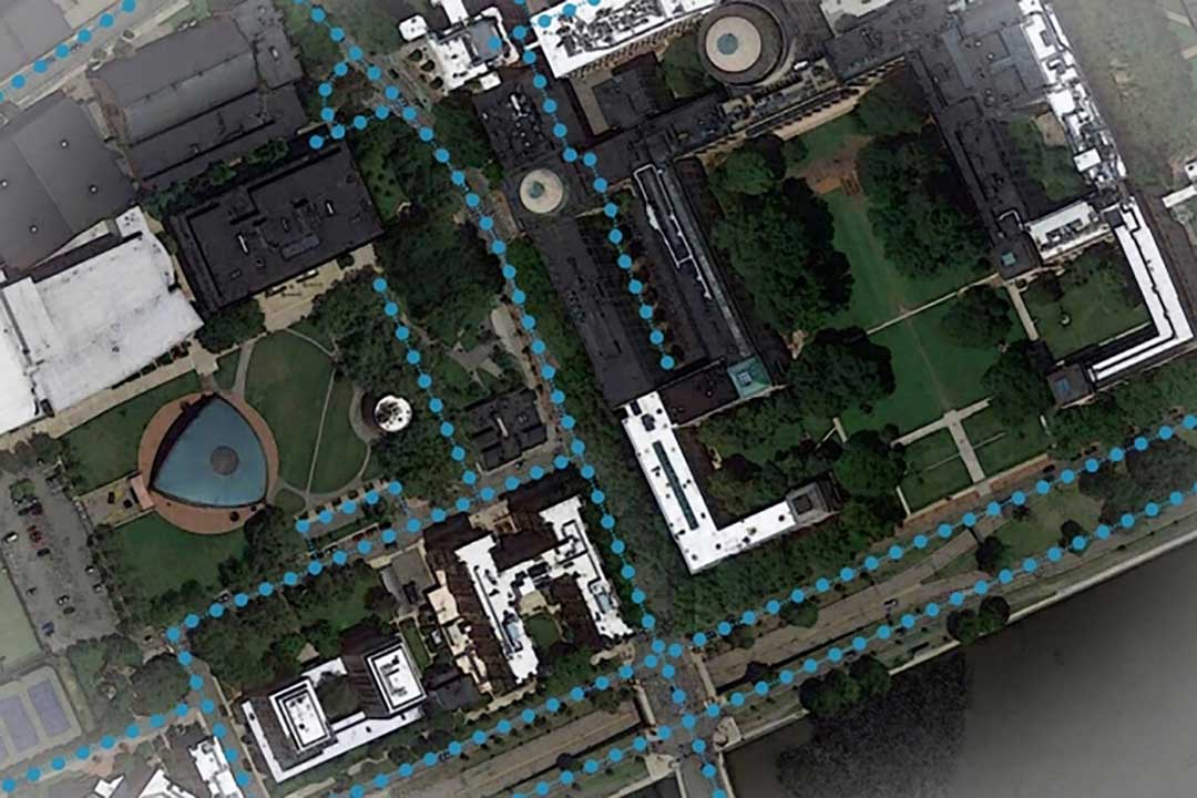
To automate the process and make accurate digital maps available in any country, researchers at the Massachusetts Institute of Technology (MIT) and the Qatar Computing Research Institute have developed an artificial intelligence (AI) model called RoadTagger. It uses satellite imagery to tag road features in digital maps, such as lane counts, which are essential for reliable navigation.

Satellite imagery companies are constantly expanding their coverage and increasing their refresh rate, so this source of mapping data is more readily available and up to date than the data collected on the ground, such as by Google’s fleet of mapping cars. However, satellite imagery often suffers from occlusion from trees, buildings, overpasses and other obstacles.

RoadTagger gets around this problem by using a combination of neural network architectures to predict hidden features. Testing of the model with digital maps of 20 U.S. cities showed that it predicted the number of lanes with 77% accuracy and the road type with 93% accuracy.

An AI model developed at MIT and Qatar Computing Research Institute that uses only satellite imagery to automatically tag road features in digital maps could improve GPS navigation, especially in countries with limited map data. (Image: Google Maps/MIT News)

An AI model developed at MIT and Qatar Computing Research Institute that uses only satellite imagery to automatically tag road features in digital maps could improve GPS navigation, especially in countries with limited map data. (Image: Google Maps/MIT News)

RoadTagger, which combines a convolutional neural network (CNN) and a graph neural network (GNN) is fed only raw data and automatically produces output, without human intervention. The CNN, commonly used for image-processing tasks, takes as input raw satellite images of target roads. The GNN — widely used to model relationships between connected nodes in a graph — breaks the road into roughly 20-meter “tiles,” each of which is a separate graph node.

For each node, the CNN extracts road features and shares that information with its immediate neighbors, thereby propagating road information along the whole graph. For example, if only two lanes of a four-lane road are visible in an image, the model uses information from nearby tiles, such as road width, to conclude that the road has four lanes.

The researchers trained and tested RoadTagger using the OpenStreetMap data set. First, they collected confirmed road attributes from 688 square kilometers of maps of 20 U.S. cities, then they gathered the corresponding satellite images from a Google Maps dataset. The training taught the model what weight to assign to various features and node connections, and it now automatically learns which image features are useful and how to propagate those features along the graph.

The researchers hope that RoadTagger will help humans validate the constant stream of changes in OpenStreetMap and similar datasets as well as enrich them with details that they do not already contain, such as whether a road is paved.

Citation. He, S., Bastani, F., Jagwani, S., Park, E., Abbar, S., Alizadeh, M., Balakrishnan, H., Chawla, S., Madden, S., & Sadeghi, M. A. (Dec. 28, 2019). “RoadTagger: Robust Road Attribute Inference with Graph Neural Networks.” arXiv:1912.12408v1.

Publicerad den Lämna en kommentar

Seen & Heard: Drones and robots fight coronavirus

“Seen & Heard” is a monthly feature of GPS World magazine, traveling the world to capture interesting and unusual news stories involving the GNSS/PNT industry.


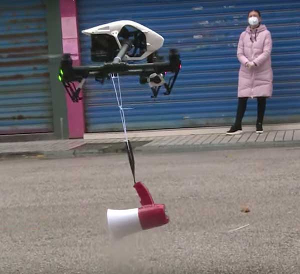
Drone with megaphone. (Screenshot: Xinhuanet video)

Drone with megaphone. (Screenshot: Xinhuanet video)

Drones and robots fight Coronavirus

China’s efforts to contain the coronavirus include drones and robots, according to news reports. Drones are being used to spray disinfectant and enforce instructions to wear face masks. Some reports say drones with thermal imaging are detecting people with fevers from the air. On the streets, hazmat workers are using tank robots to disinfect 50,000 square meters per hour. Other robots are feeding quarantined air passengers at a hotel and disinfecting rooms.


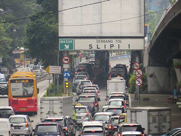
Jakarta toll road. (Photo: GeorginaCaptures/iStock Editorial/Getty Images Plus)

Jakarta toll road. (Photo: GeorginaCaptures/iStock Editorial/Getty Images Plus)

Hungary helps Indonesia with road tolling

Indonesia and Hungary are in talks to build a multi-lane free flow (MLFF) e-toll system that allows payments without gates while cars are moving. The technology is estimated to cost US$90 million. The GNSS e-toll system is already installed in several eastern European countries, including Hungary. Using GNSS, motorists are charged tolls through sensors installed inside vehicles that identify their locations.


Photo: Anne Webberi/iStock/Getty Images Plus

Photo: Anne Webberi/iStock/Getty Images Plus

Albatross on patrol

The albatross, which has a wingspan as long as 11 feet, is helping catch illegal fishing vessels. Henri Weimerskirch of the French National Center for Scientific Research has outfitted nearly 200 albatrosses with GPS trackers that detect radar from ships that lack an automatic identification system. This allows the birds to transmit the locations of fishers in the midst of illicit acts. Fishers who trawl without a license, exceed quotas or underreport their hauls imperil fragile ecosystems and cost the global economy up to $30 billion a year.


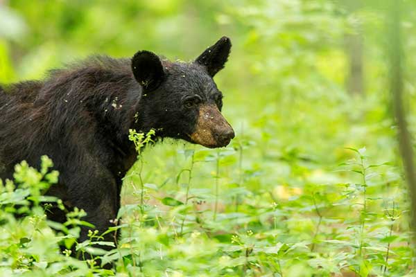
A black bear in Shenandoah National Park. (Photo: USNPS/Neal Lewis)

A black bear in Shenandoah National Park. (Photo: USNPS/Neal Lewis)

How fare the bears?

When problem bears are relocated outside the Great Smoky Mountains, 74 percent are never seen again. Do they thrive after being moved at least 40 miles from their home range? Upcoming GPS research may figure out what happens to them. “There is a mindset where everybody thinks we can just go catch a bear and move it somewhere else, and everything is okay. And it’s not,” said wildlife biologist Bill Stiver. The U.S. National Park Service has approved a three-year grant for a GPS research project beginning in 2021 to track bears relocated from the Great Smoky Mountains National Park and Shenandoah National Park in Virginia.