Publicerad den Lämna en kommentar

Quectel offers 5G sub-6GHz module for mass deployment

Photo: Quectel

Photo: Quectel

Quectel Wireless Solutions‘ RG500Q-EA 5G NR module has achieved commercial readiness and is now available to support global customers with mass deployment.

The module features the Qualcomm Snapdragon X55 5G modem. It is designed for a variety of industrial and consumer internet of things (IoT) applications, including business routers, home gateways, customer premises equipment (CPE), MiFi, industrial IoT (IIoT), industrial laptops, PDAs, video surveillance, digital signage, 4K/8K live streaming and many other bandwidth-intensive use cases.

The Quectel RG500Q-EA supports major sub-6GHz frequency bands as well as worldwide LTE-A and WCDMA network coverage, allowing customers to deploy their IoT solutions flexibly in Asia-Pacific, Europe and the Middle East.

Quectel RG500Q is a series of 5G Sub-6GHz modules optimized specially for IoT and M2M applications. Adopting the 3GPP Rel. 15 technology, it supports both 5G NSA and SA modes.

The RG500Q is provided in two variants: RG500Q-EA and RG500Q-NA. The module supports Qualcomm IZat location technology Gen9C Lite (GPS, GLONASS, BeiDou/Compass, Galileo and QZSS). The integrated GNSS receiver greatly simplifies product design and provides quicker, more accurate and more dependable positioning capability.

Publicerad den Lämna en kommentar

Tallysman releases HC977 triple-band GNSS antenna

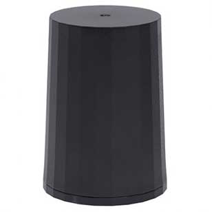
Tallysman Wireless Inc. has added the HC977 triple-band GNSS antenna to its helical antenna family.

HC977 GNSS antenna. (Photo: Tallysman)

HC977 GNSS antenna. (Photo: Tallysman)

The HC977 includes all signals covered by the HC975: GPS/QZSS-L1/L2/L5, GLONASS-G1/G3, Galileo-E1/E5a/E5b, BeiDou-B1/B2/B2a, IRNSS-L5 and L-Band correction services, and also provides reception of GLONASS-G2.

Tallysman helical antennas are designed for high-accuracy applications where precision and light weight matter, such as unmanned aerial vehicles (UAVs). The antennas are available in either a robust IP67 enclosure or an embedded format.

HC977E GNSS antenna. (Photo: Tallysman)

HC977E GNSS antenna. (Photo: Tallysman)

The HC977 features a low current, low noise amplifier (LNA) that includes an integrated low-loss pre-filter to protect against harmonic interference from high amplitude interfering signals, such as 700-MHz band LTE and other near in-band cellular signals.

The antenna is protected by a robust, military-grade plastic enclosure with an integrated SMA connector for screw-on mounting that securely seals the unit with an O-ring, complying with IP67 standards. The enclosure also provides three threaded holes in the base for secure attachment of the unit.

For the embedded version, HC977, Tallysman provides an embedded helical antenna mounting ring that traps the outer edge of the circuit board to another circuit board or to any flat surface. To facilitate a successful installation and optimum antenna performance, Tallysman also provides an Embedded Helical Antenna Installation Guide.

Publicerad den Lämna en kommentar

Airbus to produce 3D-printed visors in fight against COVID-19

Photo: Nenad Stojnev/E+/Getty Images

Photo: Nenad Stojnev/E+/Getty Images

Survey Copter, the tactical drones division of Airbus, will be starting production of medical protection visors using the 3D printers normally used to build drones.

The parts produced with a 3D printer, using fused deposition modeling on an ABS type plastic base, account for up to 15% of the components of a drone built by Survey Copter, the company said. More than 20 printers are being used to produce the visors.

The Survey Copter 3D printers take about 45 minutes to produce a visor. According to the company, they’re not certified from the outset as medical equipment but they nonetheless offer the required protection and, given the urgency, are being officially approved by the Montélimar Hospital in France.

The challenge is to be able to produce a visor capable of withstanding the disinfection procedures used in a hospital environment at temperatures of up to 110 degrees Celsius, without deformation or opacity, the company added.

“Providing our urgent assistance to the medical sector, faced as it is with the COVID-19 epidemic, is one of our priorities, both locally and internationally, and the reactivity of Nicolas Askamp and his teams at Survey Copter is a perfect illustration of this,” said Dirk Erat, head of communications at Airbus Defence and Space.

In addition, Airbus in Germany joined the project. The Airbus Protospace Germany and the Airbus Composite Technology Centre in Stade, together with the 3D-printing network named “Mobility goes Additive,” are now supporting this project in Spain, also coordinating the collection and transport of visors to the Madrid region.

Publicerad den Lämna en kommentar

UAVOS completes tests for drone delivery of humanitarian relief

UAVOS has successfully tested its cargo delivery UVH-170 unmanned helicopter. The trial aimed to validate a highly automated delivery flight from a vendor to a destination and back, across precisely pre-selected pathways.

The flight took 1.7 hours and covered a standoff distance of 62 miles (100 kilometers). Critical humanitarian aid weighing 17.6 lbs (8 kg) was delivered with neither the need to land nor the need for a ground-control station on the receiving side.

UAVOS’s UAS is equipped with line-of-sight data link (LOS) and satellite communication data link, which supports beyond visual line of sight (BVLOS) flights. Watch the cargo delivery UVH-170 UAV in action.

UVH-170 unmanned helicopter is designed for commercial operations and immediate air response, emergency relief under demanding conditions and tight timescales. The aircraft’s high standoff distance makes it well-suited to humanitarian and disaster relief applications.

The capabilities of the UVH-170 unmanned helicopter address many social (medical, pharmaceutical, remote communities, humanitarian aid, etc.) and economic (mining, oil and gas, courier, etc.) use-cases being requested by customers.

The solution is based on the gasoline engine UVH-170 unmanned helicopter. With a maximum take off weight of 99 lb (45 kg), and a payload of up to 22 lb (10 kg), the UVH-170 flies at an altitude of less than 8,200 ft (2,500 m) at maximum speed of 74 mph (120 kph).

“As we have seen during the trials, the customers can derive significant benefits from the use of the UVH-170 UAV,” said Aliaksei Stratsilatau, CEO and Lead Developer of UAVOS. “As a robust VTOL platform, the UVH-170 does not require any additional take off or recovery equipment, which makes it perfect for delivery to remote areas. Besides, the unmanned helicopter has demonstrated capability to operate in windy conditions with gusts more than 14 mps.”

UAVOS has offices in Hong Kong, the United States and Europe. Among UAVOS’ unmanned technologies is the high-altitude pseudo-satellite (HAPS) ApusDuo, multi-platform autopilot solution for converting manned vehicles of all types into unmanned, and unmanned aerial vehicles aimed to counteract systems of electronic warfare.


Feature photo: UVH-170 unmanned helicopter is designed for immediate deliveries. (Photo: UAVOS)

Publicerad den Lämna en kommentar

EO encourages public-private partnerships to secure infrastructure

By Greg Gerten & Geoffrey Hella, Centauri Corp.

Greg Gerten, Centauri Corp.

Greg Gerten, Centauri Corp.

With the rise in public unrest from COVID-19 and increasing numbers of remote operations, the susceptibility and vulnerability of a cyber attack has never been greater.

On a regular basis, we hear intelligence experts proselytize an eventual cyber doomsday where our critical infrastructure (CI) — communications systems, information technology (IT) capabilities and financial networks — are compromised or disabled. These kinds of attacks could devastate our national and economic security and even disrupt basic day-to-day activities like turning on lights or buying groceries with a debit card. Even worse, a significant cyber event could escalate to the point of military actions between nation-states.

In 2012, Defense Secretary Leon Panetta warned about a potential “Cyber Pearl Harbor.” These threats were echoed by then head of Cyber Command, Gen. Keith Alexander, with hope the public, private and CI sectors would take notice of the broad, detrimental impacts of cyber threats.

Geoff Hella, Centauri Corp.

Geoff Hella, Centauri Corp.

In kind, the Obama administration took aggressive steps to protect CI networks, and the Trump White House followed suit by enacting measures to strengthen the resilience of other technologies integral to our CI.

The latest White House Executive Order specifically addresses our reliance on position, navigation and timing (PNT) services and directs agencies to work in close coordination with the private sector to identify, secure and continue to improve the resilience of these technologies.

PNT services, such as GPS, are an extension of our IT systems, but despite this, PNT has been a relatively invisible utility and is oftentimes unknowingly utilized by most CI owners and operators. In the coming years, our reliance on PNT will only increase, making now a critical time to foster close collaboration between public and private sectors and determine which systems, networks and assets are dependent on PNT services. Identifying these dependencies will allow us to verify appropriate resilient PNT services being used, determine downstream effects of the disruption and manipulation of PNT services, and manage the associated risks to dependent systems.

The new directive is fast paced — outlined in 90-, 180- and 360-day increments — and instructs agencies to utilize existing public-private sector cybersecurity and CI information sharing relationships, such as Sector Specific Agencies (SSA), to share threat data, educate stakeholders and promote a responsible use of PNT.

What’s the Rush?

So, why is this happening right now? PNT systems are crucial to American life, and successfully securing them requires a coordinated response and sooner rather than later. In fact, malicious nation-states, such as Russia, are spreading their wings into new threat vectors to inflict damage and are shifting their attention to PNT.

Because of these risks, we must do more as a country to establish safeguards around these technologies. That being said, agencies and organizations cannot expect their current workforce to become PNT security experts overnight. Rather, business owners and operators would be better served bringing in third-party experts that have been building security into PNT even prior to this directive.

These private-sector partners can map out a systematic approach to prioritize PNT security in a three-step plan:

  1. Find. Identify PNT systems and “profile” them — establish point A.
  2. Fix. Find and correct vulnerabilities — many can be non-material/tactics, technique and procedures (TTP) solutions.
  3. Fortify. Develop TTPs, timelines and guidance for users to upgrade CI where needed — the path to Point B.

When PNT services were first developed, the systems could be openly used by anyone and security was not built into the original PNT architecture — similar to when the internet was created. This has made it easy for adoption into almost everyday life and revolutionized the world. Likewise, it has also made it easy for bad actors to access and compromise it, forcing the country to scramble, backtrack and implement cybersecurity best practices.

The good news is that we aren’t completely starting from scratch. The Department of Defense has been working to secure its PNT systems and will be updating its processes and practices as part of the recent White House directive.

The security community can also look to best practices in assessing risk of vital systems and model PNT security measures on existing guidelines such as Federal Information Processing Standards (FIPS) and NIST Special Publication 800 Series.

Path Forward

Per the Executive Order, lead agencies such as the Department of Transportation and the Department of Commerce will work in concert with the private sector to define “PNT profiles” and share these attributes with stakeholders. The coalition of partners will then be able to account for where and how PNT is used by CI owners and operators and will promote the responsible use of PNT services moving forward.

Beyond defining PNT profiles, the EO allocates new research and development funding for Commerce to develop an alternative to GNSS, which provides real-time PNT data to planes, trains, ships and automobiles that transport vital goods and resources — all in an effort to reduce the level of acceptable risk.

The White House also requires the public and private sectors to develop vulnerability testing and incident response plans and, simultaneously, encourage the private sector to use and develop more robust PNT services in anticipation of new Federal Acquisition Regulatory Council (FARC) contract requirements.

While these changes may seem like a fast moving and overwhelming process, there are many cases where CI owners and operators will not be required to integrate material solutions, but rather procedural training and behavioral adjustments. The information sharing processes already exist to provide improved situational awareness, coordination among the public and private sectors, increased reporting, solidified baseline risk assessments and a broader understanding of how systems rely on PNT. The challenge is facilitating widespread adoption across all stakeholders, increasing collaboration and education among and across the CI groups.

For this effort to be successful, it will require a whole-community, multi-pronged approach to operating in a new “threat top-of-mind” paradigm that is grounded on cross-sector information sharing, training and education. Both public and private sectors should also outsource expertise and leverage existing models like the DoD PNT doctrine, NIST standards and incident response capabilities.


Gregory Gerten is director of PNT Operations at Centauri, supporting the PNT enterprise through innovative use of modeling and simulation, hardware-in-the-loop and field testing, and process automation. He earned his master’s degree in electrical engineering from the University of Dayton, and has completed post-graduate courses in GPS from the Air Force Institute of Technology. He has more than 20 years of experience in system design, development and integration in the areas of communications, navigation, electronic warfare tactics and weapon systems.

Geoffrey Hella is a senior engineer for Centauri assigned to a Space Command contract through the Joint Navigation Warfare Center (JNWC). He has worked to achieve a Master of Aeronautical Science (MAS) from Embry-Riddle Aeronautical University in 1994. During his 40 years of experience, he has been a leader in product development and system design to successfully carry out a vast range of assignments in multiple engineering disciplines. His assignments include: aircrew member of the United States Air force (USAF); National Air Space (NAS) engineer for the Federal Aviation Administration (FAA); Special Nuclear testing and safeguards engineer for the Department of Energy/Sandia National Laboratories; and Supervisory Control and Data Acquisition (SCADA) engineer for both public and private Industry, electric and gas utility companies. Hella currently holds a six-sigma certification and a general radio operator license from the Federal Communication Commission (FCC) and a remote pilot operator certificate from the Federal Aviation Administration (FAA).

Publicerad den Lämna en kommentar

ION GNSS+ 2020 advanced conference program available online

Illustration: ION

The Institute of Navigation’s (ION) ION GNSS+ 2020 advance conference program is now available online.

The show, which is the the 33rd International Technical Meeting of the Satellite Division of the Institute of Navigation, is slated to take place Sept. 21-25 in St. Louis.

According to ION, the show will feature Commercial and Policy tracks and Research tracks with more than 36 technical sessions Sept. 23-25, in addition to a commercial exhibit.

ION GNSS+ 2020 will offer short courses on pre-conference tutorials to provide in-depth learning of specific GNSS-related disciplines and will again facilitate the CGSIC meeting. These will take place Sept. 21-22. ION’s Satellite Division will also bring back complimentary short courses, taught by internationally recognized PNT experts and educators on Sept. 21.

This year’s ION GNSS+ 2020 Plenary Session will feature two dynamic keynote addresses from Dr. Christine Darden, retired NASA program manager and one of the key researchers featured in the book Hidden Figures, and Dr. Bradford Parkinson, who will be presenting “Radio Navigation from Marconi to GNSS.”

Finally, nominations are currently being accepted for ION’s Johannes Kepler Award, which honors an individual during their lifetime for sustained and significant contributions to the development of satellite navigation, as well as the Bradford W. Parkinson Award, which recognizes an outstanding graduate student in the field of GNSS. Nominations, along with required reference letters, are due June 30.


Check out ION GNSS+ 2019 show coverage here.

Publicerad den Lämna en kommentar

Galileo Masters 2020 open for submissions

Photo: voyata/iStock / Getty Images Plus/Getty Images

Photo: voyata/iStock / Getty Images Plus/Getty Images

The 2020 Galileo Masters are open for submissions. The competition is designed to award applications, services and new ideas that use Galileo and EGNOS, in synergy with other space programs, to respond to pressing needs facing business and society.

The 2020 competition has three European GNSS Agency (GSA) challenges, themed “Space for Future Generations.”

The first challenge, the “Space for our Planet Challenge,” aims to tackle climate change and environmental degradation. Services based on data from Galileo, EGNOS and Copernicus Earth observation can be used to mitigate this threat by supporting more environmentally-conscious life choices, resulting in a healthier planet, GSA said.

The second challenge, the “Space for Being Safe and Healthy Challenge,” seeks out solutions that use downstream space data provided by Galileo, EGNOS and/or Copernicus as key enablers of innovative applications to help stem the spread of COVID-19 pandemic.

The third challenge, the “Space for Fun Challenge,” targets solutions using data from Galileo and EGNOS in the gaming, sports, leisure and tourism markets, where GNSS enables the monitoring of user performance and helps make augmented reality games even more immersive.

For all three challenges, there is a cash price of 10,000€, with another 10,000€ awarded to the overall Galileo Masters 2020 winner.

Registration is free, and entries must be submitted by June 30.

Publicerad den Lämna en kommentar

TomTom expands mapping deal with Verizon, providing APIs and SDKs

Photo: TomTom

Photo: TomTom

Verizon will integrate TomTom’s Maps application programming interfaces (API) and software development kits (SDK) into its location-services offering, making it easier for the developer community to build upon and integrate the platform. The developers’ portal is available at developer.tomtom.com.

The agreement is an expansion of the existing TomTom and Verizon agreement, where TomTom provides location-based services to enhance Verizon’s current suite of location-based data, navigation, and intelligence.

“We look forward to continuing to build upon and evolve our product suite with TomTom’s technology,” said Jeff Frantz, executive director, Verizon Location Services. “By expanding our agreement, we are furthering our commitment to providing best-in-breed location technology for Verizon and our customers.”

“We’re determined to make it as easy as possible for developers to have access to our Maps APIs and SDKs so we’re delighted that Verizon is offering TomTom products to their location-services customers,” said Anders Truelsen, managing director, TomTom Enterprise.

5G and HD Maps. In the last quarter of 2019, the companies also announced an innovation project using Verizon 5G Ultra Wideband and TomTom HD Maps to help make intersections safer for emergency vehicles.

Publicerad den Lämna en kommentar

Martek Marine launches COVID-19 tests for crew changes

Martek Marine logoNew tests instituted to stop COVID-19 infection at crew change in response to new European Union and and International Maritime Organization (IMO) guidelines

The European Union and International Maritime Organization (IMO) have issued new guidelines requiring ship operators to implement pre-boarding screening of seafarers.

To assist ship operators comply with these important new guidelines and help protect their vessels from an outbreak of COVID-19, Martek Marine has launched the CoronaSafe finger prick antibody screening test.

From a single drop of blood, CoronaSafe will detect IgM antibodies within 5-7 days of infection. It is particularly useful for detecting infections among subjects who show no symptoms and would otherwise embark undetected.

A study into the COVID-19 outbreak on the cruise ship Diamond Princess estimated that 20.6%-39.9% of cases were asymptomatic, while a study published in the British Medical Journal concluded that up to four-fifths of cases are asymptomatic.

The CoronaSafe test is approved and certified by the European Union as meeting the safety, quality and performance requirements of Standard IVDD 98/79/EC — the highest standard applicable for these devices. It is also in wide-scale use by authorities and corporations in Japan, China, Germany, Poland and Indonesia, and is formally certified by CFDA, Philippines FDA and Singapore Health Sciences Authority.

“Screening crew before boarding is a critical step to prevent avoidable transmission from an asymptomatic crew member,” said Martek CEO Paul Luen. “It’s also an important diagnostic tool for re-screening after leaving or if someone shows symptoms. The effect of an outbreak on a ship could be catastrophic in both business and human terms.”

Major corporations worldwide are rushing to adopt these occupational screening tests to help control the spread of this deadly virus, with demand rising rapidly as the crisis deepens.

Martek, which has limited supply of the tests, are urging shipowners to act quickly to define their policy for crew screening, to maintain the health of their employees and ensure continuation of their shipping operations.

Publicerad den Lämna en kommentar

Radius Telematics sees spike in vehicle theft during coronavirus crisis

Photo: deepblue4you/E+/Getty Images

Photo: deepblue4you/E+/Getty Images

Radius Telematics has seen a big increase in the thefts of commercial vehicles since the coronavirus lockdown. With many offices, factories and construction sites unattended, thieves appear to be taking advantage of unattended locations.

According to Radius, vehicles and plant not equipped with GPS security devices that detect and track unauthorized movement are especially vulnerable as the thefts may go unreported for many days or even weeks.

Radius Telematics acquired two companies in 2019 that had a substantial proportion of their business in vehicle and plant security — both are reporting significant spikes in thefts.

Radius Telematics encompasses telematics brands Kinesis, UK Telematic, Plant-I, Sure-Track, CyntrX and Key Telematics. Altogether, Radius companies track more than 250,000 vehicles across the globe, with security devices fitted to 27,000 assets ranging from generators to vans, mini-diggers and earth moving trucks.

Many are equipped with Theft Recovery Trackers, small covert wireless devices with movement and tamper alarms. Once activated, the asset is automatically tracked to ensure that stolen assets are recovered quickly and efficiently.

“From security tracker alerts, we have seen a doubling in plant and van theft since the lockdown began,” said said Greville Coe, managing director of Radius Telematics. “It’s incredible that when we are all self-isolating and worrying about a deadly virus, crime is being committed while people and organizations are so vulnerable.”

One particularly disturbing theft was of a van stolen from a hospice for the terminally ill. The incident in Coventry, UK, saw a property belonging to a hospice ransacked and the theft of a hospice van. Fortunately, the vehicle was fitted with a Sure-Track tracker previously donated by Radius Telematics and the vehicle was safely recovered after three days. The Wireless Theft Recovery Tracker allowed the Radius nationwide finder network to accurately track the movements and whereabouts of the stolen vehicle.

“It’s shocking that thieves would target a charity caring for the terminally ill in what is an exceptionally difficult time,” Coe said. “Radius Telematics tracking services remain fully operational irrespective of the travel and business restrictions imposed due to the Coronavirus crisis. We hope we can help to ensure that essential services can be delivered with minimal disruption.”

Radius Telematics is a newly branded group formed within Radius Payment Solutions. The new telematics division incorporates a number of telematics-related businesses including their own Kinesis-branded vehicle tracking and previous acquisitions including Plant-i, UK Telematics and Sure-Track.