Publicerad den Lämna en kommentar

BeiDou applications conference showcases short message service

The first International Summit on BeiDou Navigation Satellite System (BDS) Applications took place Sept. 16 in Changsha, central China's Hunan Province. (Photo/Xinhua)

The first International Summit on BeiDou Navigation Satellite System (BDS) Applications took place Sept. 16 in Changsha, central China’s Hunan Province. (Photo/Xinhua)

An enhanced version of the BeiDou short message service was showcased at the First International Summit on BeiDou Navigation Satellite System (BDS) Applications held in Changsha, central China’s Hunan Province, on Sept. 16, reports China.org.bn.

The short message service enables two-way communication on mobile phones in areas not covered by ordinary mobile communication signals or when base stations are damaged, the website reports. This service would prove useful in the event of an earthquake or other emergencies, as well as offshore fishing.

“Short message service needed a larger satellite terminal such as maritime satellite phone,” said Li Jingyuan, director of the BeiDou short message team at National University of Defense Technology (NUDT). “But the enhanced version’s low-power-consumption feature enables mobile phones to send emergency messages through BeiDou satellites, even without ground mobile communication signals. The information transmission rate of the enhanced version has increased 10 times, which means pictures and voice messages can be sent out quickly.”

At the summit, NUDT, the people’s government of Hunan, and China Electronics Corporation signed an industrial cooperation agreement to further expand short message service to low orbit satellite users. The short-message service could play a role in global satellite internet of things, international life rescue, global emergency communication and other industrial applications, the website reports.

Publicerad den Lämna en kommentar

Broadcom launches its lowest power GNSS receiver for mobile, wearables

The BCM4778’s third-generation dual-frequency GNSS receiver features advanced multipath mitigation, L5 acquisition capability, LTE filtering and jamming protection

Broadcom Inc. has launched the BCM4778, its lowest power L1/L5 GNSS receiver chip optimized for mobile and wearable applications. Equipped with the latest GNSS innovations, the third-generation chip is 35% smaller and consumes five times less power than the previous generation.


Broadcom will be presenting further information on the chip in the Session B5, Panel: GNSS Chipset Technology – Trends, Opportunities and Challenges panel at the ION GNSS+ 2021 on Sept. 24.


Dual-frequency GNSS continues to be an important location feature for modern mobile and wearable devices, providing greater positioning accuracy for location-based applications. The advanced L5 signal enables sidewalk-level accuracy for pedestrian navigation in urban environments, as well as lane-level accuracy for vehicle navigation.

Reduction in GNSS power consumption is crucial to extending the battery life of a mobile or wearable device. Compared to GNSS receivers used in integrated platforms, Broadcom’s single-chip BCM4778 delivers significantly lower power consumption and higher performance while offering more advanced GNSS features, such as the next-generation Grid Tracking urban multipath mitigation technology.


“We are excited to see this impressive power reduction, combined with the L5 Grid Tracking technology in the new Broadcom GNSS chip. This will increase the impact of Google’s 3DMA ray-tracing for urban multipath mitigation,” said Frank van Diggelen, principal software engineer at Google.


Longer battery life. The BCM4778 increases the GNSS always-on battery life on a smartwatch by 30 hours compared to the previous generation chip operating on a 300-mAh battery. The extended battery life helps drive new experiences in smartwatches and phones, including keeping the GNSS always-on for fitness applications for multiple days on a single battery charge.

In addition, the BCM4778 features fully integrated LNAs for L1 and L5 bands, which reduces RF front-end BOM costs and footprint requirements, suitable for space-constrained applications. The chip offers increased flexibility to smartwatch and phone designers with its small size. Having the ability to place the BCM4778 closer to the antenna helps improve signal reception and enhances overall GNSS performance.
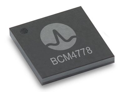
The BCM4778 dual-frequency chip is designed for small mobile and wearables. (Photo: Broadcom)

The BCM4778 dual-frequency chip is designed for small mobile and wearables. (Photo: Broadcom)

Product Highlights

  • 7nm CMOS technology
  • Typical power consumption
  • 4mW L1 band only
  • 6mW L1+L5 simultaneous
  • FCBGA package
  • New Grid Tracking technology
  • Advanced multipath mitigation
  • Continuously tracks the full L5 channel
  • Capable of L5 acquisition
  • Increased processing capability and throughput
  • Advanced LTE filtering and jamming mitigation
  • Enhanced LTE Band 13 and Band 14 filtering
  • Spoofing and jamming detector
  • Jamming mitigation through multiband and multi constellation
  • Reduced BOM cost and footprint
  • Flexibility in using internal LNAs
  • Optional operation without interstage SAW filters
  • Integrated switching regulator with direct connect to battery

“With the launch of this third generation dual-frequency GNSS receiver chip, Broadcom continues the tradition of raising the bar for mobile GNSS,” said Vijay Nagarajan, vice president of marketing for the Wireless Communications and Connectivity Division at Broadcom. “Always-on dual frequency GNSS is a key request from mobile and wearable OEMs, and we are thrilled to deliver it.”

“Consumer electronic companies have been faced with the challenge of managing power consumption versus performance, often having to choose one over the other. Broadcom’s innovative approach to the BCM4778 allows their customers to realize improvements on both fronts,” said Ramon T. Llamas, research director for mobile devices at IDC. “The result: device manufacturers can enable new experiences and run applications over a sustained period of time. In addition, by reducing its BOM cost and its physical footprint, Broadcom is enabling further benefits from cost savings and design configurability.”

Broadcom is currently sampling the BCM4778 to its early access partners and customers. Please contact your local Broadcom sales representative for samples and pricing.

Publicerad den Lämna en kommentar

GeoSLAM launches its latest software offering Connect 2.0 at Intergeo

The next-generation SLAM algorithm — GeoSLAM Beam — powers the new software

GeoSLAM has released a software update, Connect 2.0, at the Intergeo 2021 trade show. Intergeo is taking place this week in Hannover, Germany.

Connect 2.0 enables GeoSLAM scanners to achieve a higher level of accuracy compared to other SLAM-based mapping systems. Colorization from the new ZEB Vision panoramic camera provides even more visual context to a point cloud, as well as interactive “bubble” walkthroughs and measurements.

The update is powered with the next generation of GeoSLAM’s algorithm GeoSLAM Beam, which includes new filtering and georeferencing tools to help users get the best results from their datasets.

Connect 2.0 also simplifies data processing through a series of workflow scripts. This includes automatic data processing, stop-and-go georeferencing and stop-and-go alignment, all available as standard.

Screenshot: GeoSLAM

Screenshot: GeoSLAM

Connect 2.0 Features

  • Intuitive interface – The Connect viewer is integrated into the main software interface, making it easy to view multiple point clouds simultaneously and measure the distance between data points.
  • Change detection – Multiple point clouds can be compared, and any areas that have changed are automatically highlighted. Point clouds also can be compared with CAD models to track progress on a construction site or view changes between scans.
  • Floor slices – Horizontal and vertical slices can be taken from any location within the point cloud. Horizontal floor slices can also be automatically taken at any given height above the floor.
  • Environmental presets – Data is processed according to the environment it was captured in (indoor, outdoor, UAV or vehicle).
  • Draw 4.0 – Draw projects can now be created automatically for any dataset.

GeoSLAM customers with a Care subscription will have full access to Connect 2.0. Any new product shipped starting today comes with both Connect and Hub software.

Real-time processing

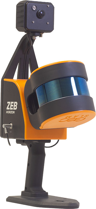
GeoSLAM has also launched real-time SLAM processing through remote access. Using an API for remote data capture or automated robotic navigation, users can see the point cloud and trajectory in real time. The ZEB Revo RT can be used on and off a robotic platform.

Photo: GeoSLAM

Photo: GeoSLAM

ZEB Vision panoramic camera

The ZEB Vision 16MP panoramic camera is now available for pre-order. Suitable for any ZEB Horizon, the new camera provides better colorization, image walkthroughs and pointcloud measurements using optional Draw software.

Use on UAVs. Further updates mean that GeoSLAM customers can now take a ZEB Horizon from handheld to UAV usage to get a more complete picture of projects. ZEB Horizon is compatible with the DJI Matrice 300 UAV.

Publicerad den Lämna en kommentar

Spirent and Qascom collaborate on OSNMA simulation tools for Galileo

SimOSNMA provides vital test tools for Galileo’s emerging end-to-end security protocol

Spirent Communications plc and Qascom have announced a simulation test solution for the Galileo Open Service Navigation Message Authentication (OSNMA) mechanism.

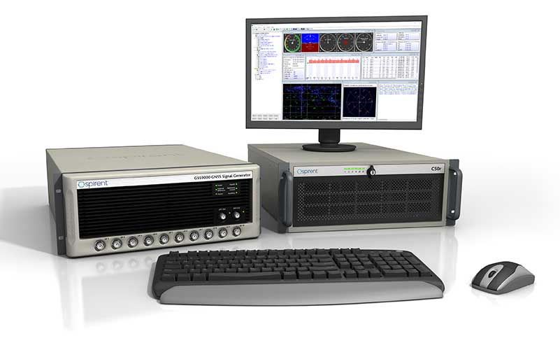
SimOSNMA is designed to work with Spirent’s GNSS simulation platforms to test OSNMA signal conformance, which will bring new levels of robustness for both civilian and commercial GNSS uses.

The GSS9000 test system. (Photo: Spirent)

The GSS9000 test system. (Photo: Spirent)

SimOSNMA provides developers with new simulation tools to test for OSNMA, the security protocol that enables GNSS receivers to verify the authenticity of signals distributed from the Galileo satellite constellation. Designed to combat spoofing, OSNMA ensures the data received is authentic and has not been modified in any way. It is now completing the test phase before its formal launch.

SimOSNMA enables developers to simulate and test OSNMA signals and features, allowing GNSS receiver manufacturers and application developers to accelerate and assure development programs.

Qascom has been a significant contributor to the development of Galileo OSNMA. The company helped create the main test vectors for early testing and led the Position Authenticated Tachograph for OSNMA Launch (PATROL) project, which is the European Union Agency for the Space Program (EUSPA) procurement looking at the implementation of OSNMA into automotive and mass-market GNSS receivers.

“During the development of the first OSNMA receiver prototype, we needed a tool that would allow us to run tests in a controlled and repeatable environment, generate reference data, test corner cases and system events that seldomly occur in reality,” said Carlo Sarto, head of Security Engineering Domain Area. Qascom. “SimOSNMA will allow industries and agencies to speed up the development and qualification of their systems.”

Since the inception of the Galileo project, Spirent has provided crucial simulation and test capabilities to many of the key organizations and projects responsible for development of the European Space Agency (ESA) program.

SimOSNMA is available now for Spirent GSS7000 and GSS9000 platforms.

Publicerad den Lämna en kommentar

Telit launches SE150A4 series with GNSS for internet of things

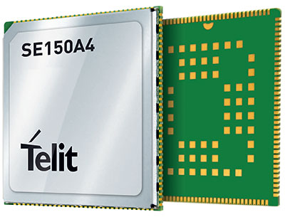
Photo: Telit

Photo: Telit

Telit has launched the SE150A4 system-on-module series with an embedded multi-constellation GNSS (GPS, BeiDou, GLONASS and Galileo) receiver for high-performance positioning and navigation.

The SE150A4 module is designed for retail and point-of-service (POS) devices, home automation and security, law enforcement and other applications that need high data rates, advanced human-machine interfaces and edge-computing functionality. It features the Android OS and the Qualcomm QCM2150, and is designed to serve internet of things (IoT) device makers and customers.

With LTE Category 4 for maximum data rates of up to 150 Mbps downlink and 50 Mbps uplink, the SE150A4 series is designed for bandwidth-intensive applications such as live, high-definition (1080p/30 fps) video from law enforcement cameras, home security systems and robots. Along with GNSS, Wi-Fi (802.11a/b/g/n) and Bluetooth Low Energy (BLE) 4.2 provide additional connection flexibility.

The SE150A4 series provides native support for integrated peripherals such as high-resolution touch displays, advanced cameras, sensors and audio interfaces, as well as SDIO 3.0, USB 2.0, UART, SPI and I2C digital interfaces. Android OS gives device OEMs, systems designers and other users access to a vast developer community and broad selection of tools and ready-to-use software components.

The modules are available in two versions.

  • The SE150A4-NA for North America supports 13 LTE bands, including Band 14 for AT&T FirstNet Band and Bands 66 and 71 for T-Mobile, as well as 3G fallback.
  • The SE150A4-EU for Europe and the rest of the world supports Band 28 and nine additional LTE bands, as well as 2G/3G fallback.

At 40.5 x 40.5 mm, the LCC +LGA form factor allows easy integration in portable, wearable and handheld devices, including mobile point-of-sale terminals, medical monitors, industrial PDAs and telematics cameras. The modules are also suitable for fixed applications such as smart-home gateways and alarm systems.

Publicerad den Lämna en kommentar

GeoMax launches Zenith60 GNSS smart antenna

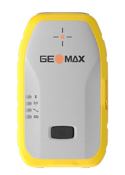
Photo: GeoMax

Photo: GeoMax

GeoMax has announced a new GNSS smart antenna, the Zenith60.

The Zenith60 is a calibration-free tilt compensating GNSS smart antenna that incorporates state-of-the-art technology. The antenna’s tilt capability makes surveys faster and more convenient, hence more productive and efficient, the company said.

The incorporated calibration-free inertial measurement unit (IMU) technology is designed to save time. The Zenith60’s resistance to magnetic fields ensures reliable data collection.

The antenna reaches its maximum performance when combined with X-PAD Ultimate field software and GeoMax field controllers, the company said.

Publicerad den Lämna en kommentar

NovAtel SMART7 now default receiver on Fendt machines

The Fendt 1000 Vario tractor. (Photo: Fendt)

The Fendt 1000 Vario tractor. (Photo: Fendt)

Fendt machines in North America, Europe and the Middle East equipped with Fendt Guide guidance systems powered by Fuse Smart Farming now come with NovAtel’s SMART7 GNSS receiver as the default configuration choice.

“We have been working with NovAtel for years, and their support and willingness to adapt to meet our needs makes them the key GNSS receiver supplier for our Fendt Guide guidance system,” said Bernhard Schmitz, director, FendtONE Market Readiness and Agronomy EME. “They are easy to work with and have high-quality products that integrate seamlessly into our machines.”

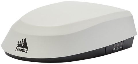
The SMART7 combines a powerful GNSS receiver with a precision antenna in a durable, all-in-one enclosure designed to stand up to the vibration, weather and temperature demands of harsh agricultural environments. Delivering exceptional positioning, the SMART7 is optimized to succeed in demanding agriculture and off-road applications.

Photo: NovAtel

Photo: NovAtel

The SMART7 uses multi L-band tracking to access TerraStar Correction Services globally, bringing repeatable centimeter-level accuracy to any application, anywhere in the world. Access to multi-frequency GPS, GLONASS, BeiDou, Galileo and QZSS signals provides better satellite availability in challenging environments.

Resiliency to radio frequency interference is ingrained in NovAtel’s hardware designs, and the company’s Interference Toolkit firmware suite provides detection and additional protection from any potential intentional or unintentional interference.

Powered by NovAtel GNSS+INS technology, the SMART7 uses an optional integrated inertial measurement unit (IMU) to provide continuous 3D positioning, velocity and roll/pitch/azimuth for deeper integration with vehicle guidance and steering systems. Additional optional features on the SMART7 include Wi-Fi and Ethernet for remote connectivity and monitoring.

Publicerad den Lämna en kommentar

Trimble DA2 GNSS receiver launched for Catalyst positioning

The Trimble DA2 receiver boosts the performance of the Trimble Catalyst GNSS positioning service. (Photo: Trimble)

The Trimble DA2 receiver boosts the performance of the Trimble Catalyst GNSS positioning service. (Photo: Trimble)

Trimble has launched the Trimble DA2 GNSS receiver for the Trimble Catalyst positioning service. The DA2 — the second-generation receiver and antenna for the Catalyst service — now includes the Trimble ProPoint GNSS engine for enhanced performance.

Unique to the latest Trimble GNSS solutions, ProPoint technology reduces convergence times and improves positioning accuracy when operating near trees and buildings.

Trimble Catalyst is a subscription-based GNSS positioning service for location-enabled field applications. The service is available in accuracy-based packages from centimeter- to submeter-level for a wide range of mapping and mobile geographic information system (GIS) data-collection projects. Catalyst continues to support a broad range of GIS field applications, including Trimble TerraFlex software, for form-based GIS data collection.

“Trimble Catalyst brings easy-to-use precise positioning to location-enabled workforces,” said Gareth Gibson, marketing director, Trimble Mapping & GIS. “The addition of ProPoint technology, together with the DA2’s support for iOS devices, means Catalyst can now deliver Trimble quality positioning to more geospatial professionals than ever before.”

Trimble Catalyst subscriptions are available through Trimble’s Authorized Distribution Network. The Catalyst DA2 digital GNSS receiver, sold separately, is expected to be available in the fourth quarter. Trimble TerraFlex software subscriptions are available separately through Trimble Geospatial distribution partners.

Publicerad den Lämna en kommentar

Orolia joins with Keysight on advanced 5G GNSS testing

Integrated solutions address GNSS test requirements defined by 3GPP and major U.S. carriers

Orolia and Keysight Technologies Inc. have joined forces to advance 5G services by addressing GNSS test requirements defined by 3GPP and major U.S. carriers.

Working with Orolia allows Keysight to extend its 5G device test solution portfolio with advanced GNSS simulation capabilities. As a result, existing users of Keysight’s 5G device test solutions can easily address GNSS-related 3GPP protocol conformance and carrier acceptance test requirements by upgrading the software in Keysight’s E7515B UXM 5G Wireless Test Platform and combining it with Orolia’s GSG-8 simulator.

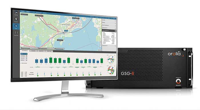
Skydel GSG-8 (Photo: Orolia)

Skydel GSG-8 (Photo: Orolia)

The efforts of Keysight and Orolia will enable chipset and device makers to verify functionality to accurately position mobile phone users within a geographic area.

“Working with Orolia has enabled Keysight to deliver GNSS-based LBS test solutions for 5G protocol conformance and carrier acceptance validation,” said Muthu Kumaran, general manager of Keysight’s device validation solutions business. “Keysight’s LBS solutions also support assisted GNSS test functionality, enabling users to comprehensively address 5G new radio conformance requirements mandated by both the Global Certification Forum (GCF) and PTCRB.”

Accurate positioning is important in a wide range of sectors including healthcare, road and aerial transportation, entertainment and homeland security.

Future applications, such as drones and autonomous vehicles, will depend on highly precise positioning services for reliable navigation and safe transportation of people and goods. Mobile operators use GNSS technologies and non-GNSS technologies, such as beamforming, angle-based positioning and round-trip time to deliver personalized services and support emergency calls.

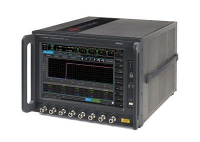
Keysight's UXM 5G Wireless Test Platform. (Photo: Keysight Technologies)

Keysight’s UXM 5G Wireless Test Platform. (Photo: Keysight Technologies)

The GSG-8 simulator, powered by the Skydel Simulation Engine, offers high performance, flexibility and an easy-to-use software-defined platform to deliver superior jamming and spoofing options that can help ensure accurate, continuous operations for critical applications during interference or signal loss. Automated and scalable, the simulator supports GPS, Galileo GLONASS and BeiDou, with upgrade paths for future constellations.

Keysight offers in-built positioning capabilities in the UXM 5G wireless test platform for non-GNSS positioning test requirements.

“We are pleased to collaborate with Keysight on developing solutions that improve PNT testing for 5G communication networks and devices,” said Lisa Perdue, Orolia’s Simulation Product Line director. “Our GSG-8 simulator, powered by Orolia’s Skydel Simulation Engine, offers ultra-high performance and unmatched flexibility. The easy-to-use software-defined platform also delivers superior jamming and spoofing options that can help ensure accurate, continuous operations for critical applications during interference or signal loss.”

Publicerad den Lämna en kommentar

Boeing to build factory in Illinois to produce MQ-25 Stingray

Boeing will build the U.S. Navy's MQ-25 Stingray unmanned aerial refueler at a new 300,000-square-foot facility at MidAmerica St. Louis Airport in Illinois. (Photo: Boeing)

Boeing will build the U.S. Navy’s MQ-25 Stingray unmanned aerial refueler at a new 300,000-square-foot facility at MidAmerica St. Louis Airport in Illinois. (Photo: Boeing)

Boeing will build the MQ-25 Stingray — the Navy’s first carrier-based unmanned aircraft — at a new high-tech facility in Illinois. The 300,000 square-foot facility at MidAmerica St. Louis Airport, Illinois, is scheduled for completion in 2024.

The MQ-25 facility will include state-of-the-art manufacturing processes and tools, including robotic automation and advanced assembly techniques, to improve product quality and employee ergonomics. The facility initially will employ 150 mechanics, engineers and support staff, but could grow to 300 with additional orders.

Boeing digitally engineered the entire MQ-25 aircraft and its systems, resulting in high-fidelity models used to drive quality, efficiency and flexibility throughout the production and sustainment process.

For two years, Boeing and the Navy have been flight testing the Boeing-owned MQ-25 test asset from MidAmerica Airport. In recent missions, the T1 model has refueled an F/A-18 Super Hornet, an E-2D Hawkeye and an F-35C Lightning II.

The U.S. Navy intends to procure more than 70 MQ-25 aircraft to help extend the range of the carrier air wing, and the majority of those will be built in the new facility. Boeing is producing the first seven MQ-25 aircraft, plus two ground test articles, at its St. Louis facilities, and they will be transported to MidAmerica for flight test. The MQ-25 program office, including its core engineering team, will remain based in St. Louis. MidAmerica is adjacent to Scott Air Force Base.

The new MQ-25 facility will be in addition to existing manufacturing operations at Boeing St. Clair, which produce components for the CH-47 Chinook, F/A-18 Super Hornet, F-15 and other defense products.

T1 Stingray refuels a Navy F/A-18. (Photo: U.S. Navy/Boeing)

T1 Stingray refuels a Navy F/A-18. (Photo:
U.S. Navy/Boeing)